Curtisden Green

Coordinates: 51°08′14″N 0°29′34″E / 51.1371°N 0.4929°E
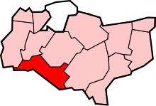
Curtisden Green is a hamlet, lying 3 miles (4.8 km) to the north of Goudhurst (where the 2011 population was included), Kent, England.[1] [2] It is the location of Bethany School.
References
- ↑ Ordnance Survey: Landranger map sheet 188 Maidstone & Royal Tunbridge Wells (Sevenoaks & Tonbridge) (Map). Ordnance Survey. 2014. ISBN 9780319228814.
- ↑ "Ordnance Survey: 1:50,000 Scale Gazetteer" (csv (download)). www.ordnancesurvey.co.uk. Ordnance Survey. 1 January 2016. Retrieved 18 February 2016.
External links
![]() Media related to Curtisden Green at Wikimedia Commons
Media related to Curtisden Green at Wikimedia Commons
 |
Horsmonden | Marden | Staplehurst | |
| Horsmonden | |
Frittenden | ||
| ||||
| | ||||
| Goudhurst | Goudhurst | Cranbrook |
This article is issued from Wikipedia - version of the 9/24/2016. The text is available under the Creative Commons Attribution/Share Alike but additional terms may apply for the media files.