Curtis, Nebraska
| Curtis, Nebraska | |
|---|---|
| City | |
|
Nebraska College of Technical Agriculture | |
 Location of Curtis, Nebraska | |
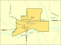 Detailed map of Curtis, Nebraska | |
| Coordinates: 40°37′57″N 100°30′53″W / 40.63250°N 100.51472°WCoordinates: 40°37′57″N 100°30′53″W / 40.63250°N 100.51472°W | |
| Country |
|
| State |
|
| County | Frontier |
| Area[1] | |
| • Total | 1.20 sq mi (3.11 km2) |
| • Land | 1.20 sq mi (3.11 km2) |
| • Water | 0 sq mi (0 km2) |
| Elevation | 2,572 ft (784 m) |
| Population (2010)[2] | |
| • Total | 939 |
| • Estimate (2012[3]) | 935 |
| • Density | 782.5/sq mi (302.1/km2) |
| Time zone | Central (CST) (UTC-6) |
| • Summer (DST) | CDT (UTC-5) |
| ZIP code | 69025 |
| Area code(s) | 308 |
| FIPS code | 31-11825[4] |
| GNIS feature ID | 0828526[5] |

Curtis is a city in Frontier County, Nebraska, United States. The population was 939 at the 2010 census.
Curtis describes itself as "Nebraska's Easter City", and presents an annual pageant on Palm Sunday.[6] The Nebraska College of Technical Agriculture is located in Curtis.[7]
History
Curtis was laid out in 1886, soon after the railroad was extended to that point.[8] The community has the name of a trapper who operated in the area.[9]
Geography
Curtis is located at 40°37′57″N 100°30′53″W / 40.63250°N 100.51472°W (40.632586, -100.514747).[10] According to the United States Census Bureau, the city has a total area of 1.20 square miles (3.11 km2), all of it land.[1]
Demographics
| Historical population | |||
|---|---|---|---|
| Census | Pop. | %± | |
| 1890 | 378 | — | |
| 1900 | 435 | 15.1% | |
| 1910 | 613 | 40.9% | |
| 1920 | 1,017 | 65.9% | |
| 1930 | 960 | −5.6% | |
| 1940 | 952 | −0.8% | |
| 1950 | 964 | 1.3% | |
| 1960 | 868 | −10.0% | |
| 1970 | 1,166 | 34.3% | |
| 1980 | 1,014 | −13.0% | |
| 1990 | 791 | −22.0% | |
| 2000 | 832 | 5.2% | |
| 2010 | 939 | 12.9% | |
| Est. 2015 | 897 | [11] | −4.5% |
| U.S. Decennial Census | |||
2010 census
As of the census[2] of 2010, there were 939 people, 365 households, and 193 families residing in the city. The population density was 782.5 inhabitants per square mile (302.1/km2). There were 426 housing units at an average density of 355.0 per square mile (137.1/km2). The racial makeup of the city was 97.7% White, 0.6% Native American, 0.2% Asian, 0.5% from other races, and 1.0% from two or more races. Hispanic or Latino of any race were 1.1% of the population.
There were 365 households of which 29.0% had children under the age of 18 living with them, 39.7% were married couples living together, 8.2% had a female householder with no husband present, 4.9% had a male householder with no wife present, and 47.1% were non-families. 36.7% of all households were made up of individuals and 16.7% had someone living alone who was 65 years of age or older. The average household size was 2.26 and the average family size was 2.98.
The median age in the city was 27.6 years. 22.3% of residents were under the age of 18; 23.9% were between the ages of 18 and 24; 20.4% were from 25 to 44; 19.1% were from 45 to 64; and 14.4% were 65 years of age or older. The gender makeup of the city was 49.4% male and 50.6% female.
2000 census
As of the census[4] of 2000, there were 832 people, 336 households, and 193 families residing in the city. The population density was 693.0 people per square mile (267.7/km²). There were 381 housing units at an average density of 317.4 per square mile (122.6/km²). The racial makeup of the city was 96.88% White, 0.24% African American, 0.24% Native American, 0.36% Asian, 0.72% from other races, and 1.56% from two or more races. Hispanic or Latino of any race were 1.44% of the population.
There were 336 households out of which 28.9% had children under the age of 18 living with them, 50.0% were married couples living together, 6.0% had a female householder with no husband present, and 42.3% were non-families. 35.7% of all households were made up of individuals and 16.4% had someone living alone who was 65 years of age or older. The average household size was 2.34 and the average family size was 3.11.
In the city the population was spread out with 25.0% under the age of 18, 18.4% from 18 to 24, 21.0% from 25 to 44, 18.6% from 45 to 64, and 16.9% who were 65 years of age or older. The median age was 32 years. For every 100 females there were 104.4 males. For every 100 females age 18 and over, there were 100.6 males.
As of 2000 the median income for a household in the city was $26,667, and the median income for a family was $36,458. Males had a median income of $28,500 versus $16,324 for females. The per capita income for the city was $12,943. About 14.3% of families and 21.1% of the population were below the poverty line, including 19.1% of those under age 18 and 10.2% of those age 65 or over.
References
- 1 2 "US Gazetteer files 2010". United States Census Bureau. Archived from the original on 2012-01-24. Retrieved 2012-06-24.
- 1 2 "American FactFinder". United States Census Bureau. Retrieved 2012-06-24.
- ↑ "Population Estimates". United States Census Bureau. Archived from the original on 2013-06-17. Retrieved 2013-05-29.
- 1 2 "American FactFinder". United States Census Bureau. Archived from the original on 2013-09-11. Retrieved 2008-01-31.
- ↑ "US Board on Geographic Names". United States Geological Survey. 2007-10-25. Retrieved 2008-01-31.
- ↑ Curtis, Nebraska's Easter City (City of Curtis website). Retrieved 2010-05-28.
- ↑ "About NCTA". Nebraska College of Technical Agriculture - Curtis. Retrieved 2010-05-28.
- ↑ "Curtis, Frontier County". Center for Advanced Land Management Information Technologies. University of Nebraska. Retrieved 9 August 2014.
- ↑ Federal Writers' Project (1938). Origin of Nebraska place names. Lincoln, NE: Works Progress Administration. p. 9.
- ↑ "US Gazetteer files: 2010, 2000, and 1990". United States Census Bureau. 2011-02-12. Retrieved 2011-04-23.
- ↑ "Annual Estimates of the Resident Population for Incorporated Places: April 1, 2010 to July 1, 2015". Retrieved July 2, 2016.
External links
| Wikimedia Commons has media related to Curtis, Nebraska. |
Municipalities and communities of Frontier County, Nebraska, United States | ||
|---|---|---|
| City | ||
| Villages | ||
| Unincorporated communities | ||