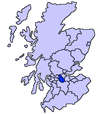
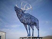
Cumbernauld
| Cumbernauld | |
| Scottish Gaelic: Comar nan Allt | |
 Skyline of Cumbernauld |
|
 Cumbernauld |
|
| Population | 52,270 [1] (2011 census) |
|---|---|
| OS grid reference | NS763736 |
| Council area | North Lanarkshire |
| Lieutenancy area | Dunbartonshire |
| Country | Scotland |
| Sovereign state | United Kingdom |
| Post town | GLASGOW |
| Postcode district | G67, G68 |
| Dialling code | 01236 |
| Police | Scottish |
| Fire | Scottish |
| Ambulance | Scottish |
| EU Parliament | Scotland |
| UK Parliament | Cumbernauld, Kilsyth and Kirkintilloch East |
| Scottish Parliament | Cumbernauld and Kilsyth |
Coordinates: 55°56′42″N 3°59′38″W / 55.945°N 3.994°W
Cumbernauld (/ˌkʌmbərˈnɔːld/; Scots: Cummernaud[2] /ˌkʌmərˈnɔːd/;[3] Scottish Gaelic: Comar nan Allt[4]) is the largest town in North Lanarkshire, Scotland. It was designated a New Town on 9 December 1955, the third of five Scottish New Towns which were built. The three much older satellite villages at Abronhill, Condorrat and The Village were expanded and incorporated into the new town, which was a population overspill for the city of Glasgow. It is the fifth largest town and the 9th most populous locality in Scotland, with about 52,000 people.
History
Early history
Cumbernauld's history stretches to Roman times, with a settlement near the Antonine Wall, the furthest and most northerly boundary of the Roman Empire. The security that the wall gave from possibly hostile tribes to the north probably allowed the foundation of a settlement.
The town's name probably comes from the Gaelic comar nan allt, meaning "meeting of the waters". There are differing views as to the etymology[5] of this. One theory is that from its high point in the Central Belt, its streams flow both west to the River Clyde and east to the Firth of Forth so Cumbernauld's name is about it being on a watershed. Another theory ascribes the name to the meeting point of the Red Burn and Bog Stank streams within Cumbernauld Glen.
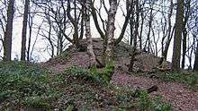

There is a record of the charter of the lands of Lenzie and Cumbernauld, granted to William Comyn by Alexander II in 1216.[6] Cumbernauld Castle was first built as a Norman-style motte and bailey castle. Owned by the Comyns, it was situated at the east end of the park, where the motte (mound) is still visible.[7] The Flemings took possession of Cumbernauld Castle and its estate (c.1306) after Robert the Bruce murdered the Red Comyn. Robert Fleming was a staunch supporter of Bruce, and one of his companions that day. To provide proof that Comyn was dead, Fleming cut off his head in order to "let the deed shaw", a Fleming family motto ever since.[8] On the 1 October 1310 Robert the Bruce wrote to Edward II of England from Kildrum[9] trying, unsuccessfully, to establish peace between Scotland and England.[10] Abercromby describes Malcolm Fleming as returning home to Inverbervie with the formerly exiled 21-year-old King David II.[11] Around 1371, the family built a second castle where the Cumbernauld House now stands.[12] One castle wall exists but most of the stonework was recycled for the House or other buildings. King Robert III knighted Malcolm and granted Sir Malcolm Fleming and his heirs the charter to Cumbernauld Castle on 2 April 1406, just two days before the king's death.[13] Malcolm (and his heir[14] in 1427[15]) were used as hostages to ransom James I back from the English. He also seems to have been arrested by James and imprisoned briefly in Dalkeith Castle.[16] In 1440, this Malcolm Fleming attended the Black Dinner along with his 16-year-old friend Earl William Douglas and his 11-year-old brother David Douglas at Edinburgh Castle.[17] Immediately after the dinner, at which a black bull's head was served, there was a trial on trumped-up charges and the brothers were beheaded in front of the 10-year-old King James II. Malcolm shared their fate three days later.[18] Malcolm was succeed by his son Robert.[19]

The castle played host to the royalty of Scotland. James IV (1473-1513) wooed Margaret Drummond at Cumbernauld Castle, where Margaret's sister was married to Lord Fleming. The Drummond sisters lie buried in Dunblane Cathedral following their poisoning, possibly by a government determined to marry an unwilling King James to the sister of Henry VIII of England, Margaret Tudor. The murders made James IV a frequent visitor to Cumbernauld, Margaret Tudor accompanying him on one occasion. It is recorded that during this James' reign in 1500, the Black Death led to a special plea from the surviving people of Cumbernauld to the church authorities in Glasgow to allow them to establish their own cemetery rather than taking all their dead to St. Ninian's in Kirkintilloch.[20] They were granted permission to do so, and used the ground at the existing Comyns' chapel which dates from the end of the 12th century.

Mary, Queen of Scots visited the castle and planted a yew tree at Castlecary Castle, only a mile or two away, which still grows there. The whole great hall collapsed while the queen was staying there on 26 January 1562, and 7 or 8 men were killed. Most of the queen's party were out hunting.[21] Mary was not hurt and visited the relatives of those who were injured or killed in the village below.[22] Royalty often visited the town to hunt the rare Scottish ox,[23] or white cattle, which roamed in the woods around Cumbernauld. These woods were a surviving fragment of the ancient Caledonian Forest, in which the oxen abounded at least till 1571 and probably until the building of the new house.

Many of these were deliberately killed by Regent Lennox's men and a plaintiff complains: "And amonges others greite enormyties perpetrated be th' erles men of werre they have slayne and destroyed the dere in John Fleming's forest of Cummernald and the quhit ky and bullis, to the gryt destructione of polecie and hinder of the commonweil. For that kynd of ky and bullis hes bein keipit this money yeiris in the said forest; and the like was not mentenit in ony uther partis of the Ile of Albion as is well knowen."[24] (In English, And amongst others, great enormities perpetrated by the Earl's soldiers, they have slain and destroyed the deer[25] in John Flemming's forest of Cumbernauld and the white cows and bulls, to the great destruction of the park of the estate[26] and hindering of the common good. For those kind of cows and bulls have been kept these many years in the said forest; and their like was not maintained in any other parts of the British Isles as is well known.")[27][28]
In 1640, eighteen Scottish noblemen met at Cumbernauld to sign the Cumbernauld Bond to oppose the policies of the Earl of Argyll who controlled the dominant political faction in Scotland. Cumbernauld may have been created a Burgh of barony in 1649,[29] although there is some dispute from Hugo Millar. The Earl of Wigton was ordered to garrison the castle in 1650.[30] Cumbernauld Castle was besieged and largely destroyed by Cromwell's General Monck in 1651.[31] Irvine records that the old castle was burned to the ground by "a party of Highlanders during the rebellion of 1715."[32]


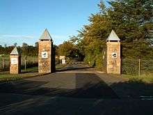
Cumbernauld House, which still survives, was designed by William Adam and built in 1731 near the older castle. In 1746 the retreating Jacobite army was billeted for a night[33] in Cumbernauld village. Rather than stay in Cumbernauld House, the commander, Lord George Murray, slept in the village's Black Bull Inn, where he could enforce closer discipline on his soldiers. After the new house was built, the castle was converted to stables, but was accidentally burnt down by dragoons posted there in 1746. The House's grounds, located in the Glen, are used today as a park, known as Cumbernauld Park.
Post Industrial Revolution
Workers laboured on about 40-50 farms and details from 1839 have been recorded for both arable and livestock farming. Some of them were said to make a "very considerable income" for their owners.[34] Weaving was an important part of the town's industry particularly during the Industrial Revolution. Irvine records that in 1841 a fifth of the whole population of 4501 people worked on about 600 hand looms.[35] Cotton weaving was not a lucrative profession; in fact workers struggled to make ends meet.[36] Many lowland workers migrated and Groome's Gazetteer 1896 records a dwindling population and states "Handloom weaving of checks and other striped fabrics is still carried on, but mining and quarrying are the staple industry."[37] There tended to be plenty of work but even for skilled labourers like the nearby Calton weavers, times were very hard.

The mining and quarrying industries flourished after the completion of the Forth and Clyde Canal in 1790. Quarrying of limestone, coal[38] and clay took place in Cumbernauld, for example at Glencryan, where adits to the old fireclay mines are still clearly visible. Groome's Gazetteer (1882-6) states: "A colliery is at Netherwood [just north of the airport[39][40]]; ironstone has been mined to a small extent by the Carron Company [at Westerwood farm[41]]; and limestone, brick-clay, sandstone, and trap are all of them largely worked, the sandstone for building, the trap for road-metal, paving, and rough masonry." The mine at Netherwood was hand-pumped, although other mines in Cumbernauld had machine pumps to clear them of water.[42]
Parish records give a snapshot of heads of family's occupations in 1835 and 1839 including several bakers, servants, shoemakers and wrights.[43]

Cumbernauld was long a staging-post for changing horses between Glasgow and Edinburgh and there were several inns and a smiddy as well as half a dozen coaches a day to various towns.[44] Old maps like the 1899 O.S. map show other employment like a gas works and a stocking factory in the Village[45] and a corn mill[46] at Lenziemill close to the old brick and pipe works.[47][48] Three schools were run but the teachers were not always paid by the heritors. There were several church ministers and the Established church paid, out of collections, about 25 poor people a week who couldn't support themselves.[49] Groome also records clerical work as there was a post office, two banks and a library with a newsroom.[50]
Towards the end of the 1890s, Jane Lindsay (also called Luggie Jean on account of having three ears according to Millar) was murdered in a pool of water[51] on the edge of Fannyside Moor. The forensic experts, professors at Glasgow and Edinburgh, appeared as witnesses on opposing sides and a not proven verdict was returned.[52]
Historically Cumbernauld has variously been in several administrative jurisdictions[53] including Stirlingshire, Dunbartonshire (sometimes spelled Dumbartonshire), and the Cumbernauld and Kilsyth District of Strathclyde region. Since 1995 it has been part of North Lanarkshire.
New Town history

Cumbernauld was designated a New Town[54] on 9 December 1955. Being in the post-war era there are abundant film and paper records of this which are now being digitized. There was an inaugural ceremony on 28 June 1957 with Viscount Muirshiel, Secretary of State for Scotland of which some silent, colour footage survives. See the On film and TV section for link to this and other footage from this period.
After the Second World War Glasgow was suffering from a chronic shortage of housing and poor housing conditions, particularly in areas such as the Gorbals. As a direct result the Clyde Valley Regional Plan 1946 allocated sites where satellite new towns were to be built to alleviate the problem through an overspill agreement.[55] Glasgow would also undertake the development of its peripheral housing estates. Cumbernauld was designated a new town in 1955, the third to be designated in Scotland. The others were East Kilbride, Glenrothes, Livingston and Irvine (Cowling 1997).

The development, promotion and management was undertaken, until 1996, by the Cumbernauld Development Corporation (CDC). This was a quango appointed by the Secretary of State for Scotland (Cowling 1997).
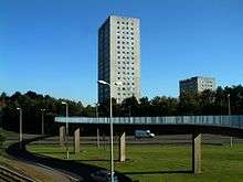
Cumbernauld is the clearest example of a modernist new town vision in the UK.[56] Housing was originally built in a series of satellite neighbourhoods clustered around the hilltop town centre. Separation of people and cars was a major element of the first town master plan, and this was carried through for much of the development of the town. Cumbernauld pioneered designs for underpasses and pedestrian footbridges as well as segregated footpaths. This seemed strange to many settlers arriving from Glasgow, and the town's nickname of Noddy Land was coined. Early neighbourhoods were designed by the CDC and were constructed at Kildrum, Cumbernauld Village, Seafar, North Carbrain and Greenfaulds. Other neighbourhoods were later developed at Condorrat, South Carbrain and Abronhill. Much of the housing in these areas won awards for their innovative designs.
Cumbernauld town centre's lead designer was Geoffrey Copcutt. Phase 1 was opened by Princess Margaret in 1967 of which some footage survives.
When originally designated a New Town the target population was 50,000. In 1961, only five years after becoming a new town, the area to the north of the A80 was added to the town's area with new planned neighbourhoods at Balloch, Dullatur, Westerwood and Eastfield. As a result, a revised target population of 70,000 was set.[57] However, the 2011 census still only shows about 52,000 residents.

When Raymond Gillies, a local businessman, gifted Cumbernauld the St. Enoch's station clock, in 1977, the Queen was celebrating her Silver Jubilee. To mark the occasion, the Queen started the clock using the pendulum motion and unveiled a commemorative plaque at Cumbernauld Town Centre, at the staircase joining the upper mall area with the old Woolco store. The clock is featured in Gregory's Girl and is now in the Antonine Centre.
After the creation of the new town, diverse industries such as high-tech, electronics, and chemical and food processing became large employers, along with the Inland revenue (now Her Majesty's Revenue and Customs). The main industrial estates were developed to the east and west along the A80 at Castlecary, Wardpark and Westfield. Areas at Luggiebank and South Carbrain to the south of the town have also been developed for industry.
The Cumbernauld Development Corporation (C.D.C.) disbanded in 1996.[58]
Modern times

The Modern era for the town can be dated from the disbanding of the C.D.C. in 1996. Since then, the outlook has changed dramatically[59] and the New Town has won a number of very unflattering awards including Urban Realm's "Plook on a Plinth" in both 2001 and 2005.[60] In December 2005 the entire Town Centre won a public nomination for demolition in the Channel 4 series Demolition, where it was voted "the worst building in Britain".[61] As a result of this, it was featured on the BBC Radio 2 comedy programme It's Been a Bad Week, where it won the show's fictional "Worst Week of the Week Award, Awarded Weekly, on a Week-By-Week Basis" in 2003.
The intended core of Cumbernauld remains the Town Centre buildings, all of which is essentially contained within one structure, segmented into "phases", the first of which was completed in 1967, the latest of which began construction in May 2003 for completion around September 2004. Initially the basic groundwork for the new shops began in 1997 and were finally completed in summer 2007. Designed to be a commerce centre, an entertainment and business venue and a luxury accommodation site, it was widely accepted as Britain's first shopping centre and was the world's first multi-level covered town centre.[56] However, the town never developed to its planned size, and the town centre has never had the life envisaged by town planners. Wealthy occupiers for the penthouses situated within the "Alien's Head" (locals' acrid moniker for the top section of the building[62][63]) never materialised. Further expansion has been primarily to provide further space for shops. A substantial portion of the original Shopping Centre was demolished due to structural damage and has been redeveloped as a new shopping and leisure complex.[64]
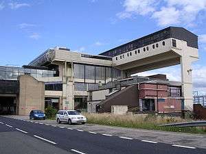
As well as the unfulfilled ambitions for the town, the passage of time has exposed serious defects in post-war concepts of centrally-planned retail and civic centres developed in the absence of proper community consultation or sensitivity to local environmental and economic conditions. This has been reflected in a country-wide backlash against modernist architecture in general. Cumbernauld's Town Centre is widely regarded as one of the ugliest[65] and least-loved[66] examples of post-war design in Scotland. The confusing layout is an abiding source of frustration for both visitors and residents, many of whom are the descendants of skilled workers who aspired to escape the frequently appalling social and housing conditions of the Glasgow conurbation in the 1960s and 70s.


Despite its bad press, from a purely aesthetic standpoint Cumbernauld is regarded as representing a significant moment in town design, and in 1993 it was listed as one of the sixty key monuments of post-war architecture by the international conservation organisation DoCoMoMo.
The residential structure of Cumbernauld is noteworthy in that there were no pedestrian crossings, i.e. zebra or pelican crossings — pedestrians originally traversed roads by bridge or underpass. These underpasses could collect litter, sometimes smelt like public toilets or were used by local youths trying to keep out of the rain. These are not things the original planners anticipated but mean that pedestrians sometimes choose to avoid them, especially at night-time or if they feel vulnerable. Some efforts have been taken to redress some of these matters but the problem is ongoing.[67] In 2004 a set of traffic lights was erected in the Condorrat Village neighbourhood, soon followed by pelican crossings beside the new Tesco Extra.
Cumbernauld in the last few years has seen a surge of business activity with the New OKI UK headquarters in Wardpark and Yaskawa Electronics too. Irn-bru makers A.G. Barr also has its World Headquarters there. The old Isola-Werke factory in the Wardpark area has been converted into film studios and production facilities for the TV series Outlander which frequently films within the town's greenspaces. In particular, the Scottish Wildlife Trust's Cumbernauld Glen reserve, has been used as a backdrop whose ancient oak forest remnant provides a convenient stand-in for 18th Century Highlands' scenes. In May 2016 North Lanarkshire Council agreed to the expansion the Wardpark site if funding could be found.
Environment
In contrast to its reputation as a "Concrete Jungle" Cumbernauld is well provisioned for environmental amenities and actually consists of more than 50% green space.[68]
The town was designed to incorporate green spaces as a resource for the community, but this network was often poorly planned, fragmented and planted with (by modern standards) an insensitive mix of non-native trees and plants. More modern management techniques are slowly seeing much of this planting replaced with native species.
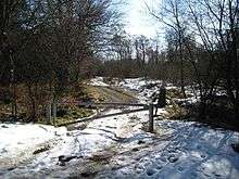
The Scottish Wildlife Trust owns four wildlife reserves in the town - Cumbernauld Glen,[69] Luggiebank Wood,[70] Forest Wood,[71] and Northside Wood.[72] These cover a multitude of habitats including ancient Oak forest (with attendant spectacular bluebell displays in early summer) and large areas of Scots Pine coverage.
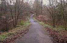


Cumbernauld (like Ben Lomond) lies on the Scottish watershed, the drainage divide which separates river systems that flow to the east from those that flow to the west. There are two main waterways which flow out of Cumbernauld: the Red Burn (from which the town's Gaelic name is derived) and the Luggie Water (immortalised by David Gray). The Red Burn[73] flows through the Glen and there are pleasant walkways alongside this and the Bog Stank which is much more appealing than the name suggests.

There is also a footpath along the Glencryan Burn with miles of quiet pathways up towards Pallacerigg and Fannyside Lochs.
Fannyside Muir, to the south of the town, is part of the Slamannan plateau, an area of 183 hectares of lowland bog. This rare and important habitat has been historically mismanaged but is now being restored by a variety of organisations including the national insect charity Buglife. The plateau is deisgnated as a SSSI (Site of Special Scientific Interest) and an SPA (Special Protection Area), partly because of its nationally important population of Taiga Bean Geese (Anser fabialis fabialis).


There are also a large number of parks, and there are also LNRs (Local Nature Reserves) and SINCs (Sites of Importance for Nature Conservation) owned and managed by North Lanarkshire Council. For example St. Maurice's Pond[74] as a SINC and Ravenswood[75] has a LNR. In 1993 Broadwood Loch, a balancing lake, was created by damming the Moss Water and using a plastic waterproof membrane, and a 6m wall to hold back the water.[76] This was primarily to prevent flooding downstream but also for recreation.

A flagship landscape scale conservation partnership led by the Scottish Wildlife Trust, the Cumbernauld Living Landscape (CLL), operates in the town with the aim of enhancing, connecting and restoring the greenspaces and improving people's perceptions of and access to them.[77]
In 2014 the CLL obtained camera trap footage of Pine Martens living in the woods within Cumbernauld and the return of this rare and iconic species (formerly extinct across the Central belt of Scotland) has become a central plank of the organisation's strategy to improve perceptions of nature in the town.
Housing
Much of the town's original housing was very poorly designed for the Scottish climate. Flat roofs routinely let in water, and long narrow terraced streets with deep gullies which collect litter and debris make some areas dark, windy and visually unappealing. Although the town was designed around the motorcar there are inadequate provisions for parking and road signage.
Cumbernauld North is home to more modern, upmarket and large detached homes, many of which are surrounded by a golf course and have a backdrop of the Campsie Fells.
Awards
In 1967 the Institute of American Architects voted Cumbernauld the world's best new town conferring the Reynold's Memorial Award.[78] Cumbernauld is a two-time winner of the Carbuncle Awards in 2001 and 2005.[79] The town has since received the award of 'Best Town' at the Scottish Design Awards 2012.[79] The Royal Town Planning Institute (RTPI) awarded the town a certificate in March 2014 for its success as a New Town. In 2015 the Town Centre was awarded the Green Apple Environmental Award.[80] Cumbernauld won the 2013 Beautiful Scotland Award for the best "Small City".[81] It has also received silver medals each year since 2009,[82] the most recent being in 2016.[83]
Sport and leisure


Cumbernauld hosts many sporting clubs including Clyde F.C, who currently play football in the Scottish League Two and reside at Broadwood Stadium, which has been their home since they relocated from their traditional base of Glasgow in February 1994.
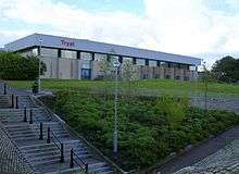
In 2012 Broadwood Stadium's grass pitch was replaced by a new artificial FIFA standard 3G surface in a partnership between fellow tenants and Lowland League club Cumbernauld Colts, North Lanarkshire Leisure and the local council. Cumbernauld is home to Junior football side Cumbernauld United who play at Guy's Meadow. Five-a-side can be played at the Tryst or Broadwood who also have seven-a-side and full size pitches. Pitches are bookable at Ravenswood and Oak Road too. Broadwood also has a BMX track[84] and spin classes for cycling.

The town's rugby team, Cumbernauld RFC, were formed in 1970 and quickly grew to have 3 senior men's teams and several junior teams.[85] The club and council agreed in the late 70's to develop the Auchenkilns area in South Condorrat. The multi-sports facility opened in 1979 and is now shared with Kildrum United FC. They currently play in West regional league 2, the 5th tier of club rugby.[86]
There has been a gymnastics team, Cumbernauld Gymnastics Club, in the town for many years, and in the early 1990s it moved into its present base at Broadwood Gymnastics Academy, a purpose built building at the same site as Broadwood Stadium. They also have tennis and short tennis at Broodwood. Dance classes are held at a number of location including Cumbernauld Theatre which also has drama classes and programmes.
There is also the Cumbernauld Handball Team, Tryst 77 which in 2007 came second in the British Handball Championships. The Tryst houses the Cumbernauld swimming team with many age groups competing in galas around the country, along with the Tryst Lions wrestling club. The Tryst also has squash and badminton courts as well as gyms. Martial arts are practised in The Link, the Tryst and at Broodwood. Raw Taekwondo also have a centre at Westfield Industrial Estate.[87]

There is an archery club, Palacerigg Field Archers, that meets for practice at the Tryst Sports Centre every Saturday morning. The club has an archery course at the nearby Palacerigg Country Park where competitions are held.
Palacerrig also has one of the town's three golf courses. The other two courses are Dullatur Golf Club (where Cumbernauld Chess Club also meet), and Westerwood, which was designed by Seve Ballesteros and Dave Thomas.
Snooker can be played at the Red Triangle. Bowling is played in the Village, at Ravenswood and in Condorrat.
Transport
In terms of public transport, Cumbernauld has bus links[88] to Glasgow, including the airport,[89] Stirling, Falkirk, Dunfermline and St Andrews, which are operated by FirstGroup and Stagecoach. Various parts of the town are linked by local bus services, operated by smaller companies such as Canavan Travel and Dunn's Coaches. Rail services to and from the town are provided by Abellio ScotRail.
.jpg)
The town has rail links to Glasgow, Falkirk, Motherwell and Edinburgh via Cumbernauld railway station. There is also a station at Greenfaulds. Croy railway station to the north of the town has rail links to Edinburgh, Alloa, Dunblane and Glasgow.
Nearby motorway links include the M8, M73, M74, M80, M876 and M9. A local campaign was recently initiated to protest at the proposed extension of the M80 within the town limits. The A80 was recently upgraded to the M80.
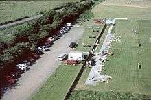
Cumbernauld Airport (EGPG) is primarily used for the training of fixed wing and rotary wing pilots, it also has an aircraft maintenance facility. The airport has a CAA Ordinary Licence that allows flights for the public transport of passengers or for flying instruction as authorised by the licensee, Cormack Aircraft Services Limited. The airport was opened by the Cumbernauld Development Corpororation in the late 1980s. Before the airport was constructed there was a grass strip in use on the same site.
Media
The local Cumbernauld newspaper is the Cumbernauld News. For online news and videos there is also Cumbernauld Media.
Governance
Cumbernauld have 11 council members out of 69 North Lanarkshire Councillors.[90]
Jamie Hepburn is the area’s elected MSP for the Scottish Parliament constituency. He is also a member of the Scottish National Party.[91] As part of the Central Scotland region there are 7 additional MSPs.
Stuart McDonald is the area’s elected MP for the UK Parliament constituency. He is a member of the Scottish National Party.[92] As he said in his maiden speech he has sometimes been mistaken for his namesake who is also an SNP MP.[93][94]
There are also 6 MEPs for Scotland (European Parliament constituency). They are members of 4 different parties.
Education
Historical
The New Statistical Accounts of Scotland (April 1839) described 3 schools: Cumbernauld Village 80-90 pupils, Condorat (sic) 60-70 pupils, Garbethill [East Fannyside] 20 pupils. It records "few people between 6 and 15 are unable to read the Bible".[95] Groome's Gazetter (1896) has "Three public schools- Cumbernauld, Condorrat, and Arns [near today's Abronhill] - and Drumglass Church school, with respective accommodation for 350, 229,50, and 195 children, had (1880) an average attendance of 225,98,30, and 171."[96]
The Town has many primary and secondary schools to cater for the needs of the town and others surrounding it. The Cumbernauld College provides further education in the town.
Primary schools
|
Secondary schools
Special-needs schoolsFurther education |
Religion
Historically Groome's Gazetteer stated "pre-Reformation chapels are thought to have existed at Achenbee, Achenkill, Chapelton, Kildrum, Kilmuir, and Croy."
There are currently about 17 churches in the town. These include:
Church of Scotland[103]
- Abronhill Parish
- Condorrat Parish
- Cumbernauld Old - The historical Groome's Gazetteer has "The parish church here is an old building, containing 660 sittings."
- Kildrum Parish
- St Mungo's
Roman Catholic[104]
- Sacred Heart
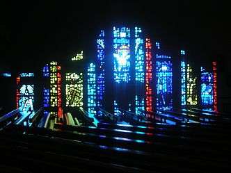 Sacred Heart Church in Kildrum, Cumbernauld.
 - St. Joseph's
- St. Lucy's
Other churches

- Apostolic Church[105]
- Carbrain Baptist Church
- Cornerstone Christian Fellowship[106]
- Craigalbert Church
- Cumbernauld Free Church[107] - Historically Groome's Gazetteer states "the Free church dates from 1826, having belonged to the Original Secession, but has been lately almost rebuilt; and there is also a new United Presbyterian church."[108]
- Holy Name Episcopal Church[109]
- Mossknowe Gospel Hall
- The Salvation Army[110]
- United Reformed Church[111]
Islam
- A purpose built mosque opened in 2011
Demographics
Population:
Year: Population.
1755: 2303
1791: 1600
1801: 1795[112]
1811: 2176
1821: 2864
1831: 3080[113]
1841: 4501
1851: 3778
1861: 3513
1871: 3602[114]
On film and TV
Film
- Cumbernauld (1957) colour 2 mins. Cutting turf silent - inaugural ceremony on 28th June 1957 with Viscount Muirshiel, Secretary of State for Scotland.[115]
- Building New Houses At Cumbernauld. (1959) colour 6 mins possibly Braehead Rd. Kildrum or Fleming Rd. Seafar?[116]
- Glasgow (1963) colour 20 mins Douglas Gray Includes very brief footage of East Kilbride and Cumbernauld[117]
- British Movietone News (1965) B&W 2 min Roundabout International journalists visit Cumbernauld.[118]
- The Design of Space (1966) Dir: Don C. Chipperfield (minutes 1-3)[119] with incredible pronunciation of Cumbernauld.
- Pathe News (1967) B&W 1 min Princess Margaret In Cumbernauld to open Phase 1 [120]
- New Towns (1969) 22 mins colour. A study of the new towns of East Kilbride, Glenrothes, Cumbernauld and Livingston.[121]
- Cumbernauld, Town For Tomorrow (1970) 25 mins colour. Director Robin Crichton. Narrated by Magnus Magnusson[122]
- Marshall-Orr (1975) 17 mins colour silent Has some footage of the Town Centre and railway station.[123]
- Cumbernauld HIT (1977) 44 mins colour. A James-Bond type fiction film about an evil woman's plans to 'hi-jack' the New Town of Cumbernauld with a bio-weapon dir: Murray Grigor, Sponsor: CDC.[124] Has some chase sequences round the old Town Centre.
- Gregory's Girl Bill Forsyth's 1981 film set in Abronhill High and around the town. The name of the town in the film was Climackston New Town (sic) and it was signed as being 20 miles from Glasgow, 25 miles from Edinburgh and 9000 miles from Caracus.[125]
- In Peter Mullan's (1998) film Orphans some of the scenes were shot in Torbrex Road and other sites in North Carbrain.
- Bill Forsyth's sequel (from 1999), Gregory's Two Girls follows the original.
- New Town Year 2059 - A re-edit of footage (can be found with video search).
TV
- STV Town Planning - The New Town of Cumbernauld (1966) Geoff Rimmer[126]
- STV - Gallimaufrey (c. 1970) 3 mins colour – A Cumbernauld Poem - A vision of a new town[127]
- It's a Knockout (1981) BBC 45 mins Dunfermline vs Cumbernauld vs Glenrothes (can be found with video search).[128]
- What's it Called? - TV advert. voice over includes Bill McLaren (can be found with video search)
- St. Mungo's church building features very briefly in Jonathan Meades' atheistic polemic Absentee Landlord where he compares God to a Ku Klux Klansman.
- Demolition (2005 - Channel 4). Episode 4[129]
- DIY SOS (c2005). Season 11 Episode 6 - a couple have run out of steam after carrying out years of DIY work[130]
- Craig Ferguson returns to Cumbernauld High School and his old haunts in Torbrex Road, North Carbrain. (Craig Ferguson 5/16/12A Late Late Show in Scotland)
- BBC Scotland's Limmy had a short sketch about moving to Cumbernauld.[131]
- STV had a short short piece about the positives of the town: Reasons Cumbernauld is possibly the best place in Scotland.[131]
Wardpark Studios
The Outlander TV series used Wardpark Studios as its base for sets. Several scenes from the TV series were shot in local woodland. In May 2016 approval was given to expand the site from 30,000 sq ft to 78,000 sq ft.[132]
Famous residents
- Neil Primrose, of the band Travis was born and raised in Cumbernauld
- Jon Lawler, of the bands The Fratellis and Codeine Velvet Club lives in Cumbernauld with his family
- Ken Buchanan, a former world boxing champion is a resident of Cumbernauld
- Craig Ferguson, comedian, writer, actor and talk show host
- Lynn Ferguson, actress and writer, best known for playing Mac in Chicken Run
- Paula Sage, actress and Special Olympics athlete, appeared in the television dramas River City and AfterLife
- The Dykeenies, band
Areas of the town
- Abronhill
- Balloch
- Blackwood
- Blairlinn
- Carbrain
- Carrickstone
- Condorrat
- Craigmarloch
- Cumbernauld Village
- Dalshannon
- Eastfield
- Greenfaulds
- Kildrum
- Lenziemill
- Luggiebank
- Ravenswood
- Seafar
- Smithstone
- Wardpark
- Westerwood
- Westfield
Nearby towns and villages
Towns
Villages
Twin towns
Notable buildings
Cumbernauld has many works by well-known architects. Gillespie, Kidd & Coia designed a number of buildings in the New Town, including:
See also
References
Specific references:
- ↑ Admin Services, Civic Centre (8 April 2009). "Table 1: 2011 census locality populations".
- ↑ http://theses.gla.ac.uk/5270/1/2014DrummondPhD.pdf#233 Peter Drummond PhD 2004 pg 233
- ↑ "Scots Culture - Names in Scots - Places in Scotland - Scots Language Centre". Scotslanguage.com. Retrieved 2011-10-30.
- ↑ "Ainmean-Àite na h-Alba - Gaelic Place-Names of Scotland - Database". Gaelicplacenames.org. Retrieved 2011-10-30.
- ↑ http://theses.gla.ac.uk/5270/1/2014DrummondPhD.pdf#233 Historical variants - Peter Drummond PhD 2004 pg 233
- ↑ https://archive.org/stream/kirkintillochtow00wats#page/n15/mode/2up Kirkintilloch, Town and Parish (The Comyns)
- ↑ http://btckstorage.blob.core.windows.net/site2667/CHttpHandler.pdf Friends of the Glen pdf map accessed July 2016
- ↑ https://flemish.wp.st-andrews.ac.uk/2014/05/19/the-flemings-of-cumbernauld-castle/ The Fleming Family and the Castle
- ↑ "Dumbarton Sheet XXVI.1 (Cumbernauld) 1864 map". National Library of Scotland. O.S. Retrieved 10 August 2016.
- ↑ "Letter from Robert the Bruce to Edward II reveals power struggle in the build-up to Bannockburn". University of Glasgow. Retrieved 10 August 2016.
- ↑ Abercromby, Patrick. The martial atchievements of the Scots nation. Edinburgh: R. Freebairn. p. 81. Retrieved 5 August 2016.
- ↑ flemish.wp.st-andrews.ac.uk/2014/05/19/the-flemings-of-cumbernauld-castle St. Andrews conference - The Fleming Family and the Castle
- ↑ https://archive.org/stream/kirkintillochtow00wats#page/14/mode/2up Kirkintilloch, Town and Parish pg 15
- ↑ Abercromby, Patrick. The martial atchievements of the Scots nation. Edinburgh: R. Freebairn. p. 270. Retrieved 5 August 2016.
- ↑ "Dictionary of National Biography, 1885-1900, Volume 23". Retrieved 5 August 2016.
- ↑ The martial atchievements of the Scots nation. p. 273. Retrieved 5 August 2016.
- ↑ Mackie, Charles (1835). The castles of Mary, Queen of Scots; being a historical description of every castellated erection which formed a residence or a prison to that Queen. (3d ed. ed.). London: T. Tegg. pp. 81–82. Retrieved 5 August 2016.
- ↑ Abercromby, Patrick. The martial atchievements of the Scots nation. Edinburgh: R. Freebairn. pp. 329–331. Retrieved 5 August 2016.
- ↑ Almon, J. (1767). The peerage of Scotland; a genealogical and historical account of all the peers of that ancient kingdom ... London. p. 103. Retrieved 5 August 2016.
- ↑ Dane Love, 1989, Scottish Kirkyards. pg 90-9 quoted in "Excavations at 3-11 Main Street, Cumbernauld" pdf
- ↑ Calendar State Papers Scotland, vol. (1898), no. 1071, p. 598.
- ↑ http://www.derelictplaces.co.uk/main/residential-sites/10294-cumbernauld-house-april-2009-a.html#.V5o72aJGQ6o Historic Timeline
- ↑ Brome, James (1707). Travels over England, Scotland, and Wales. p. 187. Retrieved 5 August 2016.
- ↑ Storer, John, of Hellidon (1879). The wild white cattle of Great Britain. An account of their origin, history, and present state. London, New York [etc.]: Cassell, Petter, Galpin & co. pp. 326–327. Retrieved 11 August 2016.
- ↑ https://archive.org/stream/newstatisticalac08edin#page/n210/mode/1up dogs trained to hunt deer pg183
- ↑ "Scottish National Dictionary (1700–)". DSL Dictionary of the Scots Language. Retrieved 8 August 2016.
- ↑ http://www.collinsdictionary.com/dictionary/english/kye ky definition see also Kyne
- ↑ https://archive.org/stream/kirkintillochtow00wats#page/28/mode/2up White Cows pg 26-28
- ↑ Website, Scottish Mining. "Misc. Areas - Scottish Mining Website".
- ↑ https://archive.org/stream/royallettersinst00mait#page/130/mode/1up Wigton papers pg 130
- ↑ "History". Cumbernauld Community Development Trust. Retrieved 2 August 2016.
- ↑ https://archive.org/stream/bookdumbartonsh04irvigoog#page/n442/mode/1up The Book of Dunbartonshire pg 397
- ↑ http://www.rbwf.org.uk/wp-content/uploads/2016/03/1963.pdf Kirkintilloch, Town and Parish pg188
- ↑ https://archive.org/stream/newstatisticalac08edin#page/n176/mode/1up Farming Stats 1839
- ↑ https://archive.org/stream/bookdumbartonsh04irvigoog#page/n443/mode/1up The Book of Dunbartonshire pg 398
- ↑ https://archive.org/stream/newstatisticalac08edin#page/n175/mode/1up Weavers' Pay
- ↑ http://www.gazetteerofscotland.org.uk/ Groome's - search for Cumbernauld
- ↑ https://archive.org/stream/newstatisticalac08edin#page/n203/mode/1up coal mine at Holland Hirst pg 176 Map: http://maps.nls.uk/view/74400286
- ↑ http://cameron.dinastee.me.uk/Netherwood.php Netherwood near airport and Antonine Wall
- ↑ http://www.scotlandsplaces.gov.uk/record/nls/24816/ordnance-survey-six-inch-mile-dunbartonshire-sheet-n-xxixse/OS6Inch2nd Zoom on R.H. map for Netherwood
- ↑ https://archive.org/stream/newstatisticalac08edin#page/n163/mode/1up iron mine Westerwood
- ↑ https://archive.org/stream/newstatisticalac08edin#page/n163/mode/1up mining pumps pg 136
- ↑ http://www.oldscottish.com/cumbernauld.html Cumbernauld Parish Records 1835, 1839
- ↑ https://archive.org/stream/newstatisticalac08edin#page/n178/mode/1up Coaches and Boats
- ↑ http://maps.nls.uk/view/75675308 Stocking Factory
- ↑ http://www.scottish-places.info/features/featurefirst16491.html Lenziemill historic employment
- ↑ http://maps.nls.uk/geo/explore/#zoom=16&lat=55.9477&lon=-3.9881&layers=1&b=1 Great Old Maps
- ↑ http://www.scotlandsplaces.gov.uk/ordnance-survey-map-series/list/os6inch2nd/dunbartonshire/cumbernauld more auld maps
- ↑ https://archive.org/stream/newstatisticalac08edin#page/n180/mode/1up Education and poor relief
- ↑ http://www.gazetteerofscotland.org.uk/ Groome's Cumbernauld
- ↑ "Jean's Hole". Open Street Map. Retrieved 8 August 2016.
- ↑ Hugo B. Millar, Historical Cumbernauld (1st edn) pg 26
- ↑ https://archive.org/stream/newstatisticalac08edin#page/n167/mode/2up Stirlingshire and Dumbartonshire
- ↑ https://archive.org/details/new_town_TNA Early cartoon showing thinking from 1948
- ↑ Fraser, W Hamish. "Modern Times: 1950s to The Present Day - Neighbourhoods -New Towns". TheGlasgowStory. Retrieved 2010-05-08.
- 1 2 "From Here To Modernity Buildings - Cumbernauld Town Centre". Open2.net. 1955-12-09. Retrieved 2011-10-30.
- ↑ "Site Record for Cumbernauld, Cumbernauld Town Centre, General Town Centre Details". Canmore.rcahms.gov.uk. Retrieved 2011-10-30.
- ↑ https://cumbernauldhousetrust.wordpress.com/about/ End of the C.D.C.
- ↑ http://www.bbc.co.uk/scotland/history/scotlandonfilm/forum/newlife/thread1.shtml testimony of decline
- ↑ "UK | Scotland | Officials condemn 'Carbuncle' tag". BBC News. 2005-10-21. Retrieved 2011-10-30.
- ↑ "Demolition". Channel 4. 2005. Retrieved 2011-10-30.
- ↑ "What's it called? Carbuncle-nauld". Airdrie & Coatbridge Advertiser. Scottish and Universal Newspapers. 21 November 2001.
[T]he centre is topped by a rather unsightly block...Cumbernauld residents dubbed [it] the 'Alien's Head', in homage to ET.
- ↑ Caro Ramsay (6 December 2013). "What's it called? Cumbernauld!". Murder is Everywhere. Retrieved 9 February 2014.
...the centre's penthouses located within the 'alien's head' lie empty and derelict.
- ↑ "Antonine Centre website".
- ↑ Campbell, Scott (August 2013). "Cumbernauld takes battering over 'ugliest UK centre' once again". Cumbernauld Media. Retrieved 6 August 2016.
- ↑ https://books.google.co.uk/books?id=zrIC4jRVTSkC&lpg=PA175&ots=skBd-lPdRn&dq=cumbernauldian&pg=PA168#v=onepage&q&f=false You Are Awful (But I Like You): Travels Through Unloved Britain
- ↑ "Craiglinn Underpass". world landscape architect. Bigg Design. Retrieved 13 August 2016.
- ↑ "About the project". Cumbernauld Living Landscape. Retrieved 6 August 2016.
- ↑ "Cumbernauld Glen". Scottish Wildlife Trust. Retrieved 6 August 2016.
- ↑ "Luggiebank Wood". Scottish Wildlife Trust. Retrieved 6 August 2016.
- ↑ "Forest Wood". Forest Wood. Scottish Wildlife Trust. Retrieved 6 August 2016.
- ↑ "Northside Wood". Northside Wood. The Scottish Wildlife Trust. Retrieved 6 August 2016.
- ↑ https://archive.org/stream/castlecaryandgr00bairgoog#page/n28/mode/2up possibly derivation of Red Burn
- ↑ Lambert, Tracy (3 June 2015). "Why St Maurice's pond is a special place!". Cumbernauld Living Landscape. Retrieved 6 August 2016.
- ↑ "Local Nature Reserves". North Lanarkshire Council. Retrieved 6 August 2016.
- ↑ http://www.scottish-places.info/features/featurefirst18072.html Broodwood Loch
- ↑ Campbell, Scott (26 June 2015). "Open day celebrates the natural beauty of Ravenswood". Cumbernauld Media. Retrieved 6 August 2016.
- ↑ http://www.scotlandsplaces.gov.uk/record/rcahms/70556/cumbernauld-seafar-general/rcahms Reynold's Aware
- 1 2 "Cumbernauld voted best town after double 'plook' shame". BBC News. 2012-05-25.
- ↑ Campbell, Scott (11 September 2015). "Cumbernauld Shopping Centre picks up environmental award". Cumbernauld Media. Retrieved 6 August 2016.
- ↑ "Cumbernauld shakes off the 'Carbuncle' tag". HeraldScotland. 11 Sep 2013. Retrieved 17 September 2016.
- ↑ Campbell, Scott (3 May 2014). "Cumbernauld gets ready to defend its Beautiful Scotland title". Cumbernauld Media. Retrieved 17 September 2016.
- ↑ "2016 Medals". Beautiful Scotland. Retrieved 17 September 2016.
- ↑ MacLean, Ian. "BMX action at Cumbernauld". Cumbernauld News. Retrieved 5 October 2016.
- ↑ "Players turn out in force for Cumbernauld event". Cumbernauld News. 19 August 2016. Retrieved 5 October 2016.
- ↑ "Information - Cumbernauld Rugby Club".
- ↑ Maclean, Ian (24 August 2016). "New Taekwondo centre can help boost sport". Cumbernauld News. Retrieved 5 October 2016.
- ↑ Campbell, Scott (11 November 2015). "Bus stance improvements nearing". Cumbernauld Media. Retrieved 6 August 2016.
- ↑ "First ever Airlink bus from Cumbernauld to Glasgow Aiport ready for launch". Cumbernauld News. Retrieved 10 August 2016.
- ↑ "Member and Committee Information". North Lanarkshire Council. Retrieved 6 August 2016.
- ↑ "Jamie Hepburn MSP". The Scottish Parliament. Retrieved 6 August 2016.
- ↑ Campbell, Scott (21 May 2015). "Cumbernauld's MP is officially sworn in". Cumbernauld Media. Retrieved 6 August 2016.
- ↑ Campbell, Scott (16 July 2015). "MP McDonald makes maiden speech". Cumbernauld Media. Retrieved 6 August 2016.
- ↑ "Stuart C. McDonald MP". UK Parliament. Retrieved 6 August 2016.
- ↑ https://archive.org/stream/newstatisticalac08edin#page/n175/mode/1up New Stats Education
- ↑ http://www.scottishmining.co.uk/157.html School attendance late 19th C
- ↑ http://www.northlanarkshire.gov.uk/index.aspx?articleid=1541 North Lanarkshire Primaries
- ↑ "Cumbernauld has new school as Greenfaulds High School opens". Cumbernauld News. Retrieved 4 October 2016.
- ↑ Campbell, Scott (20 January 2015). "Work starts on new Cumbernauld school campus". Retrieved 6 August 2016.
- ↑ http://www.northlanarkshire.gov.uk/index.aspx?articleid=1552 North Lanarskshire High Schools
- ↑ http://www.northlanarkshire.gov.uk/index.aspx?articleid=5942 Glencyran School council
- ↑ http://www.northlanarkshire.gov.uk/index.aspx?articleid=5946 Redburn School council
- ↑ The Church of Scotland in Cumbernauld https://ccosfive.wordpress.com/. Retrieved 21 August 2016. Missing or empty
|title=(help) - ↑ "Churches in North Lanarkshire". Catholic churches and weekday Mass times. Retrieved 21 August 2016.
- ↑ "Greenfaulds Apostolic Church". Retrieved 21 August 2016.
- ↑ "Cornerstone House". Retrieved 21 August 2016.
- ↑ "Cumbernauld Free Church". Retrieved 21 August 2016.
- ↑ http://www.scottishmining.co.uk/157.html Groome's Gazetteer
- ↑ "Holy Name, Cumbernauld". The Scottish Episcopal Church. Retrieved 21 August 2016.
- ↑ "Cumbernauld A church for the community". The Salvation Army. Retrieved 21 August 2016.
- ↑ "Cumbernauld URC". Retrieved 21 August 2016.
- ↑ https://archive.org/stream/historyofdumbar00irvi#page/n546/mode/1up also births, marriages and deaths
- ↑ https://archive.org/stream/newstatisticalac08edin#page/n175/mode/1up New Stats pg 148
- ↑ https://archive.org/stream/bookdumbartonsh04irvigoog#page/n443/mode/1up Irvine pg 398
- ↑ "Full record for 'CUMBERNAULD NEW TOWN INAUGURAL CEREMONY: 28th June, 1957' (5020) - Moving Image Archive catalogue".
- ↑ "Full record for 'BUILDING NEW HOUSES AT CUMBERNAULD' (5343) - Moving Image Archive catalogue".
- ↑ "Full record for 'GLASGOW' (0915) - Moving Image Archive catalogue".
- ↑ "Cumbernauld · story · British Universities Film & Video Council".
- ↑ "East Anglian Film Archive: The Design of Space, 1966".
- ↑ Pathé, British. "Princess Margaret In Cumbernauld".
- ↑ http://movingimage.nls.uk/film/1826 National Library of Scotland Ref:1826
- ↑ "Full record for 'CUMBERNAULD, TOWN FOR TOMORROW' (2227) - Moving Image Archive catalogue".
- ↑ "Full record for 'GUID GEAR 'SMA' BOOK' (8241) - Moving Image Archive catalogue".
- ↑ "Full record for 'CUMBERNAULD HIT' (4294) - Moving Image Archive catalogue".
- ↑ http://www.hiddenglasgow.com/forums/search.php?keywords=film&t=5996&sf=msgonly Gregory's Girl New Town
- ↑ "Town Planning - The New Town of Cumbernauld (1966)".
- ↑ "Gallimaufrey – A Cumbernauld Poem - Scotland on Screen".
- ↑ "It's a Knockout![26/06/81] (1981)".
- ↑ "Demolition - Episode Guide - All 4".
- ↑ TVGuide. "DIY SOS Episode Guide and Episode List - TV Guide UK TV Listings".
- 1 2 http://stv.tv/news/west-central/1345854-reasons-cumbernauld-is-possibly-the-best-place-scotland/ STV one minute of footage
- ↑ http://www.bbc.co.uk/news/uk-scotland-glasgow-west-36290779 Wardpark Studios expansion
General references:
- Cowling, D (1997) An Essay for Today- The Scottish New Towns 1947-1997 (Rutland Press, Edinburgh)
- Scotland on Film new town archive
- Film- New Towns in Scotland
- Times Online article
- Cumbernauld Park
- Cumbernauld, Town for Tomorrow
- From Here to Modernity website
- New Towns: Can They Be Given New Life?
- 360 Degree Panoramas of Cumbernauld Airport from musicpro.co.uk
External links
| Wikimedia Commons has media related to Cumbernauld. |
- Cumbernauld Media, Cumbernauld's local website (A local website covering Cumbernauld, publishing analysis, blogs, information and news about the town)
- National Library of Scotland: SCOTTISH SCREEN ARCHIVE (archive films about Cumbernauld)
- Ravenswood Local Nature Reserve video and commentary