Cumberland Historic District
|
Cumberland Historic District | |
|
Colmar and Wayburn in Cumberland, January 2011 | |
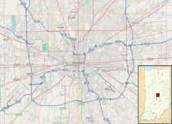   | |
| Location | Roughly bounded by Munsie, Welland, Heflin, and Warehouse Sts., Cumberland, Indiana |
|---|---|
| Coordinates | 39°46′36″N 85°57′23″W / 39.77667°N 85.95639°WCoordinates: 39°46′36″N 85°57′23″W / 39.77667°N 85.95639°W |
| Area | 46.6 acres (18.9 ha) |
| Built | c 1900 |
| Architectural style | Bungalow/craftsman |
| NRHP Reference # | 01001341[1] |
| Added to NRHP | December 7, 2001 |
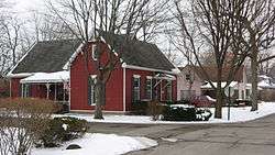
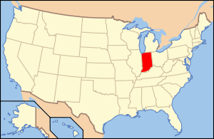
Cumberland Historic District is a national historic district located at Indianapolis, Indiana. It encompasses 91 contributing buildings in the Cumberland section of Indianapolis. The district developed between about 1880 and 1950, and includes representative examples of Folk Victorian and Bungalow / American Craftsman style architecture. Notable contributing resources include the Cumberland Bank (1907), Masonic Lodge (c. 1910), Miller's Lunch, and First Baptist Church (1912-1913).[2]
It was listed on the National Register of Historic Places in 2001.[1]
References
- 1 2 National Park Service (2010-07-09). "National Register Information System". National Register of Historic Places. National Park Service.
- ↑ "Indiana State Historic Architectural and Archaeological Research Database (SHAARD)" (Searchable database). Department of Natural Resources, Division of Historic Preservation and Archaeology. Retrieved 2016-08-01. Note: This includes John Warner (July 2001). "National Register of Historic Places Inventory Nomination Form: Cumberland Historic District" (PDF). Retrieved 2016-08-01. and Accompanying photographs

This article is issued from Wikipedia - version of the 12/2/2016. The text is available under the Creative Commons Attribution/Share Alike but additional terms may apply for the media files.