Outline of the Åland Islands

The following outline is provided as an overview of and topical guide to the Åland Islands:
Åland Islands – autonomous, demilitarized, monolingually Swedish-speaking administrative province, region and historical province of the Republic of Finland.[1] The Åland Islands form an archipelago in the Baltic Sea at the entrance to the Gulf of Bothnia. The Åland Islands are the smallest province of Finland. Due to the Åland Islands' autonomous status, the powers exercised at the provincial level by representatives of the central state administration in the rest of Finland are largely exercised by the Government of the Åland Islands.
General reference
- Pronunciation:
- Common English country names: Åland or the Åland Islands
- Official English country name: The Autonomous State of Åland of the Republic of Finland
- Common endonym(s):
- Official endonym(s):
- Adjectival(s): Alandian
- Demonym(s):
- Etymology: Name of Åland
- ISO country codes: AX, ALA, 248
- ISO region codes: See ISO 3166-2:AX
- Internet country code top-level domain: .ax
Geography of Åland

- Main article: Geography of Åland
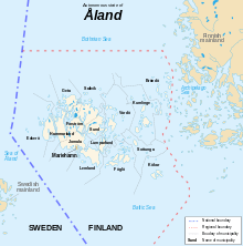
- Åland is: an archipelago of over 6,500 islands, and an autonomous province of Finland. See also Nordic countries.
- Location:
- Population of Åland: 27,210 (2008)
- Area of Åland: 13,517 square kilometres (5,219 sq mi)
- Atlas of Åland
Environment of Åland

- World Heritage Sites in Åland: None
Geographic features of Åland
- Islands of Åland
- Sea of Åland
Regions of Åland
Fasta Åland — Ninety per cent of the population of Åland live on Fasta Åland (the Main Island), which is also the site of the capital town of Mariehamn.
Administrative divisions of Åland
- Main article: Administrative divisions of Åland
Municipalities of Åland
- Capital of Åland: Mariehamn
- List of Åland municipalities by population
- List of Åland municipalities by area
Demography of Åland
- Main article: Demographics of Åland
Government and politics of Åland
- Main article: Government of Åland and Politics of Åland
- Form of government: autonomous parliamentary representative democratic demilitarised and unilingually Swedish territory of Finland
- Capital of Åland: Mariehamn
- Åland as a constituency of Finland
- Åland conventions — establish the demilitarization and neutralization of Åland.
- Elections in Åland
- Political parties in Åland
Branches of the government of Åland
Executive branch of the government of Åland
- Government of Åland
- There are two executive authorities in Åland:
- Cabinet of Åland
- Åland State Provincial Office
- Ministries of Åland
- Ministry of Finance
- Ministry of Education and Culture
- Ministry of Social Affairs and Environment
- Ministry of Administration and EU-affairs
- Ministry of Industry and Trade
- Ministry of Communications and Infrastructure
Legislative branch of the government of Åland
Judicial branch of the government of Åland
- Supreme Court of Åland
Foreign relations of Åland
- Although autonomous, Åland is part of Finland and does not conduct foreign relations.
- Åland as a constituency of Finland
- Åland conventions — establish the demilitarization and neutralization of Åland.
- Relationship of Åland to the European Union — Åland is a Special Member of the EU.
International organization membership
- none [1]
Law and order in Åland
- Main article: Law of Åland
Military of Åland
- Military status of Åland — Åland is both demilitarized and neutralized by international treaty: it may not militarize, be militarized, nor participate in war.
- Åland crisis
- Åland conventions — establish the demilitarization and neutralization of Åland.
- Command
- Commander-in-chief: none
- Ministry of Defence: none
- Conscription in Åland — Citizens of Åland cannot be conscripted into military service.
- Forces: none
- Military bases: none
History of Åland
- Main article: History of Åland
Culture of Åland
| Part of a series on the |
| Culture of Åland |
|---|
 |
| History |
| People |
| Languages |
| Cuisine |
| Festivals |
| Religion |
|
Media |
| Sport |
|
Symbols |
|
|
- Architecture of Åland
- Bomarsund — nineteenth-century fortress in Sund
- Kastelholm Castle — a Swedish-built[2] medieval castle located off Road 2[3] in Sund, approximately 25 km (16 mi) northeast of Mariehamn, overlooking a fjord to the south of the village of Kastelholm.[4][5][6] Built in the 14th century, and held in fief during the Middle Ages by various nobles,[7] feudal chiefs, and kings,[8] it had significant period in the 15th and 16th centuries.
- Art in Åland
- Cuisine of Åland
- Gambling in Åland
- Paf — a Finnish company that operates a legal gambling monopoly on the Åland Islands.
- Languages of Åland
- Museums of Åland
- National symbols of Åland
- Anthem of Åland: Ålänningens sång
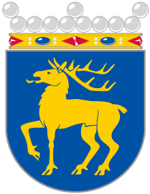
- Coat of arms of Åland
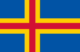
- Flag of Åland
- Public holidays in Åland
- Sport in Åland
- World Heritage Sites in Åland: None
Economy and infrastructure of Åland
- Economic rank, by nominal GDP (2007):
- Banking in Åland
- Communications in Åland
- Internet in Åland
- Newspapers of Åland
- Posten Åland — postal service.
- Currency of Åland: Euro (see also: Euro topics)
- Tourism in Åland
- Transport on the Åland Islands
- Airports in Åland
- Ports of Åland
See also
| Swedish language edition of Wikipedia, the free encyclopedia |
- All pages beginning with "Åland"
- All pages beginning with "Ålandian"
- All pages with titles containing Åland
- All pages with titles containing Ålandian
- Index of Åland-related articles
- List of Åland-related topics
- List of international rankings
- Outline of Europe
- Outline of Finland
- Outline of geography
References
- 1 2 "Finland". The World Factbook. United States Central Intelligence Agency. July 2, 2009. Retrieved July 23, 2009.
- ↑ Aarons, Felice (2006). Fodor's Scandinavia. Random House, Inc. p. 554. ISBN 1-4000-1642-8.
- ↑ Symington, Andy (2009). Lonely Planet Finland. Lonely Planet. p. 252. ISBN 1-74104-771-4.
- ↑ Johnstone, Sarah (2007). Europe on a shoestring. Lonely Planet. p. 358. ISBN 1-74104-591-6.
- ↑ Google Maps (Map). Google.
- ↑ Bing Maps (Map). Microsoft and Harris Corporation Earthstar Geographics LLC.
- ↑ Rothery, Agnes (2007). Finland – The New Nation. READ BOOKS. p. 218. ISBN 1-4067-0555-1.
- ↑ Clark University; JSTOR (1939). Economic geography. 15–16. Worcester, Mass. p. 35.
External links
- Åland - Official Site (mainly in Swedish)
- Åland in Brief
- Government of Åland (in Swedish)
- Parliament of Åland
- Act on the Autonomy of Åland
- B7 Baltic Islands Network
- The example of Åland:autonomy as a minority protector, thisisFINLAND.fi
- Buy liquor, but not a house, thisisFINLAND.fi
- Åland Official Tourist Gateway
- Ålandsbanken
- Posten Åland - the Post Office of Åland
- Ålandstidningen - Local Newspaper