Cucaita
| Cucaita | |||
|---|---|---|---|
| Municipality and town | |||
|
View of Cucaita | |||
| |||
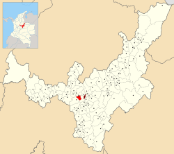 Location of the municipality and town of Cucaita in the Boyacá Department of Colombia | |||
| Country |
| ||
| Department | Boyacá Department | ||
| Province | Central Boyacá Province | ||
| Founded | 12 August 1556 | ||
| Founded by | Juan de Los Barrios | ||
| Government | |||
| • Mayor |
Carlos Eduardo Luis Vanegas (2016-2019) | ||
| Area | |||
| • Municipality and town | 43.58 km2 (16.83 sq mi) | ||
| Elevation | 2,650 m (8,690 ft) | ||
| Population (2015) | |||
| • Municipality and town | 4,687 | ||
| • Density | 110/km2 (280/sq mi) | ||
| • Urban | 1,905 | ||
| Time zone | Colombia Standard Time (UTC-5) | ||
| Website | Official website | ||

.svg.png)

Cucaita is a municipality in the Central Boyacá Province, part of Boyacá Department, Colombia. The urban centre is situated on the Altiplano Cundiboyacense at a distance of 20 kilometres (12 mi) from the department capital Tunja. Cucaita borders Sora in the north, Tunja in the east and south and Samacá in the south and west.[1]
Etymology
The name Cucaita is derived from Chibcha and means either "Seminary enclosure" or "Shade of the farming fields".[1][2]
History
The area of Cucaita in the times before the Spanish conquest was inhabited by the Muisca, organised in their loose Muisca Confederation. Cucaita was ruled by the zaque of nearby Hunza.
Modern Cucaita was founded on August 12, 1556 by friar Juan de Los Barrios.[1]
Economy
Main economical activities of Cucaita are agriculture (predominantly onions and peas), livestock farming and minor carbon mining.[1]
Born in Cucaita
- Rafael Antonio Niño, former professional cyclist
Gallery
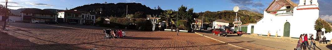
 View of Cucaita
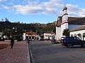 Central square
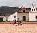 Church of Cucaita
 Church interior
 Monument to Rafael Antonio Niño
 Rural Cucaita
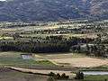 Farmfields
References
- 1 2 3 4 (Spanish) Official website Cucaita
- ↑ (Spanish) Etymology Municipalities Boyacá - Excelsio.net
External links
| Wikimedia Commons has media related to Cucaita. |
Coordinates: 5°32′N 73°27′W / 5.533°N 73.450°W