Cross Plains, Wisconsin
| Cross Plains, Wisconsin | |
|---|---|
| Village | |
|
Looking east at downtown Cross Plains on U.S. 14 | |
| Motto: "Famous for Friendliness" | |
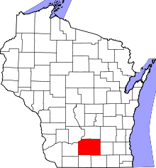
 Location in Dane County and the state of Wisconsin. | |
| Coordinates: 43°5′41″N 89°39′40″W / 43.09472°N 89.66111°WCoordinates: 43°5′41″N 89°39′40″W / 43.09472°N 89.66111°W | |
| Country | United States |
| State | Wisconsin |
| County | Dane |
| Area[1] | |
| • Total | 1.76 sq mi (4.56 km2) |
| • Land | 1.76 sq mi (4.56 km2) |
| • Water | 0 sq mi (0 km2) |
| Elevation[2] | 938 ft (286 m) |
| Population (2010)[3] | |
| • Total | 3,538 |
| • Estimate (2012[4]) | 3,641 |
| • Density | 2,010.2/sq mi (776.1/km2) |
| Time zone | Central (CST) (UTC-6) |
| • Summer (DST) | CDT (UTC-5) |
| Area code(s) | 608 |
| FIPS code | 55-17800[5] |
| GNIS feature ID | 1583030[2] |
| Website |
cross-plains |

Cross Plains is a village in Dane County, Wisconsin, United States. The population was 3,538 at the 2010 census. The village is located partially within the Town of Cross Plains. It is part of the Madison Metropolitan Statistical Area.
History
Cross Plains was named by a settler for his home in Cross Plains, Tennessee.[6] The village was incorporated in 1920.[7]
Geography
Cross Plains is located at 43°6′51″N 89°38′40″W / 43.11417°N 89.64444°W (43.114407, -89.644503).[8]
According to the United States Census Bureau, the village has a total area of 1.76 square miles (4.56 km2), all of it land.[1]
Demographics
| Historical population | |||
|---|---|---|---|
| Census | Pop. | %± | |
| 1880 | 42 | — | |
| 1930 | 302 | — | |
| 1940 | 374 | 23.8% | |
| 1950 | 464 | 24.1% | |
| 1960 | 1,066 | 129.7% | |
| 1970 | 1,478 | 38.6% | |
| 1980 | 2,156 | 45.9% | |
| 1990 | 2,098 | −2.7% | |
| 2000 | 3,084 | 47.0% | |
| 2010 | 3,538 | 14.7% | |
| Est. 2015 | 4,000 | [9] | 13.1% |

2010 census
As of the census[3] of 2010, there were 3,538 people, 1,386 households, and 966 families residing in the village. The population density was 2,010.2 inhabitants per square mile (776.1/km2). There were 1,452 housing units at an average density of 825.0 per square mile (318.5/km2). The racial makeup of the village was 97.1% White, 0.8% African American, 0.2% Native American, 0.6% Asian, 0.3% from other races, and 1.0% from two or more races. Hispanic or Latino of any race were 1.6% of the population.
There were 1,386 households of which 37.4% had children under the age of 18 living with them, 56.1% were married couples living together, 9.2% had a female householder with no husband present, 4.4% had a male householder with no wife present, and 30.3% were non-families. 23.8% of all households were made up of individuals and 5.9% had someone living alone who was 65 years of age or older. The average household size was 2.55 and the average family size was 3.04.
The median age in the village was 36.8 years. 27.4% of residents were under the age of 18; 7.3% were between the ages of 18 and 24; 28.6% were from 25 to 44; 27.4% were from 45 to 64; and 9.2% were 65 years of age or older. The gender makeup of the village was 49.8% male and 50.2% female.
2000 census
As of the census[5] of 2000, there were 3,084 people, 1,199 households, and 851 families residing in the village. The population density was 2,625.0 people per square mile (1,017.7/km²). There were 1,228 housing units at an average density of 1,045.2 per square mile (405.2/km²). The racial makeup of the village was 98.80% White, 0.23% Black or African American, 0.13% Native American, 0.16% Asian, 0.03% Pacific Islander, 0.03% from other races, and 0.62% from two or more races. 0.42% of the population were Hispanic or Latino of any race.
There were 1,199 households out of which 39.3% had children under the age of 18 living with them, 58.1% were married couples living together, 9.2% had a female householder with no husband present, and 29.0% were non-families. 22.8% of all households were made up of individuals and 5.9% had someone living alone who was 65 years of age or older. The average household size was 2.56 and the average family size was 3.05.
In the village the population was spread out with 28.5% under the age of 18, 7.2% from 18 to 24, 35.2% from 25 to 44, 20.7% from 45 to 64, and 8.4% who were 65 years of age or older. The median age was 34 years. For every 100 females there were 98.5 males. For every 100 females age 18 and over, there were 96.4 males.
The median income for a household in the village was $56,629, and the median income for a family was $62,500. Males had a median income of $40,525 versus $29,632 for females. The per capita income for the village was $23,894. About 1.0% of families and 2.6% of the population were below the poverty line, including 3.3% of those under age 18 and 3.4% of those age 65 or over.
Education
Cross Plains Public Schools belong to the Middleton-Cross Plains School District. There are six elementary schools, two middle schools, one high school and one alternative senior high school in the district.
Students attend either Middleton High School or Middleton Alternative Senior High School.[11]
Notable people
- Connie Grob, baseball player
- Matt Lepay, sports announcer
References
- 1 2 "US Gazetteer files 2010". United States Census Bureau. Archived from the original on January 24, 2012. Retrieved 2012-11-18.
- 1 2 "US Board on Geographic Names". United States Geological Survey. 2007-10-25. Retrieved 2008-01-31.
- 1 2 "American FactFinder". United States Census Bureau. Retrieved 2012-11-18.
- ↑ "Population Estimates". United States Census Bureau. Archived from the original on June 17, 2013. Retrieved 2013-06-24.
- 1 2 "American FactFinder". United States Census Bureau. Archived from the original on September 11, 2013. Retrieved 2008-01-31.
- ↑ "Profile for Cross Plains, Wisconsin, WI". ePodunk. Retrieved July 21, 2012.
- ↑ "Cross Plains, Wisconsin". City-Data.com. Retrieved July 21, 2012.
- ↑ "US Gazetteer files: 2010, 2000, and 1990". United States Census Bureau. 2011-02-12. Retrieved 2011-04-23.
- ↑ "Annual Estimates of the Resident Population for Incorporated Places: April 1, 2010 to July 1, 2015". Retrieved July 2, 2016.
- ↑ "Census of Population and Housing". Census.gov. Archived from the original on May 11, 2015. Retrieved June 4, 2015.
- ↑ "Middleton-Cross Plains Area School District". Middleton-Cross Plains Area School District. Retrieved July 21, 2012.
External links
- Village of Cross Plains
- Sanborn fire insurance map: 1894