Crook, Colorado
| Town of Crook, Colorado | |
|---|---|
| Statutory Town | |
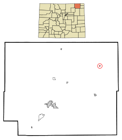 Location in Logan County and the state of Colorado | |
| Coordinates: 40°51′32″N 102°48′05″W / 40.858752°N 102.801392°WCoordinates: 40°51′32″N 102°48′05″W / 40.858752°N 102.801392°W[1] | |
| Country |
|
| State |
|
| County | Logan County[2] |
| Incorporated | September 23, 1918[3] |
| Government | |
| • Type | Statutory Town[2] |
| Area | |
| • Total | 0.1 sq mi (0.3 km2) |
| • Land | 0.1 sq mi (0.3 km2) |
| • Water | 0 sq mi (0 km2) |
| Elevation[4] | 3,711 ft (1,131 m) |
| Population (2010) | |
| • Total | 110 |
| • Density | 1,100/sq mi (370/km2) |
| Time zone | MST (UTC-7) |
| • Summer (DST) | MDT (UTC-6) |
| ZIP Code[5] | 80726 |
| Area code(s) | 970 |
| INCITS place code | 0818640 |
| GNIS feature ID | 0182716 |
The Town of Crook is a Statutory Town in Logan County, Colorado, United States. The town population was 110 at the 2010 United States Census.
Toponymy
The town was named for General George Crook, officer during the American Civil War and the Indian Wars.[6] Crook has frequently been noted on lists of unusual place names.[7]
Geography
Crook is located at 40°51′31″N 102°48′4″W / 40.85861°N 102.80111°W (40.858586, -102.801195).[8]
According to the United States Census Bureau, the town has a total area of 0.1 square miles (0.26 km2), all of it land.
Demographics
| Historical population | |||
|---|---|---|---|
| Census | Pop. | %± | |
| 1920 | 232 | — | |
| 1930 | 251 | 8.2% | |
| 1940 | 236 | −6.0% | |
| 1950 | 259 | 9.7% | |
| 1960 | 209 | −19.3% | |
| 1970 | 199 | −4.8% | |
| 1980 | 177 | −11.1% | |
| 1990 | 148 | −16.4% | |
| 2000 | 128 | −13.5% | |
| 2010 | 110 | −14.1% | |
| Est. 2015 | 110 | [9] | 0.0% |
As of the census[11] of 2000, there were 128 people, 57 households, and 38 families residing in the town. The population density was 991.5 people per square mile (380.2/km²). There were 80 housing units at an average density of 619.7 per square mile (237.6/km²). The racial makeup of the town was 100.00% White. Hispanic or Latino of any race were 3.91% of the population.
There were 57 households out of which 17.5% had children under the age of 18 living with them, 63.2% were married couples living together, 1.8% had a female householder with no husband present, and 33.3% were non-families. 33.3% of all households were made up of individuals and 17.5% had someone living alone who was 65 years of age or older. The average household size was 2.25 and the average family size was 2.82.
In the town the population was spread out with 18.0% under the age of 18, 8.6% from 18 to 24, 19.5% from 25 to 44, 31.3% from 45 to 64, and 22.7% who were 65 years of age or older. The median age was 50 years. For every 100 females there were 109.8 males. For every 100 females age 18 and over, there were 101.9 males.
The median income for a household in the town was $32,500, and the median income for a family was $35,833. Males had a median income of $29,167 versus $26,250 for females. The per capita income for the town was $19,127. There were no families and 3.7% of the population living below the poverty line, including no under eighteens and 10.3% of those over 64.
See also
References
- ↑ "2014 U.S. Gazetteer Files: Places". United States Census Bureau. July 1, 2014. Retrieved January 5, 2015.
- 1 2 "Active Colorado Municipalities". State of Colorado, Department of Local Affairs. Archived from the original on November 22, 2010. Retrieved 2007-09-01.
- ↑ "Colorado Municipal Incorporations". State of Colorado, Department of Personnel & Administration, Colorado State Archives. 2004-12-01. Retrieved 2007-09-02.
- ↑ "US Board on Geographic Names". United States Geological Survey. 2007-10-25. Retrieved 2008-01-31.
- ↑ "ZIP Code Lookup". United States Postal Service. Archived from the original (JavaScript/HTML) on December 14, 2006. Retrieved September 6, 2007.
- ↑ Dawson, John Frank. Place names in Colorado: why 700 communities were so named, 150 of Spanish or Indian origin. Denver, CO: The J. Frank Dawson Publishing Co. p. 16.
- ↑ Parker, Quentin (2010). Welcome to Horneytown, North Carolina, Population: 15: An insider's guide to 201 of the world's weirdest and wildest places. Adams Media. pp. ix.
- ↑ "US Gazetteer files: 2010, 2000, and 1990". United States Census Bureau. 2011-02-12. Retrieved 2011-04-23.
- ↑ "Annual Estimates of the Resident Population for Incorporated Places: April 1, 2010 to July 1, 2015". Retrieved July 2, 2016.
- ↑ "Census of Population and Housing". Census.gov. Archived from the original on May 11, 2015. Retrieved June 4, 2015.
- ↑ "American FactFinder". United States Census Bureau. Archived from the original on September 11, 2013. Retrieved 2008-01-31.
External links
Municipalities and communities of Logan County, Colorado, United States | ||
|---|---|---|
| City |  | |
| Towns | ||
| CDPs | ||
| Unincorporated communities | ||
