Creglingen
| Creglingen | ||
|---|---|---|
 | ||
| ||
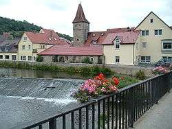
 Creglingen | ||
Location of Creglingen within Main-Tauber-Kreis district  | ||
| Coordinates: 49°28′N 10°2′E / 49.467°N 10.033°ECoordinates: 49°28′N 10°2′E / 49.467°N 10.033°E | ||
| Country | Germany | |
| State | Baden-Württemberg | |
| Admin. region | Stuttgart | |
| District | Main-Tauber-Kreis | |
| Government | ||
| • Mayor | Uwe Hehn | |
| Area | ||
| • Total | 117.22 km2 (45.26 sq mi) | |
| Population (2015-12-31)[1] | ||
| • Total | 4,731 | |
| • Density | 40/km2 (100/sq mi) | |
| Time zone | CET/CEST (UTC+1/+2) | |
| Postal codes | 97993, 97990 (Standorf | |
| Dialling codes | 07932, 07933, 07939, 09335, 09865 | |
| Vehicle registration | TBB, MGH | |
| Website | www.creglingen.de | |

Creglingen is a town in the Main-Tauber district of Baden-Württemberg, Germany.
Geography
Subdivision
The town Creglingen contains the following Stadtteile(since the municipal reform of 1972): Archshofen, Blumweiler, Craintal, Erdbach, Finsterlohr (together with the villages Schonach, Burgstall and Seldeneck), Frauental, Freudenbach, Münster, Niederrimbach, Oberrimbach, Lichtel, Reinsbronn (together with the village of Niedersteinach), Reutsachsen, Schirmbach, Schmerbach, Schön, Schwarzenbronn, Waldmannshofen (together with the village of Sechselbach and the hamlets Fuchshof und Seewiesenhof), Wolfsbuch, Weiler.
History
The Celts who founded the town between 200 and 100 B.C. also farmed the surrounding plateaus and valleys. In 1349, Creglingen received its town charter from Emperor Karl IV (Charles IV).
Sons and daughters of the town
- Gustav Vorherr (1778-1847), architect and economist, Royal Bavarian Baurat
- Georg Bernhard Schifterling (1815-1880), a day laborer's son, a Protestant minister, then an author and editor first social revolutionary writings in Ulm
- Georg Pflüger (1835-1896), member of the Reichstag
- Wilhelm Michler (1846-1899), chemist
- Hermann Stern (1866-1933), Holocaust victim
- Manfred Hollenbach (born 1946), mayor, politician (CDU), Member of Landtag
- Helmut Böttiger (born 1956), writer, literary critic and essayist
References
External links
| Wikimedia Commons has media related to Creglingen. |
- Official town website (German)
Towns and municipalities in Main-Tauber (district) | ||
|---|---|---|