Covina, California
| Covina, California City of Covina | ||
|---|---|---|
| City | ||
| ||
| Motto: “One Square Mile and All There”, “Where Friendship is Traditional” (1965) | ||
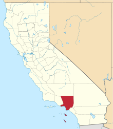
 Location of Covina in Los Angeles County, California | ||
 Covina, California Location in the United States | ||
| Coordinates: 34°5′30″N 117°52′45″W / 34.09167°N 117.87917°WCoordinates: 34°5′30″N 117°52′45″W / 34.09167°N 117.87917°W | ||
| Country |
| |
| State |
| |
| County |
| |
| Founded | 1882 | |
| Incorporated | August 14, 1901[1] | |
| Government | ||
| • Type | Council-Manager | |
| • Mayor | Peggy Delach[2] | |
| • Mayor Pro Tem | John C. King[2] | |
| • Councilmember | Jorge Marquez[2] | |
| • Councilmember | Kevin Stapleton[2] | |
| • Councilmember | Walt Allen III[2] | |
| Area[3] | ||
| • Total | 7.041 sq mi (18.236 km2) | |
| • Land | 7.026 sq mi (18.196 km2) | |
| • Water | 0.015 sq mi (0.039 km2) 0.22% | |
| Elevation[4] | 558 ft (170 m) | |
| Population (April 1, 2010)[5] | ||
| • Total | 47,796 | |
| • Estimate (2014)[5] | 49,002 | |
| • Density | 6,800/sq mi (2,600/km2) | |
| Time zone | Pacific (UTC-8) | |
| • Summer (DST) | PDT (UTC-7) | |
| ZIP codes | 91722, 91723, 91724[6] | |
| Area code | 626[7] | |
| FIPS code | 06-16742 | |
| GNIS feature IDs | 1652693, 2410251 | |
| Website | Covina, California | |

Covina is a city in Los Angeles County, California, about 22 miles (35 km) east of downtown Los Angeles, in the San Gabriel Valley region. The population was 47,796 at the 2010 census, up from 46,837 at the 2000 census. The city's slogan, "One Mile Square and All There", was coined when the incorporated area of the city was only (some say slightly less than) one square mile.
Covina is often confused with West Covina which is actually larger in both area and population, located to its south and westside. Irwindale lies to the west, as well as the unincorporated area of Vincent, and the city of Baldwin Park. Azusa and Glendora are to the north, the unincorporated community of Charter Oak to the northeast, San Dimas to the east, the unincorporated areas of Ramona and Via Verde, and the city of Pomona to the southeast.
History
Present day Covina was originally within the homelands of the indigenous Tongva people for 5,000 to 8,000 years. In the 18th century it the became part of Rancho La Puente in Alta California, a 1770s Spanish colonial and 1842 Mexican land grants.
The city of Covina was founded in 1882 by Joseph Swift Phillips, on a 2,000-acre (8.1 km2) tract that was purchased from the holdings of John Edward Hollenbeck, one of the 1842 grantees of Rancho La Puente. In 1875 Hollenbeck had purchased a failed coffee plantation from 3 Costa Rican brothers, Pedro Maria Badilla, Julian Badilla, and Pedro Antonio Badilla, the latter who purchased it from the heirs of Hollenbeck's 1842 co-grantee John A. Rowland.[8]
The City of Covina was named by a young engineer, Frederick Eaton, who was hired by Phillips to survey the area. Impressed by the way in which the valleys of the adjacent San Gabriel Mountains formed a natural cove around the vineyards that had been planted by the region's earlier pioneers, Eaton merged the words "cove" and "vine", and in 1885, created the name Covina for the new township.[9]
The city was incorporated in 1901, the townsite being bounded by Puente Street on the south, 1st Avenue on the east, the alley north of College Street on the north, & 4th Avenue on the west. The city’s slogan, “One Mile Square and All There”,[9] was coined by Mrs F. E. Wolfarth, the winner of a 1922 slogan contest sponsored by the chamber of commerce, when the incorporated area of the city was only (some say slightly less than) one square mile, making it the smallest city in area in the country.
It would be orange and grapefruit groves, not vineyards, that would soon blanket the city and make it famous. By 1909, the city was the third largest orange producer in the world,[9] and it still claimed to have “the best oranges in the world” as late as the 1950s. Since World War II, however, the orange groves have been largely replaced by single-family (houses) and multiple-family (apartments) dwellings.[10]
The Covina Valley Historical Society maintains an extensive archive illustrating the city’s history in the 1911-built Firehouse Jail Museum, Covina’s first municipal building, located immediately behind City Hall in Covina’s Old Town.[9]
Currently
Covina claims to have the largest movie multiplex in Los Angeles County. Opened in 1997, the Covina AMC 30 located at Arrow Highway and Azusa Avenue is one of the busiest theatres in the United States.[11] The movie theater was built on the site of a former Sears building.
It has been a sister city of Xalapa, Mexico, since 1964. A replica of a giant stone Olmec head, located in a place of honor in beautiful Parque Xalapa, was given to the city in 1989 by the state of Veracruz, Mexico.[12] According to the placard placed below the head, it was originally excavated from San Lorenzo de Tenochtitlan. The statue was recently moved from its location in front of the police department to Jalapa Park in the southeast portion of the city.
During the election held March 6, 2007, nine candidates ran for two of the five positions on the city council. The voters then rejected the 10-year renewal of a 6% Utility Users Tax the city has had since 1999. Only 3,797 ballots were cast out of 21,633 registered voters. The Utility Users Tax was subsequently renewed at the June 3, 2008, election which attracted 5,032 voters.
2008 marked both the opening as well as charter season of the Covina Center for the Performing Arts, a newly remodeled multimillion-dollar theatrical venue in downtown Covina.
2008 massacre
On December 24, 2008, a shooting and arson occurred in Covina, in which a man, Bruce Jeffrey Pardo, dressed in a Santa Claus costume entered a Christmas party at his ex-wife's residence and proceeded to open fire. When he left, nine family members were dead and the house was engulfed in flames. The slayings left 15 children without one or both parents.[13] After the shootings, Pardo unwrapped a Christmas package containing a homemade flamethrower and used it to spray racing fuel gasoline to set the home ablaze. Nine people were killed during the massacre. After the attack, Pardo put on his street clothes and drove his rental car to his brother's house in Sylmar, approximately 30 miles (48 km) away from the crime scene, where he was later found dead from a self-inflicted gunshot wound.[14]
Geography
Covina is located at 34°5′30″N 117°52′45″W / 34.09167°N 117.87917°W (34.091609, -117.879193).[15]
No freeways pass through the city limits (except for a very small stretch of I-10), although it is centered in the midst of Interstate 210 (Foothill Freeway) to the north, Interstate 10 (San Bernardino Freeway) to the south, Interstate 605 (San Gabriel River Freeway) to the west, and the State Route 57 (Orange Freeway) to the east.[12]
The Southern Pacific Railroad, which reached Covina in 1884, and the Metrolink San Bernardino Line pass through the city just north of the downtown area. The town is located at the foot of the San Gabriel Mountains in the San Gabriel Valley.[12] According to the United States Census Bureau, the city has a total area of 7.0 square miles (18 km2). 7.0 square miles (18 km2) of it is land and 0.22% of it is water.
Climate
This region experiences warm, hot and dry summers. According to the Köppen Climate Classification system, Covina has a hot-summer Mediterranean climate, abbreviated "Csa" on climate maps.[16]
Demographics
| Historical population | |||
|---|---|---|---|
| Census | Pop. | %± | |
| 1930 | 2,774 | — | |
| 1940 | 3,049 | 9.9% | |
| 1950 | 3,956 | 29.7% | |
| 1960 | 20,124 | 408.7% | |
| 1970 | 30,395 | 51.0% | |
| 1980 | 32,746 | 7.7% | |
| 1990 | 43,207 | 31.9% | |
| 2000 | 46,837 | 8.4% | |
| 2010 | 47,796 | 2.0% | |
| Est. 2015 | 48,984 | [17] | 2.5% |
2010
The 2010 United States Census[19] reported that Covina had a population of 47,796. The population density was 6,788.3 people per square mile (2,621.0/km²). The racial makeup of Covina was 27,937 (58.5%) White (29.9% Non-Hispanic White),[20] 2,013 (4.2%) African American, 532 (1.1%) Native American, 5,684 (11.9%) Asian, 104 (0.2%) Pacific Islander, 9,230 (19.3%) from other races, and 2,296 (4.8%) from two or more races. Hispanic or Latino of any race were 25,030 persons (52.4%).
The Census reported that 47,361 people (99.1% of the population) lived in households, 68 (0.1%) lived in non-institutionalized group quarters, and 367 (0.8%) were institutionalized.
There were 15,855 households, out of which 6,396 (40.3%) had children under the age of 18 living in them, 7,931 (50.0%) were opposite-sex married couples living together, 2,815 (17.8%) had a female householder with no husband present, 1,072 (6.8%) had a male householder with no wife present. There were 978 (6.2%) unmarried opposite-sex partnerships, and 94 (0.6%) same-sex married couples or partnerships. 3,153 households (19.9%) were made up of individuals and 1,179 (7.4%) had someone living alone who was 65 years of age or older. The average household size was 2.99. There were 11,818 families (74.5% of all households); the average family size was 3.43.
The population was spread out with 11,896 people (24.9%) under the age of 18, 5,043 people (10.6%) aged 18 to 24, 13,113 people (27.4%) aged 25 to 44, 12,174 people (25.5%) aged 45 to 64, and 5,570 people (11.7%) who were 65 years of age or older. The median age was 35.7 years. For every 100 females there were 93.3 males. For every 100 females age 18 and over, there were 89.5 males.
There were 16,576 housing units at an average density of 2,354.2 per square mile (909.0/km²), of which 9,256 (58.4%) were owner-occupied, and 6,599 (41.6%) were occupied by renters. The homeowner vacancy rate was 1.1%; the rental vacancy rate was 6.4%. 28,707 people (60.1% of the population) lived in owner-occupied housing units and 18,654 people (39.0%) lived in rental housing units.
According to the 2010 United States Census, Covina had a median household income of $66,726, with 11.3% of the population living below the federal poverty line.[20]
An additional 31,072 residents live in zip codes associated with Covina but outside the city limits, making the total Covina area population 78,868 at the time of the 2010 census.[21]
2000
As of the census[22] of 2000, there were 46,837 people, 15,971 households, and 11,754 families residing in the city. The population density was 6,723.7 inhabitants per square mile (2,594.5/km²). There were 16,364 housing units at an average density of 2,349.1 per square mile (906.5/km²). The racial makeup of the city was 62.10% White, 5.03% Black or African American, 0.90% Native American, 9.82% Asian, 0.21% Pacific Islander, 17.18% from other races, and 4.78% from two or more races. 40.29% of the population were Hispanic or Latino of any race.[12]
There were 15,971 households out of which 38.4% had children under the age of 18 living with them, 51.6% were married couples living together, 16.3% had a female householder with no husband present, and 26.4% were non-families. 20.8% of all households were made up of individuals and 7.7% had someone living alone who was 65 years of age or older. The average household size was 2.89 and the average family size was 3.36.[12]
In the city the population was spread out with 28.1% under the age of 18, 9.5% from 18 to 24, 31.1% from 25 to 44, 20.4% from 45 to 64, and 10.9% who were 65 years of age or older. The median age was 34 years. For every 100 females there were 92.0 males. For every 100 females age 18 and over, there were 87.0 males.[12]
The median income for a household in the city was $48,474, and the median income for a family was $55,111. Males had a median income of $40,687 versus $32,329 for females. The per capita income for the city was $20,231. About 8.9% of families and 11.6% of the population were below the poverty line, including 15.4% of those under age 18 and 6.9% of those age 65 or over.[12]
An additional 30,000 residents live in unincorporated areas of the three zip codes associated with Covina but outside the city limits, making the total Covina area population 76,417.
Government and infrastructure
Local government in Covina is run by an elected city council through their hired city manager. Covina residents are represented at-large, currently by the following elected officials: Mayor Peggy Delach, Mayor Pro Tem John King, Councilmember Jorge Marquez, Councilmember Kevin Stapleton, and Councilmember Walter Allen III.[2]
In the California State Legislature, Covina is in the 22nd Senate District, represented by Democrat Ed Hernandez, and in the 48th Assembly District, represented by Democrat Blanca Rubio.[23]
In the United States House of Representatives, Covina is in California's 32nd congressional district, represented by Democrat Grace Napolitano.[24]
Covinians who access county health services may use the Pomona Health Center in Pomona or the Monrovia Health Center in Monrovia, both operated by the Los Angeles County Department of Health Services.[25][26]
Economy
Top employers
According to the City's 2009 Comprehensive Annual Financial Report,[27] the top employers in the city are:
| # | Employer | # of Employees |
|---|---|---|
| 1 | Covina Valley Unified School District | 1,291 |
| 2 | Citrus Valley Medical Center | 1,139 |
| 3 | Charter Oak Unified School District | 584 |
| 4 | Wal-Mart | 286 |
| 5 | Magan Medical Clinic | 270 |
| 6 | City of Covina | 268 |
| 7 | Bert's Mega Mall | 220 |
| 8 | Pall Medical | 202 |
| 9 | MedLegal | 193 |
| 10 | IKEA | 186 |
Appearances in fiction
Covina is the fictional setting for the Harold Teen comic strip and 1934 movie that depicted several teenagers from Covina High School. A downtown Covina malt shop was named the Sugar Bowl (with the permission of the artist Carl Eds), imitating the after-school gathering place in the comic strip.
Movie/TV locations
Scenes from several movies were filmed in Covina, including:
- The television series Roswell was filmed in various location in Covina[28] including the downtown area on North Citrus Avenue. City Hall, Charter Oak High School and several other businesses and residences served as locations for the fictional version of the town of Roswell, NM.
- Multiple episodes of the hit television series Knight Rider were filmed in Downtown "Old" Covina, including an episode coincidentally shot at Knight's Photo Studio on Citrus, where David Hasselhoff greeted fans and passed out signed photographs.
- One of the ending shots of the movie Frailty was filmed on Center St. off of Hollenbeck.
- The Bohemian Rhapsody scene from the film Wayne's World was filmed on Citrus Ave. in downtown Covina, although some external shots were filmed in other locations.
- The "Grey Poupon" scene from Wayne's World was shot on Citrus Avenue. Covina Hobby was visible in the background. Having two cars side-by-side reflect (incorrectly) that the main drag was four lanes.
- The "cruising" portion of Hometown USA was filmed on Citrus Avenue.
- The interior of Covina Public Library served as the Baltimore County Public Library for the 2004 television movie Back When We Were Grownups.
- An episode of Tabatha's Salon Takeover was filmed in Downtown "Old" Covina at Tantrum on Citrus Avenue.
- The theater in downtown Covina (refurbished in 2008), the library and neighborhood streets around downtown were used in the filming of "High School USA" - a movie starring Michael J. Fox and Nancy McKeon in 1983.
- Small independent film Small Time starring Christopher Meloni and Bridget Moynahan was filmed at Clippinger Chevrolet (used to be at) San Bernardino Road and Citrus Avenue in Downtown Covina
Notable people
- Lacey Baker — professional skateboarder who attended Northview High School.
- Rick Baker — seven-time Academy Award-winning make-up artist. His films include American Werewolf In London, Ed Wood, Men In Black and The Wolfman.
- Irma Blanco — L.A. radio personality resided in Covina
- Tom Brunansky — Major League Baseball player and coach who was born in Covina. He played from 1985-2000 for the New York Mets, Minnesota Twins, Boston Red Sox,and Chicago Cubs. He was an American League All Star in 1985 with Minnesota and a member of the 1987 World Series champion Twins.
- Jack Clark — Major League Baseball player, graduated from Gladstone High School in Covina in 1973. He played for the San Francisco Giants, St. Louis Cardinals, New York Yankees, San Diego Padres and Boston Red Sox from 1975 to 1992. He hit .267 with 340 home runs for his MLB career, played in the 1985 World Series and was a four-time MLB All-Star.
- Art Clokey — creator of Gumby. Clokey and his wife, Ruth, invented Gumby in the early 1950s at their Covina home shortly after Art had finished film school at USC.
- Casey Dailey — football player
- William ("Billie") Raymond DeVrell (1937-1981) — Wonderland Gang member killed in the 1981 Wonderland Murders is buried at Forest Lawn Memorial-Parks and Mortuaries (Covina Hills)
- Donald W. Evans, Jr., Sp4., (July 23, 1943 – January 27, 1967) — United States Army medic born in Covina; awarded the United States military's highest decoration the Medal of Honor for his bravery in the Vietnam War. He was also awarded the Purple Heart.
- Donna Fargo — country singer who taught English at Northview High School in the 1960s and 1970s.
- Hussein Mohamed Farrah — son of Mohamed Farrah Aidid and former President of Somalia, graduated from Covina High School.
- Jason David Frank — who has played Tommy Oliver in the Power Rangers series.
- Rod Gilfry — opera baritone.
- Roy Harris — composer, grew up on a strawberry farm in Covina and attended Covina High School.
- Hanan Ibrahim - Television Personality, Model
- Suha Ibrahim - Television Personality, Model
- Lillian Kinkella Keil — decorated World War II flight nurse; born in Covina.
- Ward Kimball — one of the original Disney animators, and leader of the Dixieland band Firehouse Five Plus Two, was a member of the Covina High School class of 1929.
- Robert Knapp — actor, lived in Covina in his teenage years and worked in the orange groves.
- Bob Lorenz — anchor and studio host, New York Yankees TV network (YES Network), previously sports anchor and studio host for CNN, CNNSI and Turner Sports.
- Mike Lynn — former NBA player who played for the Los Angeles Lakers.
- Jeremy Miller — TV comedy Growing Pains; was born and raised in Covina.
- John Molina, Jr., professional boxer; born in Covina.
- Corey Nakatani — jockey, was born and raised in Covina.
- Vince Neil (born Vincent Neil Wharton; attended Charter Oak High School) and Tommy Lee of Mötley Crüe — met while attending Royal Oak High School (California) (now Royal Oak Middle School) in Covina. Tommy Lee did not graduate. Neil has a son who also grew up in Covina.
- Alice Huyler Ramsey — died in Covina; first woman to drive across America from coast to coast. On June 9, 1909, the 22-year-old housewife and mother from Hackensack, New Jersey completed the 3,800 miles (6,100 km) from Manhattan, New York to San Francisco, California in a Maxwell. She was accompanied on her fifty-nine-day trek by three female companions, none of whom could drive a car.[29]
- Gary Roenicke — born in Covina, former Major League Baseball outfielder for the Montreal Expos (1976), Baltimore Orioles (1978–85), New York Yankees (1986) and Atlanta Braves (1987–88). In his 12-year MLB career, he hit .247 with 121 home runs.
- Ron Roenicke — born in Covina, former Major League Baseball player and manager.
- Willie Shoemaker (1931–2003) — Hall of Fame jockey; went to Covina High School.
- Jean Stafford — Pulitzer Prize-winning novelist and short-story writer.
- Rob Wilfong — Major League Baseball player, graduated from Northview HS in 1971. He played for the Minnesota Twins, California Angels and the San Francisco Giants from 1977 to 1987. He batted .248 for his career with 39 home runs.
- Chris Woodward — Major League Baseball player who was born in Covina and attended Northview High School. He played from (1999–2010) for the Toronto Blue Jays, New York Mets, Atlanta Braves, Boston Red Sox, and Seattle Mariners.
- Ellen Beach Yaw (known as Lark Ellen) — internationally famous coloratura soprano during the late 19th and early to mid-20th century. She toured the world singing opera for over 40 years and chose to retire in Covina. A street in Covina is named for her.
- Michael Young — Major League Baseball infielder who was born in Covina; 7-time All-Star selection with the Texas Rangers (2004–2009, 2011), 2005 American League batting champion, 2006 MLB All-Star Game MVP, and a Gold Glove Award winner in 2008.
See also
References
- ↑ "California Cities by Incorporation Date". California Association of Local Agency Formation Commissions. Archived from the original (Word) on November 3, 2014. Retrieved August 25, 2014.
- 1 2 3 4 5 6 "City Council". City of Covina. Retrieved November 6, 2014.
- ↑ "2010 Census U.S. Gazetteer Files – Places – California". United States Census Bureau.
- ↑ "Covina". Geographic Names Information System. United States Geological Survey. Retrieved November 3, 2014.
- 1 2 "Covina (city) QuickFacts". United States Census Bureau. Retrieved April 9, 2015.
- ↑ "USPS - ZIP Code Lookup - Find a ZIP+ 4 Code By City Results". Retrieved 2007-01-18.
- ↑ "Number Administration System - NPA and City/Town Search Results". Retrieved 2007-01-18.
- ↑ Covina Argus, May 4, 1912, p. 5, c. 2.
- 1 2 3 4 "Downtown Covina, California - Shopping, Dinning, Entertainment, Covina.com Website".
- ↑ Pitt, Leonard, and Dale Pitt. Los Angeles A to Z : an encyclopedia of the city and county. Berkeley, Calif. : University of California Press, 1997. ISBN 0-520-20274-0
- ↑ "North Azusa". City of Covina: The Tour. Retrieved 2007-05-04.
During the summer of 1999 the Covina AMC 30 Theater was ranked 28th in the United States in attendance.
- 1 2 3 4 5 6 7 "City of Covina, California information".
- ↑ DA, Schwartz. "CEO". Retrieved 12 August 2016.
- ↑ "Coroner: Ninth body found in ruins of 'Santa massacre' home". CNN. 2008-12-26. Retrieved 2008-12-26.
The car was parked outside a Sylmar, California, home where Bruce Jeffrey Pardo, 45, committed suicide hours after he opened fire at a holiday party and then started a raging blaze inside a Covina, California, home, police said.
- ↑ "US Gazetteer files: 2010, 2000, and 1990". United States Census Bureau. 2011-02-12. Retrieved 2011-04-23.
- ↑ "Covina, California Köppen Climate Classification (Weatherbase)". Weatherbase.
- ↑ "Annual Estimates of the Resident Population for Incorporated Places: April 1, 2010 to July 1, 2015". Retrieved July 2, 2016.
- ↑ "Census of Population and Housing". Census.gov. Archived from the original on May 11, 2015. Retrieved June 4, 2015.
- ↑ "2010 Census Interactive Population Search: CA - Covina city". U.S. Census Bureau. Retrieved July 12, 2014.
- 1 2 "State and County quick facts".
- ↑ "Zip code statistics".
- ↑ "American FactFinder". United States Census Bureau. Archived from the original on September 11, 2013. Retrieved 2008-01-31.
- ↑ "Statewide Database". UC Regents. Retrieved November 7, 2014.
- ↑ "California's 32nd Congressional District - Representatives & District Map". Civic Impulse, LLC.
- ↑ "Pomona Health Center." Los Angeles County Department of Health Services. Retrieved on March 27, 2010.
- ↑ "Monrovia Health Center." Retrieved on March 27, 2010.
- ↑ City of Covina CAFR
- ↑ "Roswell Location Photos (photo)".
- ↑ Ramsey, Alice Huyler. Veil, duster and tire iron. Covina, Calif. : Printed at the Castle Press, 1961.
External links
| Wikimedia Commons has media related to Covina, California. |
- Official website
- Covina Chamber of Commerce
- Covina Concert Band
- Covina Downtown Association
- Covina Economic Development Web Site
- Covina Valley Historical Society