County of Stanley (South Australia)
| Stanley South Australia | |||||||||||||
|---|---|---|---|---|---|---|---|---|---|---|---|---|---|
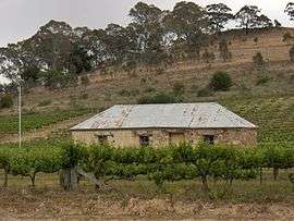 Cottage among grape vines at Penwortham in the Hundred of Clare | |||||||||||||
 Stanley | |||||||||||||
| Coordinates | 33°48′S 138°35′E / 33.8°S 138.58°ECoordinates: 33°48′S 138°35′E / 33.8°S 138.58°E | ||||||||||||
| Established | 1842 | ||||||||||||
| Area | 4,077 km2 (1,574.1 sq mi) | ||||||||||||
| LGA(s) |
Wakefield Regional Council District Council of Clare and Gilbert Valleys Regional Council of Goyder Northern Areas Council Port Pirie Regional Council | ||||||||||||
| |||||||||||||
The County of Stanley is one of the 49 counties of South Australia. It was proclaimed by Governor George Grey and named for Lord Edward Stanley, Secretary of State for the Colonies from February–June 1858, who had earlier advocated financial support for South Australia in 1842.[1] It is roughly bounded by the Wakefield River in the south, the approximate path of the Barrier Highway in the east, latitude 33°28' S in the north and longitudes 138°08' to 138°15' E in the west.[1]
Hundreds
The County of Stanley is divided into the following hundreds:
- Hundred of Koolunga
- Hundred of Yackamoorundie
- Hundred of Andrews
- Hundred of Ayers
- Hundred of Boucaut
- Hundred of Hart
- Hundred of Milne
- Hundred of Hanson
- Hundred of Everard
- Hundred of Blyth
- Hundred of Clare
- Hundred of Stanley
- Hundred of Goyder
- Hundred of Stow
- Hundred of Hall
- Hundred of Upper Wakefield
See also
- Locality of Stanley Flat in the Hundred of Clare, County of Stanley
- Locality of Stanley in the Hundred of Stanley, County of Stanley
- Stanley Football Association
References
- 1 2 "Search for 'County of Stanley, CNTY' (ID SA0064493)". Government of South Australia. Retrieved 16 February 2016.
Derivation of Name: Lord Stanley, Sec of State for Colonies; Other Details: Area 1574 square miles. Lord Stanley sponsored a bill in the House of Commons in 1842 to make further advances to South Australia in order to allow the State to meet its liabilities.
This article is issued from Wikipedia - version of the 8/24/2016. The text is available under the Creative Commons Attribution/Share Alike but additional terms may apply for the media files.