County Waterford
| County Waterford Contae Phort Láirge | ||
|---|---|---|
| ||
|
Motto: Déisi oc Declán co Bráth (Irish) "May the Déise remain with Declan forever" | ||
 | ||
| Country | Ireland | |
| Province | Munster | |
| Dáil Éireann | Waterford | |
| EU Parliament | South | |
| County town | Waterford | |
| Government | ||
| • Type | City and County Council | |
| Area | ||
| • Total | 1,857 km2 (717 sq mi) | |
| Area rank | 20th | |
| Population (2011) | 113,795 | |
| • Rank | 20th | |
| Vehicle index mark code |
W (since 2014) WD (1987–2013) | |
| Website |
www | |

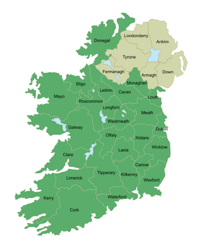
County Waterford (Irish: Contae Phort Láirge; the English name comes from Old Norse Vedrafjörður) is a county in Ireland. It is part of the South-East Region and is also located in the province of Munster. It is named after the city of Waterford, which is derived from the Old Norse name Veðrafjǫrðr or Vedrarfjord. There is an Irish-speaking area, Gaeltacht na nDéise in the south-west of the county. Waterford City and County Council is the local authority for the county. The population of the county at large, including the city, is 113,795 according to the 2011 census.
Geography and political subdivisions
County Waterford has two mountain ranges, the Knockmealdown Mountains and the Comeragh Mountains. The highest point in the county is Knockmealdown, at 794m. It also has many rivers, including Ireland's third longest river, the River Suir (184 km); and Ireland's fourth longest river, the Munster Blackwater (168 km). There are over 30 beaches along Waterford's volcanic coast line. A large stretch of this coastline, known as the Copper Coast has been designated as a UNESCO Geopark, a place of great geological importance. The area around Ring (An Rinn) is a Gaeltacht, an Irish-speaking area.
Waterford City is the county seat, prior to the merger of the 2 Waterford authorities in June 2014 Dungarvan was the county seat[1] for Waterford County Council.
Baronies
There are eight historic baronies in the county: Coshmore and Coshbride, Decies-within-Drum, Decies-without-Drum, Gaultiere, Glenahiry, Middle Third, Upperthird and Waterford City.
Towns and villages
| Historical population | ||
|---|---|---|
| Year | Pop. | ±% |
| 1600 | 14,456 | — |
| 1610 | 9,887 | −31.6% |
| 1653 | 13,136 | +32.9% |
| 1659 | 13,286 | +1.1% |
| 1821 | 76,103 | +472.8% |
| 1831 | 85,217 | +12.0% |
| 1841 | 196,187 | +130.2% |
| 1851 | 164,035 | −16.4% |
| 1861 | 134,252 | −18.2% |
| 1871 | 123,310 | −8.2% |
| 1881 | 112,768 | −8.5% |
| 1891 | 98,251 | −12.9% |
| 1901 | 87,187 | −11.3% |
| 1911 | 83,966 | −3.7% |
| 1926 | 78,562 | −6.4% |
| 1936 | 77,614 | −1.2% |
| 1946 | 76,108 | −1.9% |
| 1951 | 75,061 | −1.4% |
| 1956 | 74,031 | −1.4% |
| 1961 | 71,439 | −3.5% |
| 1966 | 73,080 | +2.3% |
| 1971 | 77,315 | +5.8% |
| 1979 | 87,278 | +12.9% |
| 1981 | 88,591 | +1.5% |
| 1986 | 91,151 | +2.9% |
| 1991 | 91,624 | +0.5% |
| 1996 | 94,680 | +3.3% |
| 2002 | 101,546 | +7.3% |
| 2006 | 107,961 | +6.3% |
| 2011 | 113,795 | +5.4% |
| 2016 | 116,401 | +2.3% |
| [2][3][4][5][6][7] | ||
- Abbeyside, Affane, Aglish, Annestown, An Rinn, Ardmore
- Ballinacourty, Ballinameela, Ballinamult, Ballinroad, Ballybeg, Ballybricken, Ballyduff Lower, Ballyduff Upper, Ballydurn, Ballygunner, Ballylaneen, Ballymacarbry, Ballymacart, Ballynaneashagh, Ballysaggart, Ballytruckle, Bilberry, Bunmahon, Butlerstown
- Cappoquin, Carrickbeg, Carriglea, Cheekpoint, Clashmore, Clonea-Power, Clonea Strand, Colligan, Coolnasmear, Crooke
- Dungarvan, Dunhill, Dunmore East
- Dunhill
- Faha, Faithlegg, Fenor, Ferrybank, Fews, Fourmilewater
- Glencairn, Grange
- Helvick Head
- Kilbrien, Kilgobinet, Kill, Killea, Kilmacthomas, Kilmanahan, Kilmeaden, Kilrossanty, Kilwatermoy, Kinsalebeg, Knockanore
- Lemybrien, Lisduggan, Lismore
- Mahon Bridge, Mine Head, Modeligo, Mothel, Mount Congreve, Mount Mellaray
- Newtown
- Old Parish
- Passage East, Portlaw
- Rathgormack
- Sliabh gCua, Stradbally
- Tallow, Tramore, Touraneena, Tourin, Tycor
- Waterford, Whitechurch, Whiting Bay, Woodstown
- Villierstown
History
.jpg)
County Waterford is colloquially known as "The Déise", pronounced "day-sha" (Irish: An Déise). Some time between the 4th and 8th centuries, a tribe of native Gaelic people called the Déisi were driven from southern county Meath/north Kildare, conquering and settled there. The ancient principality of the Déise is today roughly coterminous with the current Roman Catholic Diocese of Waterford and Lismore thus including part of south County Tipperary.
The westernmost of the baronies are "Decies within Drum" and "Decies without Drum", separated by the Drum-Fineen hills.[8]
There are many megalithic tombs and ogham stones[9] in the county. The Viking influence can still be seen with Reginald's Tower, one of the first buildings to use a brick and mortar construction method in Ireland. Woodstown, a settlement dating to the 9th Century was discovered 5.5 kilometres west of Waterford city. It was the largest settlement outside of Scandinavia and the only large-scale 9th Century Viking settlement discovered to date in Western Europe. Other architectural features are products of the Anglo-Norman Invasion of Ireland and its effects.
Local government and politics
As of 1 June 2014, Waterford City and County Council is the local government authority for Waterford. The authority was formed following the merger of Waterford City Council and Waterford County Council. The merger occurred following the Local Government Reform Act 2014. Each local authority ranks equally as first level local administrative units of the NUTS 3 South-East Region for Eurostat purposes. There are 31 LAU 1 entities in the Republic of Ireland. The local authority is responsible for certain local services such as sanitation, planning and development, libraries, the collection of motor taxation, local roads and social housing.
The county is part of the South constituency for the purposes of European elections. For elections to Dáil Éireann, the county is part of two constituencies: Waterford and Tipperary South. Together they return 7 deputies (TDs) to the Dáil. The Electoral (Amendment) Act 2009 defines the Waterford constituency as "The county of Waterford, except the part thereof which is comprised in the constituency of Tipperary South; and the city of Waterford."[10]
Gaeltacht
Gaeltacht na nDéise is a Gaeltacht area in Co. Waterford consisting of the parish of An Rinn and An Sean Phobal. Gaeltacht na nDéise is located 10 km from the town of Dungarvan, has a population of 1,784 people (Census 2011) and encompasses a geographical area of 62 km2. According to the Comprehensive Linguistic Study of the use of Irish in the Gaeltacht (Revised), the percentage of daily Irish speakers in Gaeltacht na nDéise was 46.04% (2014).[11]
See also

- High Sheriff of County Waterford
- Lord Lieutenant of Waterford
- List of abbeys and priories in the Republic of Ireland (County Waterford)
- Saint Declan
- Limerick–Rosslare railway line
References
- ↑ "Waterford County Council website".
- ↑ For 1653 and 1659 figures from Civil Survey Census of those years, Paper of Mr Hardinge to Royal Irish Academy 14 March 1865.
- ↑ "Census for post 1821 figures.". Cso.ie. Retrieved 2014-08-08.
- ↑ histpop.org
- ↑ "NISRA - Northern Ireland Statistics and Research Agency (c) 2013". Nisranew.nisra.gov.uk. 27 September 2010. Archived from the original on 17 February 2012. Retrieved 2014-08-08.
- ↑ Lee, JJ (1981). "On the accuracy of the Pre-famine Irish censuses". In Goldstrom, J. M.; Clarkson, L. A. Irish Population, Economy, and Society: Essays in Honour of the Late K. H. Connell. Oxford, England: Clarendon Press.
- ↑ Mokyr, Joel; O Grada, Cormac (November 1984). "New Developments in Irish Population History, 1700-1850". The Economic History Review. 37 (4): 473–488. doi:10.1111/j.1468-0289.1984.tb00344.x.
- ↑ Egan, P.M. (20 November 2004) [1893]. "Early Waterford History 2. The Decies". History of Waterford. Retrieved 2008-02-23.
- ↑ "Prehistoric Waterford tombs, dolmens and standing stones". Prehistoricwaterford.com.
- ↑ "Electoral (Amendment) Act 2009: Schedule". Irish Statute Book database. Retrieved 29 September 2010.
- ↑ http://www.udaras.ie/media/pdf/002910_Udaras_Nuashonr%C3%BA_FULL_report_A4_FA.pdf
External links
| Wikimedia Commons has media related to County Waterford. |
| Wikivoyage has a travel guide for County Waterford. |
 |
County Tipperary |
| ||
| County Cork |
|
County Wexford | ||
| ||||
| | ||||
| Celtic Sea |
Places in County Waterford | ||
|---|---|---|
| Towns | | |
| Villages and Townlands |
| |
| ||
The counties are listed per province | ||
 | ||
| ||
Coordinates: 52°15′N 7°30′W / 52.250°N 7.500°W