|
|
| Highway names |
|---|
| Interstates: |
Interstate X (I-X) |
|---|
| US Highways: |
U.S. Route X (US X) |
|---|
| State: |
New York State Route X (NY X) |
|---|
| County: |
County Route X (CR X) |
|---|
| System links |
|---|
|
|
County routes in Niagara County, New York, are not signed and there is no apparent numbering pattern. Most of the county routes act as primary roads in the less developed areas and also serve to interconnect the various villages and hamlets of Niagara County. Niagara County maintains few county routes, including only the most important connecting thoroughfares, and those are maintained by the Niagara County highway department. Most of the roads in the county, including many of the local through highways, are maintained by the towns. Routes 76 through 100 are listed below.
County Route 76
| County Route 76 |
|---|
| Location: |
Wilson |
|---|
| Length: |
1.3 mi[1] (2.1 km) |
|---|
County Route 76 is a north–south route in the northeastern part of the town of Wilson named North Beebe Road. Route 76 runs from its south end at Wilson–Burt Road (CR 52) and travels north to an end at Lake Road (NY 18) in the northeastern part of town near the Newfane town line.
- Major intersections
The entire route is in Wilson, Niagara County.
County Route 77
County Route 77 is an east–west route, named North Canal Road, northeast of the city of Lockport and travels in the towns of Lockport and Royalton. Route 77 runs from its west end at Old Niagara Road (CR 31) and heads east paralleling the north side of the Erie Canal for 2 miles (3.2 km) before crossing the canal and paralleling the south side for a short distance before entering the town of Royalton and heading to its east end at Rochester Road (NY 31).
- Major intersections
County Route 78
| County Route 78 |
|---|
| Location: |
Wilson |
|---|
| Length: |
0.2 mi[1] (0.3 km) |
|---|
County Route 78 is a short east–west route in the town of Wilson just outside the village of Wilson named West Lake Road. Route 78 runs from its west end at Lake Road and Harbour Street (NY 18) to Youngstown–Wilson Road, which heads into the village.
- Major intersections
The entire route is in Wilson, Niagara County.
County Route 82
| County Route 82 |
|---|
| Location: |
Niagara |
|---|
| Length: |
2.1 mi[1] (3.4 km) |
|---|
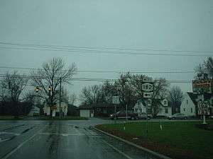
County Route 82 is a well traveled east–west route in the town of Niagara named Packard Road. Route 82 begins at the Niagara Falls city line and heads in a northeast direction through Niagara. After 0.6 miles (0.97 km) the roadway intersects I-190 (Niagara Expressway) and then very shortly thereafter NY 182 (Porter Road). Route 82 ends briefly here as NY 182 follows Packard Road for roughly 0.2 miles (0.32 km), intersecting NY 265 (Military Road) in the process. Porter Road resumes just east of the NY 265 junction, and NY 182 turns onto Porter Road while CR 82 resumes and continues on its northeast track until its end at Lockport Road (CR 6).
- Major intersections
The entire route is in Niagara, Niagara County.
County Route 83
| County Route 83 |
|---|
| Location: |
Wilson |
|---|
| Length: |
4.3 mi[1] (6.9 km) |
|---|
County Route 83 is a north–south route in the western part of the town of Wilson named Randall Road. Route 83 runs from its south end at Youngstown–Lockport Road (NY 93) near the south town border with Cambria and travels north to an end at Youngstown Road (CR 36) in the north part of town.
- Major intersections
County Route 85
| County Route 85 |
|---|
| Location: |
Lockport |
|---|
| Length: |
1.3 mi[1] (2.1 km) |
|---|
County Route 85 is a north–south route in the southeast part of the town of Lockport named Raymond Road. Route 85 runs from its south end at Rapids Road (CR 12) and travels north 1.4 miles (2.3 km) to come to an end at Dysinger Road (NY 93).
- Major intersections
The entire route is in Lockport, Niagara County.
County Route 86
County Route 86 is an east–west route in the town of Porter and village of Youngstown. Route 86 begins at its west end at Main Street (NY 18F and CR 907) in Youngstown and is named Church Street within the village. Once the roadway exits the village and enters the town, it is known as Blairville Road, named after the hamlet where Route 86 comes to its east end at Creek Road (NY 18). Route 86 passes under the Robert Moses State Parkway east of the Youngstown village limits.
- Major intersections
County Route 89
County Route 89 is a busy north–south route in the town of Wheatfield named Nash Road. Route 89 runs from its south end at the North Tonawanda city line, and travels north from there, intersecting Niagara Falls Boulevard (US 62) after 0.6 miles (0.97 km). After that intersection, Nash Road continues north through Wheatfield to come to its north end at busy Lockport Road (CR 6).
- Major intersections
The entire route is in Wheatfield, Niagara County.
County Route 91
| County Route 91 |
|---|
| Location: |
Newfane |
|---|
| Length: |
3.0 mi[1] (4.8 km) |
|---|
County Route 91 is an east–west route in the town of Newfane. Route 91 runs from its west end at Lockport–Olcott Road (NY 78) in the hamlet of Newfane and heads east as East Avenue, turning into Charlotteville Road when the roadway exits the hamlet. Route 91 ends 3 miles (4.8 km) east of the hamlet at an intersection with Hess Road (CR 24).
- Major intersections
The entire route is in Newfane, Niagara County.
County Route 92
| County Route 92 |
|---|
| Location: |
Lockport |
|---|
| Length: |
3.3 mi[1] (5.3 km) |
|---|
County Route 92 is an east–west route named Lincoln Avenue that lies in the town of Lockport. Route 92 runs from its west end at an intersection with CR 14 (Beattie Avenue) and travels 1.2 miles (1.9 km) east to an end at Akron Road (unsigned NY 954M), the former routing of NY 93 through the city of Lockport. The roadway itself that is named Lincoln Avenue continues west into the city for another 0.9 miles (1.4 km) and comes to an end at South Transit Street (NY 78); likewise at the west end, Lincoln continues east another 4.1 miles (6.6 km) to come to an end at Gasport Road.
- Major intersections
County Route 93
County Route 93 is a fairly short east–west route named Crescent Drive, and lies entirely in the town of Wheatfield. Route 93 runs 0.4 miles (0.64 km) from its west end at Niagara Falls Boulevard (US 62) to Townline Road (CR 20) at the Wheatfield–Pendleton town line.
- Major intersections
County Route 96
County Route 96 is a well traveled north–south (southwest–northeast) route named Bear Ridge Road. CR 96 travels predominately through the town of Pendleton, but also passes through the town of Lockport for a short distance towards its north end. Route 96 begins at the Erie County line, where it connects to Tonawanda Creek Road (CR 2) by way of a short, locally-maintained extension of Bear Ridge Road. Route 96 travels roughly northeast through the town of Pendleton, intersecting north–south Campbell Boulevard (NY 270) prior to approaching and eventually paralleling the west side of the Erie Canal. The next major intersection is at Lockport Road (CR 6) and Robinson Road (CR 123) southwest of the city of Lockport. CR 96 continues northeast along the canal to its end at the Lockport city line. The roadway itself continues for a short distance to a junction with Hinman Avenue.
- Major intersections
See also
.svg.png) New York Roads portal
New York Roads portal
References