County Route 528 (New Jersey)
| ||||
|---|---|---|---|---|
|
CR 528 highlighted in red | ||||
| Route information | ||||
| Length: | 39.89 mi[1] (64.20 km) | |||
| Major junctions | ||||
| West end: |
| |||
|
| ||||
| East end: |
| |||
| Location | ||||
| Counties: | Burlington, Ocean | |||
| Highway system | ||||
| ||||

_map.svg.png)
County Route 528, abbreviated CR 528, is a county highway in the U.S. state of New Jersey. The highway is designated 39.89 miles (64.20 km) from Farnsworth Avenue (CR 545) in Bordentown to Ocean Avenue (Route 35) in Mantoloking. The eastern end of the highway sustained extensive damage in 2012 when an inlet opened between Barnegat Bay and the Atlantic Ocean during Hurricane Sandy, scouring away the road east of the Mantoloking Bridge. The bridge and Route 35 intersection fully reopened in February 2013.
Route description
CR 528 begins at an intersection with CR 545 in Bordentown, Burlington County, heading east on two-lane undivided Crosswicks Street through areas of homes and businesses. The route crosses US 130/US 206 in commercial areas before continuing into Bordentown Township and passing a mix of farm fields, businesses, and residential neighborhoods. The road enters Chesterfield Township as it turns southeast and passes over the New Jersey Turnpike (I-95) before coming to a junction with CR 672. CR 528 continues through areas of farms and woods with some homes, intersecting CR 660 at a roundabout and CR 677. After the junction with the latter, the road turns east in residential areas before passing more agricultural areas. The route turns southeast onto Jacobstown-Chesterfield Road at the CR 664 intersection and continues through areas of farmland, woodland, and residences as it crosses into North Hanover Township. CR 528 briefly joins with CR 665 as it turns east into a mix of woods and homes as Jacobstown Road, turning southeast again to intersect CR 537, where CR 528 Truck heads east along CR 537. Past CR 537, the route continues into a mix of agricultural and wooded areas.[1][2]

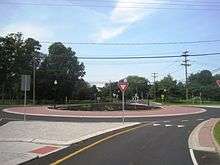
CR 528 continues into Plumsted Township in Ocean County, continuing into the community of New Egypt, where the road passes homes and businesses. After intersecting CR 616, the route heads east onto Main Street and passes through the commercial downtown of New Egypt before turning northeast near more homes. CR 528 leaves New Egypt by heading east on Lakewood Road, with CR 10 continuing northeast along Main Street. The road continues through rural residential areas as it reaches a junction with CR 539 and the eastern terminus of CR 528 Truck. From here, the route enters forested areas of the Pine Barrens with some residences, crossing into Jackson Township at the CR 640 intersection. CR 528 becomes West Veterans Highway and heads east to an intersection with CR 571 in the community of Cassville. From this point, the road runs through more residential sections of the Pine Barrens before coming to the CR 527 junction. At this point, CR 528 heads southeast concurrent with CR 527, with CR 636 heading east. The road passes near more wooded areas of homes before turning east and passing to the south of a lake. CR 527 splits from CR 528 by heading south on Whitesville Road, with CR 528 continuing east as East Veterans Highway. Farther east, the route intersects CR 547 and CR 639, where CR 547 turns east to form a concurrency with CR 528. The two routes continues through residential and commercial development, intersecting CR 626 before crossing into Lakewood Township. At this point, CR 528/CR 547 becomes Lakewood-New Egypt Road and turns northeast into wooded residential neighborhoods. In this area, the routes turn east onto Central Avenue and passes more homes before crossing Lake Carasaljo and coming to an intersection with US 9.[1][2]
At this point, CR 528 continues northeast on Hurley Avenue and CR 547 turns north to follow US 9 on Madison Avenue. The route turns east-southeast onto Cedar Bridge Avenue a short distance later and widens to four lanes. After crossing Conrail Shared Assets Operations' Southern Secondary line, the road continues through commercial, residential, forested and then commercial areas again prior to reaching the CR 623 junction at FirstEnergy Park. The road passes through industrial areas and passes to the north of Lakewood Airport prior to reaching a partial interchange with the Garden State Parkway that has access to and from the northbound direction of the parkway. Following this interchange, the route heads southeast into Brick Township and runs through woods before passing businesses as it comes to the Route 70 intersection. At this point, CR 528 gains a center left-turn lane and continues through commercial areas as it crosses CR 549 and CR 631. After the CR 631 junction, the road narrows to two lanes and passes a mix of homes and businesses as Mantoloking Road, running a short distance to the south of the Metedeconk River. The route intersects CR 624 and passes more residences before it enters areas of woods and marshland CR 528 crosses the Barnegat Bay on the Mantoloking Bridge, which is a drawbridge. After crossing the Barnegat Bay, the route enters Mantoloking and becomes Herbert Street, passing resort homes before ending at Route 35 near the Atlantic Ocean.[1][2]
History

A spur route, County Route 528 Spur, existed, which is now Burlington County Route 670, Burlington County Route 616, and Ocean County Route 616.[4]
In the aftermath of Hurricane Sandy in October 2012, much of Herbert Street, Route 35 and the surrounding area in Mantoloking were destroyed when a new inlet between Barnegat Bay and the Atlantic Ocean opened around the eastern base of the bridge over the bay.[5] The bridge and Route 35 intersection fully reopened in February 2013.[6]
Major intersections
| County | Location | mi[1] | km | Destinations | Notes |
|---|---|---|---|---|---|
| Burlington | Bordentown | 0.00 | 0.00 | ||
| 0.53 | 0.85 | ||||
| North Hanover Township | 9.87 | 15.88 | Western terminus of CR 528 Truck | ||
| Ocean | Plumsted Township | 14.75 | 23.74 | Eastern terminus of CR 528 Truck | |
| Jackson Township | 19.92 | 32.06 | |||
| 22.46 | 36.15 | West end of CR 527 overlap | |||
| 26.20 | 42.16 | East end of CR 527 overlap | |||
| 27.33 | 43.98 | West end of CR 547 overlap | |||
| Lakewood Township | 30.25 | 48.68 | East end of CR 547 overlap | ||
| 33.51 | 53.93 | Exit 89 (GSP); access to GSP northbound and from GSP southbound only | |||
| Brick Township | 34.54 | 55.59 | |||
| 34.94 | 56.23 | ||||
| Mantoloking | 39.89 | 64.20 | |||
1.000 mi = 1.609 km; 1.000 km = 0.621 mi
| |||||
CR 528 Truck
| |
|---|---|
| Location: | New Egypt |
| Length: | 5.64 mi[7][8] (9.08 km) |

CR 528 Truck is a 5.64-mile-long (9.08 km) signed truck route of CR 528 that bypasses New Egypt.[7][8][9] The route begins in North Hanover Township, Burlington County at the intersection of CR 528 and CR 537. CR 528 Truck heads northeast along CR 537 where it exits Burlington County and forms the border between Upper Freehold Township, Monmouth County and Plumsted Township, Ocean County. At CR 539, CR 528 Truck turns south onto CR 539 and ends at its intersection with CR 528 east of New Egypt.
Major intersections
| County | Location | mi[7][8] | km | Destinations | Notes |
|---|---|---|---|---|---|
| Burlington | North Hanover Township | 0.00 | 0.00 | Western terminus, west end of CR 537 overlap | |
| Monmouth–Ocean county line | Upper Freehold–Plumsted township line | 3.65 | 5.87 | East end of CR 537 overlap, west end of CR 539 overlap | |
| Ocean | Plumsted Township | 5.64 | 9.08 | Eastern terminus, east end of CR 539 overlap | |
| 1.000 mi = 1.609 km; 1.000 km = 0.621 mi | |||||
See also
 U.S. Roads portal
 New Jersey portal
References
- 1 2 3 4 5 "County Route 528 straight line diagram" (PDF). Trenton, New Jersey: New Jersey Department of Transportation (NJDOT). 2009. Retrieved January 5, 2011.
- 1 2 3 Google (January 7, 2011). "overview of County Route 528" (Map). Google Maps. Google. Retrieved January 7, 2011.
- ↑ New Jersey County High Points, Peakbagger.com. Accessed August 17, 2014.
- ↑ Steve Alpert. "New Jersey Roads - NJ State Highways - CR 515-530". Retrieved 2008-08-28.
- ↑ Dopp, Terrence. "Sandy Leaves House Bobbing in Bay Amid Wide N.J. Devastation". SFGate.com. Bloomberg News. Retrieved 6 November 2012.
- ↑ "Route 35 Now Open North of Mantoloking with Restrictions". The Ocean Signal. February 1, 2013. Retrieved February 16, 2013.
- 1 2 3 "CR 539 Straight Line Diagram" (PDF). NJDOT. August 2006. Retrieved June 8, 2014.
- 1 2 3 "CR 537 Straight Line Diagram" (PDF). NJDOT. August 2006. Retrieved June 8, 2014.
- ↑ Google (June 8, 2014). "Overview of CR 528 Truck" (Map). Google Maps. Google. Retrieved June 8, 2014.
External links
 Media related to County Route 528 (New Jersey) at Wikimedia Commons
- NJ State Highways: CR 515-530
- CR 528 pictures