County Route 106 (Rockland County, New York)
| |
|---|---|
_map.png) | |
| Route information | |
| Length: | 7.8 mi[1] (12.6 km) |
| Existed: | 1982 – present |
| Major junctions | |
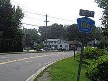
| West end: |
|
|
| |
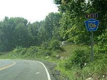
| East end: |
|
| Highway system | |

County Route 106 (CR 106) is a 7.8-mile (12.6 km) east–west county route in Rockland County, New York, in the United States. It serves as an eastward continuation of Orange CR 106, extending from the Orange County line to U.S. Route 9W (US 9W) and US 202 in Stony Point via Harriman State Park. CR 106 intersects with several county highways in Rockland County along the way. The route is only one of two in Rockland County to keep its numbering from Orange County, with the other being CR 72. CR 106 had one spur route, CR 106A, which was recently decommissioned.
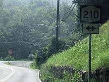
The route was originally designated County Highway 416 in the 1920s and 1930s. In 1930, it became the easternmost part of New York State Route 210 (NY 210), a state highway continuing westward into Orange County. In 1982, NY 210 was truncated to end in Greenwood Lake, and its former routing east of NY 17 was replaced by CR 106 in Orange and Rockland counties.
Route description
CR 106 begins at the Orange County line in Harriman State Park as a continuation of that county's CR 106. The route is only one of two county routes that have the same number in both Rockland and Orange counties; the other is CR 72.[1]
CR 106 proceeds east from here providing a border between Harriman State Park (to the west) and Bear Mountain State Park (to the east). It then intersects Lake Welch Parkway, a seasonal road which provides a route to Lake Welch Beach on the northern side of the lake. Then, CR 106 splits Lake Welch in two different locations on the southern side of the lake. CR 106 then begins its trek out of Harriman State Park and into the town of Stony Point.[1]
Immediately after entering Stony Point, CR 106 intersects CR 98 where CR 106 makes a left turn. CR 106 then proceeds east toward its intersection with the Palisades Parkway. This is at exit 15 and is the last residential exit northbound on the PIP, with everything north of this point being exits within Harriman and Bear Mountain.
Just after its intersection with the PIP, the road intersects two former Rockland County Routes (CR 106A & CR 69).[1] Also, at this point CR 106 enters the village limits of Stony Point, and becomes a 55-mile-per-hour (89 km/h), highway with extra lanes in some places. The highway intersects CR 108, CR 47, and CR 33 as Central Drive. CR 106 comes to an end shortly after these intersections at US 9W and US 202 in downtown Stony Point, about a mile west from the Hudson River and the Stony Point Marina.[1]
History
CR 106 originated in 1824, when the road was chartered for the New Turnpike and headed from Monroe to Haverstraw.[2] Back in the 1820s, what is now Southfields was known as Monroe. The New Turnpike started at a nail factory in Monroe to a crossing over the Ramapo River, and progressed eastward, passing Lake Stahahe (then known as Car Pond). The turnpike continued eastward, meeting the Old Turnpike at a fork in the road. At the fork, part of the road became NY 210 in the 1930 New York State Route renumbering. In 1910, when the park opened, the road became known as the Southfields Road. Three years later, it became part of the Seven Lakes Drive. Three more years later, the route became known as County Highway 416. In 1919 and 1920, the western section of the road was reconstructed. After a bridge was built to cross a river in 1923, a new route, making up part of the original Warwick Turnpike, became NY 17A.[2]
The responsibility for maintaining NY 210 was turned over to the county in 1982. The road was replaced with CR 106.[2][3]
CR 106A
CR 106A was a 0.1-mile (0.16 km) spur which began at CR 106 and ended at a dead end near CR 69 in Stony Point.[4]
Major intersections
| Location | mi[1] | km | Destinations | Notes | |
|---|---|---|---|---|---|
| Harriman State Park | 0.00 | 0.00 | Continuation into Orange County | ||
| 1.30 | 2.09 | ||||
| Community of Stony Point | 3.40 | 5.47 | Western terminus of CR 98 | ||
| 3.50 | 5.63 | Western terminus of CR 98A | |||
| 4.30 | 6.92 | Northern terminus of CR 83 | |||
| Harriman State Park | 4.90 | 7.89 | Exit 15 (Palisades Parkway) | ||
| Community of Stony Point | 5.70 | 9.17 | Cedar Flats Road north (CR 69) | Southern terminus of CR 69 | |
| 6.40 | 10.30 | Eastern terminus of CR 108 | |||
| 6.80 | 10.94 | ||||
| 7.50 | 12.07 | Northern terminus of CR 33 | |||
| 7.8 | 12.6 | ||||
| 1.000 mi = 1.609 km; 1.000 km = 0.621 mi | |||||
See also
- County Route 106 (Orange County, New York)
- List of county routes in Rockland County, New York (76–118A)
References
- 1 2 3 4 5 6 Google (September 22, 2007). "overview map of CR 106" (Map). Google Maps. Google. Retrieved September 22, 2007.
- 1 2 3 Myles, William J. (1999). Harriman Trails, A Guide and History. New York, NY: The New York–New Jersey Trail Conference.
- ↑ Westchester & Rockland county map (Map). Cartography by New York State Department of Transportation. New York State Department of Transportation. 1991.
- ↑ Google (January 11, 2008). "overview map of CR 106A" (Map). Google Maps. Google. Retrieved January 11, 2008.
External links
| Wikimedia Commons has media related to County Route 106 (Rockland County, New York). |
- County Route 106 at Alps' Roads