San Juan Cotzal
| San Juan Cotzal Cotzal | |
|---|---|
| Municipality | |
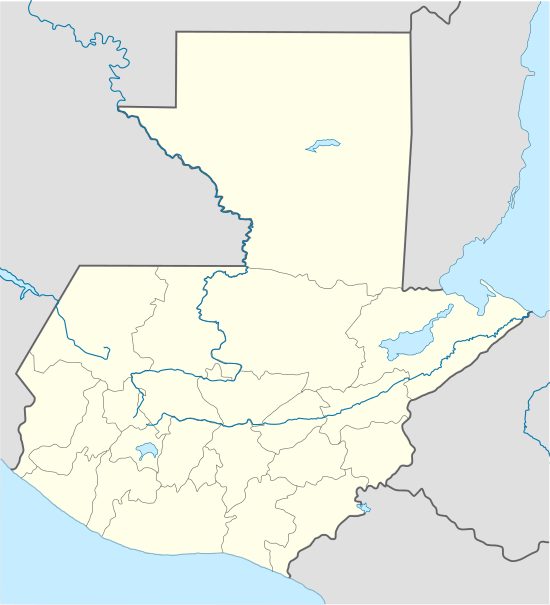 San Juan Cotzal Location in Guatemala | |
| Coordinates: 15°26′7″N 91°2′8″W / 15.43528°N 91.03556°WCoordinates: 15°26′7″N 91°2′8″W / 15.43528°N 91.03556°W | |
| Country |
|
| Department |
|
| Municipality | San Juan Cotzal |
| Government | |
| • Type | Municipal |
| • Mayor | Baltazar Cruz Torres (PP) |
| Elevation | 5,600 ft (1,700 m) |
| Population (Census 2002) | |
| • Municipality | 20,050 |
| • Urban | 9,037 |
| • Ethnicities | Ixil, K'iche', Ladino |
| • Religions | Roman Catholicism, Evangelicalism, Maya |
| Climate | Cfb |
| Website | http://www.inforpressca.com/cotzal/ |
San Juan Cotzal (Spanish pronunciation: [saŋ ˈxwan kotˈsal]) is a municipality in the Guatemalan department of El Quiché. San Juan Cotzal is part of the Ixil Community, along with Santa Maria Nebaj and San Gaspar Chajul.
History
Pre Hispanic era

Worried about the defection of the aj K’ub’ul family chief -who had taken his family away in order to look for fertile and, above all, pacific land-, the K’iche’ king sent a group of soldiers to control every single movement of them. He was afraid that the aj K'ub'ul would look for reinforcements from other ethnic group in the area to form a strong army and then attack the k'iche's. The warriors settled to the east of the aj K’ub’ul and since the latter had moved away to look for peace and tranquility, they were a very peaceful community. And that is exactcly wha the warriors inform the K’iche’ king, reassuring him by telling that he should not worry about the exiled group, as they were really peaceful.[1]
As time went by, the k'iche' warriors realized that the aj K'ub'ul life was very different from the one they were used to have under the ruling of their king, as they simple worked on their land and crops and then enjoyed their families without having to worry about being invaded or called to fight in a war. Therefore, they went back to their place of origin, Tujalj (Sacapulas and Canillá)), but only to pick up their families and went on to settle a new community where they were once stationed to keep an eye on the aj K'ub'ul.[lower-alpha 1]
Campaigns in the Cuchumatanes

In the ten years after the fall of Zaculeu various Spanish expeditions crossed into the Sierra de los Cuchumatanes and engaged in the gradual and complex conquest of the Chuj and Q'anjob'al.[2] The Spanish were attracted to the region in the hope of extracting gold, silver and other riches from the mountains but their remoteness, the difficult terrain and relatively low population made their conquest and exploitation extremely difficult.[3] The population of the Cuchumatanes is estimated to have been 260,000 before European contact. By the time the Spanish physically arrived in the region this had collapsed to 150,000 because of the effects of the Old World diseases that had run ahead of them.[4]
Uspantán and the Ixil
After the western portion of the Cuchumatanes fell to the Spanish, the Ixil and Uspantek Maya were sufficiently isolated to evade immediate Spanish attention. The Uspantek and the Ixil were allies and in 1529, four years after the conquest of Huehuetenango, Uspantek warriors were harassing Spanish forces and Uspantán was trying to foment rebellion among the K'iche'. Uspantek activity became sufficiently troublesome that the Spanish decided that military action was necessary. Gaspar Arias, magistrate of Guatemala, penetrated the eastern Cuchumatanes with sixty Spanish infantry and three hundred allied indigenous warriors.[5] By early September he had imposed temporary Spanish authority over the Ixil towns of Chajul and Nebaj.[6] The Spanish army then marched east toward Uspantán itself; Arias then received notice that the acting governor of Guatemala, Francisco de Orduña, had deposed him as magistrate. Arias handed command over to the inexperienced Pedro de Olmos and returned to confront de Orduña. Although his officers advised against it, Olmos launched a disastrous full-scale frontal assault on the city. As soon as the Spanish began their assault they were ambushed from the rear by more than two thousand Uspantek warriors. The Spanish forces were routed with heavy losses; many of their indigenous allies were slain, and many more were captured alive by the Uspantek warriors only to be sacrificed on the altar of their deity Exbalamquen. The survivors who managed to evade capture fought their way back to the Spanish garrison at Q'umarkaj.[7]
A year later Francisco de Castellanos set out from Santiago de los Caballeros de Guatemala (by now relocated to Ciudad Vieja) on another expedition against the Ixil and Uspantek, leading eight corporals, thirty-two cavalry, forty Spanish infantry and several hundred allied indigenous warriors. The expedition rested at Chichicastenango and recruited further forces before marching seven leagues northwards to Sacapulas and climbed the steep southern slopes of the Cuchumatanes. On the upper slopes they clashed with a force of between four and five thousand Ixil warriors from Nebaj and nearby settlements. A lengthy battle followed during which the Spanish cavalry managed to outflank the Ixil army and forced them to retreat to their mountaintop fortress at Nebaj. The Spanish force besieged the city, and their indigenous allies managed to scale the walls, penetrate the stronghold and set it on fire. Many defending Ixil warriors withdrew to fight the fire, which allowed the Spanish to storm the entrance and break the defences.[7] The victorious Spanish rounded up the surviving defenders and the next day Castellanos ordered them all to be branded as slaves as punishment for their resistance.[8] The inhabitants of Chajul immediately capitulated to the Spanish as soon as news of the battle reached them. The Spanish continued east towards Uspantán to find it defended by ten thousand warriors, including forces from Cotzal, Cunén, Sacapulas and Verapaz. The Spaniards were barely able to organise a defence before the defending army attacked. Although heavily outnumbered, the deployment of Spanish cavalry and the firearms of the Spanish infantry eventually decided the battle. The Spanish overran Uspantán and again branded all surviving warriors as slaves. The surrounding towns also surrendered, and December 1530 marked the end of the military stage of the conquest of the Cuchumatanes.[9]
Population
According to official census done by the Guatemalan National Statistics Institute (INE), the municipality had a total population of 14137 in 1994; in 2002 this grew by 42% and in 2008 a study determined that there was an additional 29% increase. The following tables show the difference population classification in San Juan Cotzal:[10]
|
| ||||||||||||||||||||||||||||||||||||||||||||||||||||||||||||||||||||||
|
|
Dwelling
86% of the population owns their home, while the rest live in borrowed (12%) or rented houses(2%).[14] Most of the urban structures are made of zinc sheets roofing and brick walls.[15] On the other hand, rural area homes are built out of wood and "teja", and lack any kind of flooring.[15]
Occupation and salaries
Agriculture is by far the main productive activity of the area,[15] and those who work their own land are the ones that fare better income-wise.[15]
|
|
|
82% of the population had an income of Q1,200.00/month, which was less than minimal wage at the time.[16] Area development halted during the Guatemalan Civil War, although economic conditions were not all that prosperous even before it.[16]
Education
San Juan Cotzal has numerous educational institutions: twenty two of them are public schools run by the Government.[17]
|
| ||||||||||||||||||||||||||||||||||||||||||||||||||||||||||||||||||||||||||||||||||||||||||||||||||||||||||||||||||||||||||||||||||||||||||||||
|
| ||||||||||||||||||||||||||||||||||||||||||||||||||||||||||||||||||||||||||||||||||||||||||||||||||||||||||||||||||||||||||||||||||||||||||||||
Economy
The production activity details are shown in the following tables:
|
|
| ||||||||||||||||||||||||||||||||||||||||||||||||||||||||||||||||||||||||||||||||||||||||||||||||||||||||||||||||||||||||||||||||||||||||||
|
|
Climate
San Juan Cotzal has an oceanic climate (Köppen: Cfb).
| Climate data for San Juan Cotzal | |||||||||||||
|---|---|---|---|---|---|---|---|---|---|---|---|---|---|
| Month | Jan | Feb | Mar | Apr | May | Jun | Jul | Aug | Sep | Oct | Nov | Dec | Year |
| Average high °C (°F) | 21.4 (70.5) |
22.4 (72.3) |
24.2 (75.6) |
24.7 (76.5) |
24.3 (75.7) |
23.3 (73.9) |
22.7 (72.9) |
23.1 (73.6) |
23.0 (73.4) |
22.0 (71.6) |
22.1 (71.8) |
21.8 (71.2) |
22.92 (73.25) |
| Daily mean °C (°F) | 15.5 (59.9) |
16.0 (60.8) |
17.5 (63.5) |
18.2 (64.8) |
18.3 (64.9) |
18.3 (64.9) |
17.6 (63.7) |
17.6 (63.7) |
17.6 (63.7) |
17.0 (62.6) |
16.5 (61.7) |
16.0 (60.8) |
17.18 (62.92) |
| Average low °C (°F) | 9.6 (49.3) |
9.6 (49.3) |
10.8 (51.4) |
11.7 (53.1) |
12.4 (54.3) |
13.3 (55.9) |
12.5 (54.5) |
12.1 (53.8) |
12.3 (54.1) |
12.0 (53.6) |
10.9 (51.6) |
10.2 (50.4) |
11.45 (52.61) |
| Average precipitation mm (inches) | 44 (1.73) |
29 (1.14) |
40 (1.57) |
53 (2.09) |
118 (4.65) |
284 (11.18) |
231 (9.09) |
199 (7.83) |
227 (8.94) |
197 (7.76) |
104 (4.09) |
46 (1.81) |
1,572 (61.88) |
| Source: Climate-Data.org[26] | |||||||||||||
Geographic location
San Juan Cotzal is 269 km from Guatemala City and 104 km from Santa Cruz del Quiché through the Quiché 6 West highway.[27]
 |
Chajul | | ||
| Nebaj | |
Uspantán[27] | ||
| ||||
| | ||||
| Cunén[27] |
See also
Notes and references
- ↑ This was confirmed by Antonio Rodríguez, from Sacapulas, who witnessed the contact his family had with Rabinal, San Miguel Chicaj and Salamá in the 1950s. They knew that their families were related and always brought Sacapulas produce into those municipalities.[1]
References
- 1 2 Tz’unun, Francisco Luis; Chom, Miguel Antret; Terga, Ricardo (n.d.). Transcripción de la tradición oral de Cubulco (in Spanish). Guatemala.
- ↑ Limón Aguirre 2008, p. 10.
- ↑ Limón Aguirre 2008, p. 11.
- ↑ Lovel 2005, p. 71
- ↑ Lovell 2005, p. 64
- ↑ Lovell 2005, pp. 64–65.
- 1 2 Lovell 2005, p. 65
- ↑ Lovell 2005, pp. 65–66.
- ↑ Lovell 2005, p. 66
- 1 2 Bran Prado, Byron Rafael et al. 2010, p. 13
- ↑ Bran Prado, Byron Rafael et al. 2010, p. 14.
- ↑ Bran Prado, Byron Rafael et al. 2010, p. 15.
- ↑ Bran Prado, Byron Rafael et al. 2010, p. 16.
- ↑ Marroquín Lopez, Marvin Ottoniel et al. 2010, p. 16.
- 1 2 3 4 5 Marroquín Lopez, Marvin Ottoniel et al. 2010, p. 17
- 1 2 3 Marroquín Lopez, Marvin Ottoniel et al. 2010, p. 19
- 1 2 Marroquín Lopez, Marvin Ottoniel et al. 2010, p. 24
- 1 2 Marroquín Lopez, Marvin Ottoniel et al. 2010, p. 22
- ↑ Marroquín Lopez, Marvin Ottoniel et al. 2010, p. 23.
- ↑ Flores Moreno, Nery Osvaldo et al. 2010, p. 18
- ↑ Flores Moreno, Nery Osvaldo et al. 2010, p. 24.
- ↑ Flores Moreno, Nery Osvaldo et al. 2010, p. 25.
- ↑ Flores Moreno, Nery Osvaldo et al. 2010, p. 22.
- ↑ Flores Moreno, Nery Osvaldo et al. 2010, p. 23.
- ↑ Zarceño Guzmán, Sandra Judith; Rodas Ramírez, Berta Julissa; Bran Prado, Byron Rafael; Cuyuch Martínez, Marta Rossibell; López Matheu, Jorge Javier; Mazariegos Cuyuch, Melvin Orlando; Yupe Ramírez, José Guillermo; García Valenzuela, Francisca; Rojas Escalante, Pabla Bartola; Flores Moreno, Nery Osvaldo; Cabrera Ruano, Miriam Alicia; Marroquín López, Marvin Ottoniel; Rodríguez Lemus, Gerson Giovanni Steve (2010). Diagnóstico socioecnómico: potentialidades productivas y propuestas de inversión. Municipio de San Juan Cotzal, departamento de El Quiché. Informe general (PDF). Investigación de Campo, Grupo EPS (in Spanish). Guatemala: Universidad de San Carlos de Guatemala.
- ↑ "Climate: San Juan Cotzal". Climate-Data.org. Retrieved 20 August 2015.
- 1 2 3 SEGEPLAN. "Municipios de Quiché, Guatemala". Secretaría General de Planificación y Programación de la Presidencia de la República (in Spanish). Guatemala. Archived from the original on 2 July 2015. Retrieved 30 June 2015.
Bibliography
- Bran Prado, Byron Rafael; et al. (2010). "Diagnóstico de inversión social". Diagnóstico socioeconómico: potentialidades productivas y propuestas de inversión. Municipio de San Juan Cotzal, departamento de El Quiché. Informe general (PDF). Investigación de Campo, Grupo EPS (in Spanish). 2. Guatemala: Facultad de Ciencias Económicas de la Universidad de San Carlos de Guatemala.
- Flores Moreno, Nery Osvaldo; et al. (2010). "Diagnóstico financiero municipal". Diagnóstico socioeconómico: potentialidades productivas y propuestas de inversión. Municipio de San Juan Cotzal, departamento de El Quiché. Informe general (PDF). Investigación de Campo, Grupo EPS (in Spanish). 10. Guatemala: Facultad de Ciencias Económicas de la Universidad de San Carlos de Guatemala.
- García Valenzuela, Francisca; et al. (2010). "Diagnóstico de las fuentes de financiamiento municipal". Diagnóstico socioecnómico: potentialidades productivas y propuestas de inversión. Municipio de San Juan Cotzal, departamento de El Quiché. Informe general (PDF). Investigación de Campo, Grupo EPS (in Spanish). 11. Guatemala: Facultad de Ciencias Económicas de la Universidad de San Carlos de Guatemala.
- Limón Aguirre, Fernando (2008). "La ciudadanía del pueblo chuj en México: Una dialéctica negativa de identidades" (PDF) (in Spanish). San Cristóbal de Las Casas, México: El Colegio de la Frontera Sur – Unidad San Cristóbal de Las Casas. Retrieved 15 September 2011.
- Lovell, W. George (2005). Conquest and Survival in Colonial Guatemala: A Historical Geography of the Cuchumatán Highlands, 1500-1821 (3rd ed.). Montreal, Canadá: McGill-Queen's University Press. ISBN 0-7735-2741-9. OCLC 58051691.
- Marroquín Lopez, Marvin Ottoniel; et al. (2010). "Costos y rentabilidad de unidades pecuarias (crianza y engorde de ganado bovino)". Diagnóstico socioecnómico: potentialidades productivas y propuestas de inversión. Municipio de San Juan Cotzal, departamento de El Quiché. Informe general (PDF). Ejercicio Profesional Supervisado (in Spanish). 4. Facultad de Ciencias Económicas de la Universidad de San Carlos de Guatemala.
- Thompson, John Eric Sidney (1990) [1977]. Maya History and Religion. Civilization of the American Indian series. 99. University of Oklahoma Press. p. 415. ISBN 9780806122472.
External links
-
 Media related to Cotzal at Wikimedia Commons
Capital: Santa Cruz del Quiché | ||
| Municipalities | 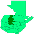 | |