Conrad, Montana
| Conrad, Montana | |
|---|---|
| [City] | |
|
Conrad, Montana | |
| Nickname(s): As Country as They Come | |
| Motto: "The Heart Of The Golden Triangle" | |
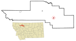 Location of Conrad, Montana | |
| Coordinates: 48°10′22″N 111°56′50″W / 48.17278°N 111.94722°WCoordinates: 48°10′22″N 111°56′50″W / 48.17278°N 111.94722°W | |
| Country | United States |
| State | Montana |
| County | Pondera |
| Area[1] | |
| • Total | 1.25 sq mi (3.24 km2) |
| • Land | 1.25 sq mi (3.24 km2) |
| • Water | 0 sq mi (0 km2) |
| Elevation | 3,517 ft (1,072 m) |
| Population (2010)[2] | |
| • Total | 2,570 |
| • Estimate (2015)[3] | 2,593 |
| • Density | 2,056.0/sq mi (793.8/km2) |
| Time zone | Mountain (MST) (UTC-7) |
| • Summer (DST) | MDT (UTC-6) |
| ZIP code | 59425 |
| Area code(s) | 406 |
| FIPS code | 30-17275 |
| GNIS feature ID | 0806937 |

Conrad is a city in and the county seat of Pondera County, Montana, United States.[4] The population was 2,570 at the 2010 census.
Geography
Conrad is located at 48°10′22″N 111°56′50″W / 48.172807°N 111.947131°W (48.172807, -111.947131).[5]
According to the United States Census Bureau, the city has a total area of 1.25 square miles (3.24 km2), all of it land.[1]
Demographics
| Historical population | |||
|---|---|---|---|
| Census | Pop. | %± | |
| 1910 | 888 | — | |
| 1920 | 988 | 11.3% | |
| 1930 | 1,499 | 51.7% | |
| 1940 | 1,471 | −1.9% | |
| 1950 | 1,865 | 26.8% | |
| 1960 | 2,665 | 42.9% | |
| 1970 | 2,770 | 3.9% | |
| 1980 | 3,074 | 11.0% | |
| 1990 | 2,891 | −6.0% | |
| 2000 | 2,753 | −4.8% | |
| 2010 | 2,570 | −6.6% | |
| Est. 2015 | 2,593 | [6] | 0.9% |
| U.S. Decennial Census[7] 2015 Estimate[3] | |||
2010 census
As of the census[2] of 2010, there were 2,570 people, 1,113 households, and 676 families residing in the city. The population density was 2,056.0 inhabitants per square mile (793.8/km2). There were 1,266 housing units at an average density of 1,012.8 per square mile (391.0/km2). The racial makeup of the city was 95.1% White, 0.2% African American, 1.8% Native American, 0.3% Asian, 0.2% from other races, and 2.4% from two or more races. Hispanic or Latino of any race were 1.5% of the population.
There were 1,113 households of which 28.6% had children under the age of 18 living with them, 45.9% were married couples living together, 10.7% had a female householder with no husband present, 4.1% had a male householder with no wife present, and 39.3% were non-families. 35.1% of all households were made up of individuals and 17.3% had someone living alone who was 65 years of age or older. The average household size was 2.19 and the average family size was 2.82.
The median age in the city was 45.7 years. 22.7% of residents were under the age of 18; 6.4% were between the ages of 18 and 24; 19.9% were from 25 to 44; 26.9% were from 45 to 64; and 24.2% were 65 years of age or older. The gender makeup of the city was 45.8% male and 54.2% female.
2000 census
As of the census[8] of 2000, there were 2,753 people, 1,154 households, and 755 families residing in the city. The population density was 2,338.5 people per square mile (900.8/km2). There were 1,332 housing units at an average density of 1,131.5 per square mile (435.8/km2). The racial makeup of the city was 95.75% White, 0.11% African American, 2.29% Native American, 0.18% Asian, 0.11% Pacific Islander, 0.22% from other races, and 1.34% from two or more races. Hispanic or Latino of any race were 0.94% of the population.
There were 1,154 households out of which 32.1% had children under the age of 18 living with them, 52.6% were married couples living together, 9.4% had a female householder with no husband present, and 34.5% were non-families. 31.3% of all households were made up of individuals and 16.2% had someone living alone who was 65 years of age or older. The average household size was 2.33 and the average family size was 2.92.
In the city the population was spread out with 26.3% under the age of 18, 5.9% from 18 to 24, 25.7% from 25 to 44, 21.1% from 45 to 64, and 21.0% who were 65 years of age or older. The median age was 40 years. For every 100 females there were 87.9 males. For every 100 females age 18 and over, there were 85.0 males.
The median income for a household in the city was $29,432, and the median income for a family was $42,056. Males had a median income of $31,908 versus $19,286 for females. The per capita income for the city was $15,742. About 10.6% of families and 13.4% of the population were below the poverty line, including 15.3% of those under age 18 and 5.7% of those age 65 or over.
Climate
Conrad experiences a semi-arid climate (Köppen BSk) with cold, dry winters and hot, wetter summers.
| Climate data for Conrad, Montana | |||||||||||||
|---|---|---|---|---|---|---|---|---|---|---|---|---|---|
| Month | Jan | Feb | Mar | Apr | May | Jun | Jul | Aug | Sep | Oct | Nov | Dec | Year |
| Record high °F (°C) | 65 (18) |
72 (22) |
79 (26) |
88 (31) |
93 (34) |
101 (38) |
103 (39) |
105 (41) |
99 (37) |
91 (33) |
82 (28) |
72 (22) |
105 (41) |
| Average high °F (°C) | 31.7 (−0.2) |
37.2 (2.9) |
45.6 (7.6) |
56.9 (13.8) |
66.1 (18.9) |
73.8 (23.2) |
80.2 (26.8) |
80.2 (26.8) |
69.9 (21.1) |
58.8 (14.9) |
41.7 (5.4) |
34.0 (1.1) |
56.34 (13.53) |
| Daily mean °F (°C) | 19.4 (−7) |
24.5 (−4.2) |
32.5 (0.3) |
42.5 (5.8) |
51.8 (11) |
59.3 (15.2) |
64.3 (17.9) |
63.8 (17.7) |
54.0 (12.2) |
43.9 (6.6) |
29.4 (−1.4) |
22.0 (−5.6) |
42.28 (5.71) |
| Average low °F (°C) | 7.0 (−13.9) |
11.7 (−11.3) |
19.4 (−7) |
28.0 (−2.2) |
37.5 (3.1) |
44.8 (7.1) |
48.3 (9.1) |
47.4 (8.6) |
38.0 (3.3) |
28.9 (−1.7) |
17.1 (−8.3) |
9.9 (−12.3) |
28.17 (−2.13) |
| Record low °F (°C) | −42 (−41) |
−45 (−43) |
−32 (−36) |
−19 (−28) |
9 (−13) |
27 (−3) |
31 (−1) |
25 (−4) |
0 (−18) |
−16 (−27) |
−32 (−36) |
−46 (−43) |
−46 (−43) |
| Average precipitation inches (mm) | 0.44 (11.2) |
0.33 (8.4) |
0.67 (17) |
1.04 (26.4) |
2.17 (55.1) |
2.23 (56.6) |
1.22 (31) |
1.45 (36.8) |
1.01 (25.7) |
0.58 (14.7) |
0.47 (11.9) |
0.45 (11.4) |
12.06 (306.2) |
| Source #1: NOAA (normals, 1971–2000) [9] | |||||||||||||
| Source #2: The Weather Channel (Records) [10] | |||||||||||||
Notable people
- LeRoy H. Anderson, United States Congressman from Montana, resided in Conrad.
- Scott Curry, American football offensive tackle in the National Football League was born in Conrad.
- Wylie Gustafson, country and western singer, was born in Conrad.
- Duncan McKenzie was convicted of murdering Lana Harding, a teacher, in Conrad.
- Shannen Rossmiller, The youngest female judge in United States history, whose testimony led to the conviction of Ryan G. Anderson, and (Alaskan pipeline terrorist) Michael Curtis Reynolds was born and worked in Conrad.
References
- 1 2 "US Gazetteer files 2010". United States Census Bureau. Archived from the original on 2012-01-24. Retrieved 2012-12-18.
- 1 2 "American FactFinder". United States Census Bureau. Retrieved 2012-12-18.
- 1 2 "Population Estimates". United States Census Bureau. Retrieved July 16, 2016.
- ↑ "Find a County". National Association of Counties. Archived from the original on 2011-05-31. Retrieved 2011-06-07.
- ↑ "US Gazetteer files: 2010, 2000, and 1990". United States Census Bureau. 2011-02-12. Retrieved 2011-04-23.
- ↑ "Annual Estimates of the Resident Population for Incorporated Places: April 1, 2010 to July 1, 2015". Retrieved July 2, 2016.
- ↑ "Census of Population and Housing". Census.gov. Archived from the original on May 11, 2015. Retrieved June 4, 2015.
- ↑ "American FactFinder". United States Census Bureau. Archived from the original on 2013-09-11. Retrieved 2008-01-31.
- ↑ "Climatography of the United States NO.81" (PDF). National Oceanic and Atmospheric Administration. Retrieved January 15, 2011.
- ↑ "Monthly Averages for Conrad, MT". The Weather Channel. Retrieved January 15, 2011.
Municipalities and communities of Pondera County, Montana, United States | ||
|---|---|---|
| City |  | |
| Town | ||
| CDPs | ||
| Unincorporated community | ||
| Indian reservation | ||
| Footnotes | ‡This populated place also has portions in an adjacent county or counties | |
| Wikimedia Commons has media related to Conrad, Montana. |