Trent Hills
| Trent Hills | |
|---|---|
| Municipality (lower-tier) | |
| Municipality of Trent Hills | |
|
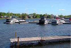
Hastings as seen across the Trent-Severn Waterway | |
 Trent Hills | |
| Coordinates: 44°17′N 77°51′W / 44.283°N 77.850°WCoordinates: 44°17′N 77°51′W / 44.283°N 77.850°W | |
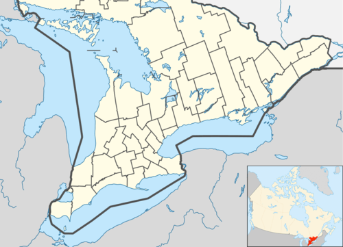
| Country |
|
| Province |
|
| County | Northumberland |
| Incorporated | 2001 |
| Government | |
| • Governing Body | Trent Hills Municipal Council |
| • Federal riding | Northumberland—Quinte West |
| • Prov. riding | Northumberland—Quinte West |
| Area[1] | |
| • Land | 511.90 km2 (197.65 sq mi) |
| Population (2011)[1][2] | |
| • Total | 12,604 |
| • Density | 24.6/km2 (64/sq mi) |
| Time zone | EST (UTC-5) |
| • Summer (DST) | EDT (UTC-4) |
| Postal code | K0L |
| Area code(s) | 705 |
| Website | www.trenthills.ca |
The Municipality of Trent Hills is a town in central-eastern Ontario, Canada, in northeast Northumberland County on the Trent River. It was created in 2001 through the amalgamation of the municipalities of Campbellford/Seymour, Percy and Hastings. Thereafter it was briefly known as Campbellford/Seymour, Percy, Hastings.
The mayor of Trent Hills is Hector MacMillan.
Communities
The three major population centres in Trent Hills are the former town of Campbellford, the former village of Hastings and the community of Warkworth, formerly the municipal seat of Percy Township prior to the amalgamation of Trent Hills.
Smaller communities within the town include Allan Mills, Brickley, Burnbrae, Connellys, Crowe Bridge, Dartford, English Line, Godolphin, Green Acres, Healey Falls, Hoards Station, Kellers, Menie, Meyersburg, Norham, Percy Boom, Pethericks Corners, Stanwood, Sunnybrae, Trent River, West Corners, Westview and Woodland.
Demographics
| Canada census – Trent Hills community profile | |||
|---|---|---|---|
| 2011 | 2006 | 2001 | |
| Population: | 12,604 (2.9% from 2006) | 12,247 (-2.6% from 2001) | 12,569 (1.1% from 1996) |
| Land area: | 511.90 km2 (197.65 sq mi) | 510.83 km2 (197.23 sq mi) | 511.10 km2 (197.34 sq mi) |
| Population density: | 24.6/km2 (64/sq mi) | 24.0/km2 (62/sq mi) | 24.6/km2 (64/sq mi) |
| Median age: | 48.0 (M: 47.2, F: 49.0) | 45.1 (M: 44.2, F: 45.8) | |
| Total private dwellings: | 6613 | 6468 | 5582 |
| Median household income: | $44,437 | $38,559 | |
| References: 2011[1] 2006[3] 2001[4] | |||
Mother tongue:[3]
- English as first language: 93.3%
- French as first language: 0.9%
- English and French as first language: 0%
- Other as first language: 5.8%
Population trend:[5]
- Population in 2011: 12,604
- Population in 2006: 12,247
- Population in 2001: 12,569
- Population total in 1996: 12,437
- Campbellford (town): 3647
- Hastings (village): 1140
- Percy (township): 3208
- Seymour (township): 4442
- Population in 1991:
- Campbellford (town): 3528
- Hastings (village): 1148
- Percy (township): 3191
- Seymour (township): 4347
Government
The chart below shows the structure of the municipal government of Trent Hills. These politicians were elected as of the 2014 municipal election.
| Mayor | Ward 1 - Campbellford/Seymour | Ward 2 - Percy | Ward 3 - Hastings |
|---|---|---|---|
| Hector Macmillan | Catherine Redden | Rick English | Robert (Bob) Crate |
| Rosemary Kelleher-MacLennan | Ken Tully | ||
| William (Bill) J. Thompson | |||
The Member of Parliament for the riding of Northumberland-Quinte West is Kim Rudd of the Liberal Party of Canada.[7] The Member of Provincial Parliament for Northumberland-Quinte West is Rob Milligan of the Progressive Conservative Party of Ontario.[8]
See also
References
- 1 2 3 "Trent Hills census profile". 2011 Census of Population. Statistics Canada. Retrieved 2012-03-12.
- ↑ "Trent Hills census profile". 2011 Census of Population. Statistics Canada. Retrieved 2012-03-12.
- 1 2 "2006 Community Profiles". Canada 2006 Census. Statistics Canada. March 30, 2011. Retrieved 2012-03-12.
- ↑ "2001 Community Profiles". Canada 2001 Census. Statistics Canada. February 17, 2012. Retrieved 2012-03-12.
- ↑ Statistics Canada: 1996, 2001, 2006 census
- ↑ http://trenthills.ca/en/resourcesGeneral/2014ELECTIONRESULTSUNOFFICIALMUNICIPAL.pdf
- ↑ "Members of the House of Commons". National Parliament website. Retrieved 2009-01-17.
- ↑ "Current MPPs". Ontario Parliament website. Retrieved 2009-01-17.
External links
| Wikimedia Commons has media related to Trent Hills. |
- Municipality of Trent Hills
- Trent Hills & District Chamber of Commerce
- Trent Hills Tourism
- Northumberland Tourism
 |
Asphodel-Norwood | Havelock-Belmont-Methuen | Marmora and Lake | |
| Alnwick/Haldimand | |
Stirling-Rawdon | ||
| ||||
| | ||||
| Cramahe, Brighton | Quinte West |