Connecticut Avenue
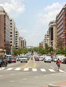 Connecticut Avenue, looking north, from Farragut Square | |
| Other name(s) | Connecticut Avenue NW |
|---|---|
| Maintained by | DDOT |
| Location | Washington, D.C., U.S. |
| Coordinates | 38°58′07″N 77°04′38″W / 38.96861°N 77.07722°WCoordinates: 38°58′07″N 77°04′38″W / 38.96861°N 77.07722°W |
| South end | Lafayette Square |
| Major junctions |
Dupont Circle Florida Avenue Columbia Road Calvert Street Tilden Street Nebraska Avenue Military Road |
| North end |
|
Connecticut Avenue is a major thoroughfare in the Northwest quadrant of Washington, D.C., and suburban Montgomery County, Maryland. It is one of the diagonal avenues radiating from the White House, and the segment south of Florida Avenue was one of the original streets in Pierre (Peter) Charles L'Enfant's's plan for Washington.[1]
Route description
District of Columbia

Connecticut Avenue begins just north of the White House at Lafayette Square. It is interrupted by Farragut Square. North of Farragut Square and K Street, Connecticut Avenue is one of the major streets in downtown Washington, with high-end restaurants, historical buildings such as Sedgwick Gardens, hotels, and shopping.
As Connecticut Avenue approaches the Dupont Circle neighborhood, it splits at N Street into a through roadway and service roadways. The through roadway tunnels under Dupont Circle, while the service roadways intersect the outer roadway of the circle. Just north of the circle, the service roadways are known for their many gay-oriented businesses, of which the most famous is Lambda Rising. The through roadway and service roadways rejoin at R Street. Originally, there was no tunnel, and all vehicular traffic on Connecticut Avenue went through the circle. The tunnel was built in 1949.
After crossing Florida Avenue near the Hilton Washington hotel, Connecticut Avenue narrows and winds between the Kalorama neighborhoods. (The Kalorama Triangle district extends eastward from Connecticut, while Sheridan-Kalorama lies to the west.) The avenue then crosses Rock Creek Park on the William Howard Taft Bridge and goes through upper Northwest Washington, D.C., including the Woodley Park, Cleveland Park, and Chevy Chase, D.C. neighborhoods. Between Woodley Park and Cleveland Park, Connecticut Avenue is carried over a deep valley on another bridge. Numerous older, Art Deco high-rise apartment buildings line the 3000 block, with slightly newer apartment buildings in the 4000 and 5000 blocks.
The National Zoological Park is located along Connecticut Avenue, halfway between the Woodley Park-Zoo/Adams Morgan and Cleveland Park Metro stations. Also located along this stretch of Connecticut Avenue is a major operational center of Intelsat, as are the landmark Wardman Park Marriott Hotel, the city's largest, and the Omni Shoreham Hotel. This section is also a major commuter route and has reversible lanes along most of its length which operate during the morning and evening rush hours (7:00–9:30 a.m. and 4:00–6:30 p.m.). It connects with the Rock Creek and Potomac Parkway via 24th Street. Mid-century era high-rise apartments line the avenue, with elegant, older detached homes on shady side streets.
Maryland

After passing the main campus of the University of the District of Columbia near the Van Ness metrorail station, Connecticut Avenue exits the District of Columbia at Chevy Chase Circle, which is at the intersection of Connecticut and Western Avenues. Once entering Maryland, it gains the route designation Maryland State Highway 185 and goes through the Chevy Chase, Maryland postal area. The National 4-H Youth Conference Center is on this stretch of Connecticut Avenue, as is the Chevy Chase Club.
After interchanging with the Capital Beltway at Exit 33, Connecticut Avenue enters Kensington, where it is the major north-south street of the central business district. Connecticut Avenue used to end at University Boulevard (Maryland State Highway 193). However, Concord Avenue was extended northward to form an extension of Connecticut Avenue.
That extension of Connecticut Avenue passes through Wheaton and Aspen Hill. The state route designation ends at Georgia Avenue (Maryland State Highway 97). Connecticut Avenue, now simply a local street, continues past Georgia Avenue and ends at Leisure World Boulevard.
Connecticut Avenue is an arterial route in the National Highway System between K Street and Nebraska Avenue.
Transit service
Metrorail
The Red Line of the Washington Metro subway system runs beneath Connecticut Avenue. Metro stations along or near Connecticut Avenue include:
Metrobus
The following Metrobus routes travel along the street (listed from south to north):
- 42, 43 (Columbia Road to Farragut Square)
- N2, N4, N6 (southbound only, from Dupont Circle to Farragut Square)
- L1, L2 (Chevy Chase Circle to Farragut Square)
- H2 (Van Ness Street to Porter Street)
- L8 (Aspen Hill to Friendship Heights)
Ride On
The following Ride On routes travel along the street (listed from south to north):
- 1, 11 (East West Highway to Chevy Chase Circle)
- 34 (Bel Pre Road to Veirs Mill Road, and later University Boulevard to Knowles Avenue)
- 41 (Bel Pre Road to Weller Road)
MARC Train
The following MARC Train stop lies on the street:
Notes
| Wikimedia Commons has media related to Connecticut Avenue. |
- ↑ L'Enfant identified himself as "Peter Charles L'Enfant" during most of his life, while residing in the United States. He wrote this name on his "Plan of the city intended for the permanent seat of the government of t(he) United States ...." (Washington, D.C.) and on other legal documents. However, during the early 1900s, a French ambassador to the U.S., Jean Jules Jusserand, popularized the use of L'Enfant's birth name, "Pierre Charles L'Enfant". (Reference: Bowling, Kenneth R (2002). Peter Charles L'Enfant: vision, honor, and male friendship in the early American Republic. George Washington University, Washington, D.C. ISBN 978-0-9727611-0-9). The United States Code states in 40 U.S.C. 3309: "(a) In General.—The purposes of this chapter shall be carried out in the District of Columbia as nearly as may be practicable in harmony with the plan of Peter Charles L'Enfant." The National Park Service identifies L'Enfant as Major Peter Charles L'Enfant and as Major Pierre (Peter) Charles L'Enfant Archived February 28, 2010, at the Wayback Machine. on its website.