Comitancillo
| Comitancillo | |
|---|---|
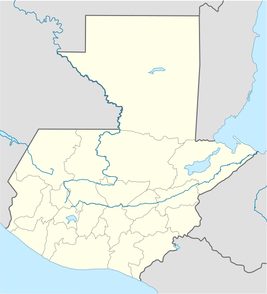 Comitancillo Location in Guatemala | |
| Coordinates: 15°05′29″N 91°44′52″W / 15.09139°N 91.74778°W | |
| Country |
|
| Department |
|
| Government | |
| • Mayor (2016-2020) | Basilio García[1] (LIDER) |
| Climate | Cwb |
Comitancillo is a municipality in the San Marcos department of Guatemala.The spoken language is Mam.The municipality was founded by the Spaniards between 1633 and 1648 year. There is an archaeological site called Chipel, with remains of the Mam culture.
History

In 1690, Tejutla had a large area and included the modern municipalities of Comitancillo, Ixchiguán, Concepción Tutuapa, Sipacapa, Sibinal, Tajumulco, Tacaná and part of what is now San Miguel Ixtahuacán. According to the historical writings from Recordación Florida of Francisco Antonio de Fuentes y Guzmán, Tejutla belonged to Quetzaltenango Department and it was a "prosperous land with rich weathers and comfortable forest with enough water".[2]
Tejutla was an important commercial and religious center; in August 1767, Joseph Domingo Hidalgo described Santiago Tejutla as "El Curato" -i.e., the focal center of commerce of all the towns that were around it− in the Gaceta de Guatemala, the official newspaper of the times. Then, in the last quarter of the 18th century, bishop Dr. Pedro Cortés y Larraz, who arrived from Cuilco in 1770 as part of the inspection he was doing of the Guatemalan dioceses, called Tejutla "Santiago en la Cima del Monte" (English: Santiago at the top of the hill" and reported that there were "sixty four families who lived very well" in the area.[3]
The Central American United Provinces constitution from 11 October 1821, showed Tejutla under modern San Marcos jurisdiction for the very first time.
In 1870 Tejutla reached "Villa" category and, due to its development, its authorities requested to the House of Representatives of Guatemala to be named a Department capital. The department was going to have the municipalities mentioned above, along with the modern municipalities of Cuilco, Santa Bárbara and [[San Gaspar, Huehuetenango, from the modern Huehuetenango Department. Besides, in those days, Motocintla, Cacahuatán and Tapachula—which would go definitively to México in 1892 due to the Herrera-Mariscal treaty[4][5]— were under the jurisdiction of the Mercedarian convent located in Tejutla. Furthermore, Tejutla even had House representatives of its own in those days.
But power shifted when the conservatives led by field marshall Vicente Cerna were defeated by the liberal forces of generals Miguel Garcia Granados and Justo Rufino Barrios −who was a San Lorenzo native; once the liberals were in power, the expelled the regular clergy from Guatemala leaving Tejutla without their main administrative and leadership support, the Mercedarians. In fact, Barrios government confiscated monasteries, large extensions of farm land, sugar mills and Indian doctrines from the Mercedarians and other regular orders and then distributed it to his liberal friend and comrades, who became large landowners in the area.[6]
Tourism
Comitancillo municipal capital can be reached in four ways:
- Through the road that goes by San Lorenzo.
- By Serchil and Tuilelén villages.
- From Tejutla.
- From San Luis Tuimuj village.[7]
Climate
Comitancillo has temperate climate (Köppen:Cwb]]).
| Climate data for Concepción Tutuapa | |||||||||||||
|---|---|---|---|---|---|---|---|---|---|---|---|---|---|
| Month | Jan | Feb | Mar | Apr | May | Jun | Jul | Aug | Sep | Oct | Nov | Dec | Year |
| Average high °C (°F) | 19.4 (66.9) |
20.0 (68) |
21.6 (70.9) |
22.4 (72.3) |
22.1 (71.8) |
21.0 (69.8) |
20.9 (69.6) |
21.5 (70.7) |
20.9 (69.6) |
20.3 (68.5) |
20.1 (68.2) |
19.6 (67.3) |
20.82 (69.47) |
| Daily mean °C (°F) | 12.1 (53.8) |
12.4 (54.3) |
14.0 (57.2) |
15.3 (59.5) |
16.2 (61.2) |
15.9 (60.6) |
15.6 (60.1) |
15.7 (60.3) |
15.6 (60.1) |
15.0 (59) |
13.7 (56.7) |
12.8 (55) |
14.53 (58.15) |
| Average low °C (°F) | 4.8 (40.6) |
4.9 (40.8) |
6.5 (43.7) |
8.3 (46.9) |
10.3 (50.5) |
10.9 (51.6) |
10.4 (50.7) |
9.9 (49.8) |
10.4 (50.7) |
9.7 (49.5) |
7.4 (45.3) |
6.1 (43) |
8.3 (46.93) |
| Average precipitation mm (inches) | 5 (0.2) |
6 (0.24) |
24 (0.94) |
61 (2.4) |
176 (6.93) |
274 (10.79) |
213 (8.39) |
222 (8.74) |
246 (9.69) |
176 (6.93) |
22 (0.87) |
10 (0.39) |
1,435 (56.51) |
| Source: Climate-Data.org[8] | |||||||||||||
Geographic location
Comitancillo is almost completely surrounded by San Marcos Department municipalities, except on the East side, where it borders Cabricán, a Quetzaltenango Department municipality.[9]
 |
San Miguel Ixtahuacán and Sipacapa | | ||
| Tejutla and San Marcos | |
Cabricán, Quetzaltenango Department municipality Río Blanco, San Marcos Department municipality[10] | ||
| ||||
| | ||||
| San Lorenzo and San Marcos[10] |
See also
 Guatemala portal
 Geography portal
- La Aurora International Airport
- Tapachula International Airport
Notes and references
References
- ↑ "San Marcos elige autoridades municipales". Prensa Libre (in Spanish). Guatemala. 8 September 2015. Retrieved 8 September 2015.
- ↑ Fuentes y Guzmán 1932.
- ↑ Cortés y Larraz 1770.
- ↑ Comisión Guatemalteca de Límites con México (1900). Memoria sobre la cuestión de límites entre Guatemala y México (in Spanish). Guatemala: Tipografía Nacional. p. 325.
- ↑ "Nuestras fronteras". La Ilustración Guatemalteca (in Spanish). Guatemala: Síguere, Guirola y Cía. I (13). 1896.
- ↑ Castellanos Cambranes, Julio (1992). "5. Tendencias del desarrollo agrario en el siglo XIX y surgimiento de la propiedad capitalista de la tierra en Guatemala" (PDF). 500 años de lucha por la tierra. Estudios sobre propiedad rual y reforma agraria en Guatemala (in Spanish). Guatemala: FLACSO. 1.
- ↑ Duarte Godínez 2010, p. 4.
- ↑ "Climate: Comitancillo". Climate-Data.org. Retrieved 5 September 2015.
- ↑ Duarte Godínez 2010, p. 2
- 1 2 SEGEPLAN. "Municipios del departamento de San Marcos". Secretaría General de Planificación. Archived from the original on 10 July 2015.
Bibliography
- Cortés y Larraz, Pedro (1770). Descripción Geográfico-Moral de la Diócesis de Goathemala (in Spanish). Guatemala: Diócesis de Guatemala.
- Duarte Godínez, Boris Gustavo (2010). Municipio de Comitancillo: Diagnóstico administrativo municipal (PDF). Ejercicio Profesional Supervisado (in Spanish). Guatemala: Facultad de Ciencias Económicas, Universidad de San Carlos de Guatemala.
- Fuentes y Guzmán, Francisco Antonio de (1932) [1690]. Recordación Florida. Discurso historial y demostración natural, material, militar y política del Reyno de Guatemala. Biblioteca Goathemala de la Sociedad de Geografía e Historia Volumen VI (in Spanish). I-III. Guatemala: Tipografía Nacional.
External links
- Some information (in Spanish)

Coordinates: 15°05′00″N 91°43′00″W / 15.0833°N 91.7167°W