Colijnsplaat
| Colijnsplaat | ||
|---|---|---|
| Town | ||
|
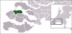
Colijnsplaat in the municipality Noord-Beveland | ||
| ||
 | ||
 The town centre (dark green) and the statistical district (light green) of Colijnsplaat in the municipality of Noord-Beveland. | ||
| Coordinates: 51°35′55″N 3°50′53″E / 51.59861°N 3.84806°ECoordinates: 51°35′55″N 3°50′53″E / 51.59861°N 3.84806°E | ||
| Country | Netherlands | |
| Province | Zeeland | |
| Municipality | Noord-Beveland | |
| Population (1 January 2008) | ||
| • Total | 1,563 | |
| Time zone | CET (UTC+1) | |
| • Summer (DST) | CEST (UTC+2) | |

Colijnsplaat is a town in the Dutch Province of Zeeland. It is a part of the Municipality of Noord-Beveland, and lies about 20 km (12 mi) northeast of Middelburg.
In 2001, the town of Colijnsplaat had 1563 inhabitants. The built-up area of the town was 0.38 km².[1] The statistical area "Colijnsplaat" can also include the surrounding countryside.[2]

Windmill: de Oude Molen

Windmill: korenmolen Nooit Gedacht
Items of local interest
- Once the location of a shrine dedicated to Nehalennia.
References
| Wikimedia Commons has media related to Colijnsplaat. |
- ↑ Statistics Netherlands (CBS), Bevolkingskernen in Nederland 2001 . (Statistics are for the continuous built-up area).
- ↑ Statistics Netherlands (CBS), Statline: Kerncijfers wijken en buurten 2003-2005 "Archived copy". Archived from the original on 2006-07-24. Retrieved 2006-07-24.. As of 1 January 2005.
This article is issued from Wikipedia - version of the 11/27/2016. The text is available under the Creative Commons Attribution/Share Alike but additional terms may apply for the media files.