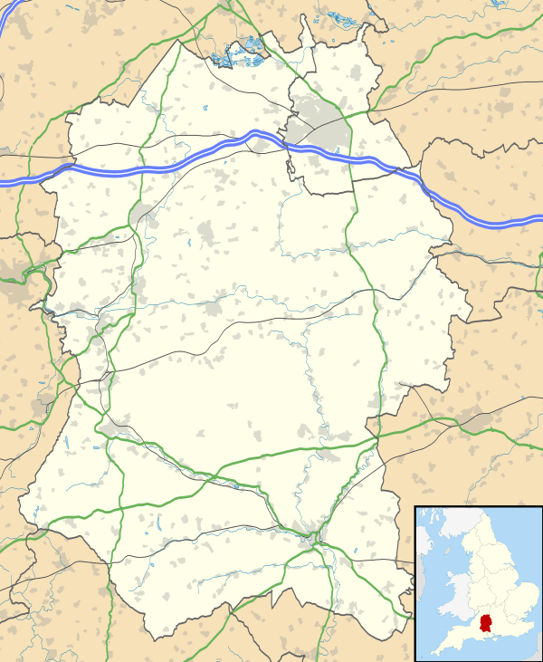
Colerne
| Colerne | |
 St. John the Baptist parish church |
|
 Colerne |
|
| Population | 2,972 (in 2011)[1] |
|---|---|
| OS grid reference | ST819711 |
| Civil parish | Colerne |
| Unitary authority | Wiltshire |
| Ceremonial county | Wiltshire |
| Region | South West |
| Country | England |
| Sovereign state | United Kingdom |
| Post town | CHIPPENHAM |
| Postcode district | SN14 |
| Dialling code | 01225 |
| Police | Wiltshire |
| Fire | Dorset and Wiltshire |
| Ambulance | South Western |
| EU Parliament | South West England |
| UK Parliament | North Wiltshire |
| Website | Parish Council |
Coordinates: 51°26′20″N 2°15′43″W / 51.439°N 2.262°W
Colerne is a village and civil parish in north Wiltshire, England. The village is about 3.5 miles (6 km) west of the town of Corsham and 7 miles (11 km) northeast of the city of Bath. It has an elevated and exposed position, 545 feet (166 m) above sea level, and overlooks the Box valley to the south (where Brunel's Box Tunnel is).
The parish includes the hamlets of Eastrip and Thickwood. It is bounded to the west by a stretch of the Fosse Way Roman road, which forms the county boundary with Gloucestershire, and to the east by the Bybrook River. Part of the northern boundary is the Doncombe Brook, a tributary of the Bybrook, and part of the southern boundary is the Lid Brook, another tributary.
History
Evidence of early settlement in the area includes three bowl barrows[2] near Thickwood, overlooking the Bybrook valley, and an Iron Age hillfort[3] from around 100 BC[4] in the north of the parish, known as Bury Wood Camp, overlooking the Doncombe valley.
A Roman villa has been found on the site of the present airfield.[5] The 1086 Domesday Book recorded 28 households at Colerne[6] and six at Thickwood.[7] The enclosure known as Colerne Park (today largely woodland) was created in the early 14th century by William of Colerne, Abbot of Malmesbury.[4]
In the 14th century the local economy was based on sheep-rearing, cloth production (assisted by mills on the By Brook) and stone quarrying.[4] The former farmhouse known as Daubenys, on the High Street, is a long house from c. 1400, now Grade II* listed.[8]
The Manor House, near the church, bears a date of 1689.[9] The country house at Lucknam Park was built in the late 17th century.[10] Many houses in the village are from the 18th century, partly as a result of a large fire of 1774.[4]
By the 19th century, cloth-making had migrated to industrial towns and the economy was mainly agricultural.[4] Some of the watermills were converted to paper production, an example being Chapps Mill near Slaughterford.[11] In the 1840s many labourers were employed on the construction of the Great Western Railway and its Box Tunnel.
From 1939, employment was provided by the construction of RAF Colerne close to the north of the village, followed by its operation and current use as an Army base.
Religious sites
The Church of England parish church of St John the Baptist dates from the 13th century; it has a 15th-century tower and was restored in the 19th century. There are fragments of medieval glass, and pieces of a 9th-century cross shaft which Pevsner describes as "two large fragments of one of the best C9 crosses in the West Country".[12] In 1960 the church was designated as Grade I listed.[13]
A Congregational chapel was built in 1824 and renovated in 1924; in 1974 it became Colerne Evangelical Church[14] and joined the Fellowship of Independent Evangelical Churches.[15]
In 1867, Providence Strict Baptist Chapel was opened in Colerne.[16] The building fell into disuse in 1986 and is now a private house.[17]
A Primitive Methodist chapel was built in Colerne in 1895 and closed in 1984.[18] An earlier small Methodist chapel was built at Thickwood in 1860 but was demolished in 1904.[19]
Modern Colerne
Colerne's historic core sits on a high ridge, though some of its stone-built houses are located down the valley side to the south. Modern estates were built to the north of the ancient, narrow streets, and there is some modern infill. Thickwood is a separate development of mainly late twentieth century houses 1 mile (1.6 km) to the northeast.
Colerne CE Primary School serves the village. Its building was opened in 1965 to replace a small National School of 1853, near the church. Pupil numbers were high while the school served families from RAF Colerne, and classrooms at the old school remained in use until the RAF station closed in 1976.[20] In 2015 the old school was in use by a pre-school playgroup.
Calder House School is an independent special school at Thickwood.
The village has two pubs, in buildings from the early 18th century: the Fox and Hounds[21] and the Six Bells Inn.[22] There is a village hall, a post office and several shops.
The Lucknam Park Hotel, originally a Georgian country house but much expanded in the Victorian era, is located around 1 mile (1.6 km) north of the village, near Thickwood.
Colerne Park and Monk's Wood is a Site of Special Scientific Interest, south and east of the village.
Weather
As the "Village on the Hill", Colerne is in an exposed position and local people are well aware that the weather will often be the opposite of that in nearby, but low lying, Bath. Colerne tends to be very windy and rainy in winter and prone to get cut off from the outside world when it snows. It can often be foggy when the lower lying towns and villages around aren't.
Toponym
The name Colerne appears in the Domesday Book of 1086. Other early spellings include Culerna, Culerne, Cullerne, Collern.[23] Various interpretations of the name have been proposed. Gover, Mawer and Stenton, in The Place Names of Wiltshire,[24] cite a form aern meaning 'house', and say "col-aern might well denote a house where charcoal was made, used or stored." Or, the altitude of the village suggests that the first syllable is from the Welsh or Cornish word col, 'peak';[25] this would mean the 'dwelling on the peak'. Alternatively it could mean 'cold dwelling' from the Anglo-Saxon cald.
Yet another possible derivation is from (Goidelic)= Old Irish, 'Cuillean', (Brythonnic)= Welsh, Celyn or Celynnen, and (Old English) Holegn (the 'h' is pronounced gutturally). Each of these words translate to 'holly tree' or 'holly branches' which were significant in Celtic history and folklore.
Local government
Colerne civil parish is administered by a parish council and by the Wiltshire Council unitary authority.
Trivia
- The clock on the church tower has only one hand. There is a similar one-handed clock on Westminster Abbey.
- Bristol Rovers' training facilities used to be based in Colerne.
- The former RAF Colerne was one of very few airfields suitable for the rare Westland Whirlwind during World War II, operated by No. 263 Squadron RAF.
- RAF Colerne hosted 616 squadron, the first Allied squadron with jets, relocating with Gloster Meteor I's from Culmhead and then re-equipping with Meteor III's.
Notable residents
- Derek Fowlds (b. 1937), the British actor (Yes Minister; formerly straight man to Basil Brush) was a former resident of the village.
- Brian Ashton (b. 1946), rugby union player and England coach from late 2006 to April 2008, was a former resident of the village.
- Goldfrapp (b. 1966 & b. ?), the electronic music duo, are former residents of the village.
- Kristan Bromley (b. 1972) and Shelley Rudman (b. 1981), champion skeleton racers, are former residents of Colerne.
The Colerne Donkey
According to village legend, a Colerne parson in former years owned a donkey to which he was much attached. While the clergyman was away, the unfortunate ass died, and the sexton felt it proper to have the beast buried in consecrated ground. But the undertaker, inexperienced in interring specimens of E. asinus, neglected to dig the grave wide and deep enough, so the donkey was buried feet-up with its hooves sticking out. The parson had the animal reburied when he returned, but the story was already out, and well into the 20th century young men from the nearby villages of Box or Marshfield who were at a loose end needed only visit Colerne and mention the word Donkey sufficiently loudly to be rewarded with a violent altercation on a moment's notice. It was also the habit for visiting footballers unacquainted with Colerne history to be dispatched to the home dressing room with a piece of sandpaper and instructions to ask to polish the donkey's hooves.
Churchyard Mysteries
Two mysterious stones were visible the wall opposite the church entrance as late as the 1970s. These were just part of the wall and without closer inspection no different from their neighbours. One, at ground level, had a faint inscription "A Black Man Died Here". A nearby stone had a visible hand print in it as clear as if someone has pressed their hand in clay – though this was limestone. Local children connected the two into a story of a man falling from the church tower centuries earlier. Sadly neither the inscription or the hand are visible now, presumably due to weathering.
Shire Stones
The counties of Wiltshire, Gloucestershire and Somerset meet in the far southwest of the parish, on the Fosse Way. The Shire Stones, made from coarsely cut stone slabs, mark this point. This marker was erected in 1736 and rebuilt in 1859.[26]
Colerne Water Tower

The Colerne Water Tower is a large concrete structure in the shape of an inverted cone. It is approximately 30 meters (100 ft) high, and replaced an older tower that was part of a 1930s scheme to bring mains water to the area. The location of the present tower, on the southern edge of Colerne Airfield, is shown as "Wr Twr" on the current Ordnance Survey maps (1:25,000 and 1:50,000).
The original tower was located on the eastern edge of the village near the housing estate called Martins Croft (built in the late 1940s-early '50s). The Colerne History Group's book, The Village on the Hill, Vol. 1, tells the story of this project.[27] In 2005, housing was built on the site of the original tower and that development is called Tower Close.
References
- ↑ "Wiltshire Community History – Census". Wiltshire Council. Retrieved 17 November 2015.
- ↑ Historic England. "Three bowl barrows in Colerne Park (1010758)". National Heritage List for England. Retrieved 17 November 2015.
- ↑ Historic England. "Bury Wood Camp hillfort and earthwork enclosure (1018385)". National Heritage List for England. Retrieved 17 November 2015.
- 1 2 3 4 5 "Colerne". Wiltshire Community History. Wiltshire Council. Retrieved 17 November 2015.
- ↑ Historic England. "Roman villa, Colerne (208491)". PastScape. Retrieved 17 November 2015.
- ↑ Colerne in the Domesday Book
- ↑ Thickwood in the Domesday Book
- ↑ Historic England. "Daubenys (1363531)". National Heritage List for England. Retrieved 18 November 2015.
- ↑ Historic England. "The Manor House and 2 garden gateways to south (1022940)". National Heritage List for England. Retrieved 18 November 2015.
- ↑ Historic England. "Lucknam Park (1283410)". National Heritage List for England. Retrieved 18 November 2015.
- ↑ "W.J. Dowding & Son, papermakers, Chapps Mill, Slaughterford". The National Archives. Retrieved 18 November 2015.
- ↑ Pevsner, Nikolaus; Cherry, Bridget (revision) (1975) [1963]. Wiltshire. The Buildings of England (2nd ed.). Harmondsworth: Penguin Books. p. 186. ISBN 0-14-0710-26-4.
- ↑ Historic England. "Church of St. John the Baptist, Colerne (1022922)". National Heritage List for England. Retrieved 17 November 2015.
- ↑ "Colerne Evangelical Church". Wiltshire Community History. Wiltshire Council. Retrieved 17 November 2015.
- ↑ "Our Churches – Colerne Evangelical Church". FIEC. Retrieved 17 November 2015.
- ↑ "Providence Baptist Chapel, Colerne". Wiltshire Community History. Wiltshire Council. Retrieved 17 November 2015.
- ↑ Ryrie, Charlie (3 June 2006). "Divine conversion". The Guardian. Retrieved 17 November 2015.
- ↑ "Methodist Chapel, Colerne". Wiltshire Community History. Wiltshire Council. Retrieved 17 November 2015.
- ↑ "Primitive Methodist Chapel, Thickwood, Colerne". Wiltshire Community History. Wiltshire Council. Retrieved 17 November 2015.
- ↑ "Colerne Church of England Primary School, Colerne". Wiltshire Community History. Wiltshire Council. Retrieved 17 November 2015.
- ↑ Historic England. "The Fox and Hounds public house (1199364)". National Heritage List for England. Retrieved 17 November 2015.
- ↑ Historic England. "The Six Bells Inn (1283402)". National Heritage List for England. Retrieved 17 November 2015.
- ↑ Ekwall, Eilert (1987). The Concise Oxford Dictionary of English Place-names. Clarendon Press.
- ↑ Glover, J.E.B.; Mawer, A; Stenton, F.M. (1939). The Place-names of Wiltshire. The University Press.
- ↑ Longstaff, John C. (1911). Notes on Wiltshire Names. Bradford-on-Avon.
- ↑ Historic England. "Three Shire Stones (1156410)". National Heritage List for England. Retrieved 18 November 2015.
- ↑ Langley, Andrew (1990). The Village on the Hill: Aspects of Colerne History, Volume 1. Colerne History Group. p. 153. ISBN 0951572806.
External links
| Wikimedia Commons has media related to Colerne. |