Coleridge, Nebraska
| Coleridge, Nebraska | |
|---|---|
| Village | |
|
Downtown Coleridge on Broadway | |
| Nickname(s): Heart of Cedar County | |
 Location of Coleridge, Nebraska | |
| Coordinates: 42°30′20″N 97°12′16″W / 42.50556°N 97.20444°WCoordinates: 42°30′20″N 97°12′16″W / 42.50556°N 97.20444°W | |
| Country | United States |
| State | Nebraska |
| County | Cedar |
| Area[1] | |
| • Total | 0.51 sq mi (1.32 km2) |
| • Land | 0.51 sq mi (1.32 km2) |
| • Water | 0 sq mi (0 km2) |
| Elevation | 1,558 ft (475 m) |
| Population (2010)[2] | |
| • Total | 473 |
| • Estimate (2012[3]) | 467 |
| • Density | 927.5/sq mi (358.1/km2) |
| Time zone | Central (CST) (UTC-6) |
| • Summer (DST) | CDT (UTC-5) |
| ZIP code | 68727 |
| Area code(s) | 402 |
| FIPS code | 31-09865[4] |
| GNIS feature ID | 0828259[5] |
| Website | coleridge-ne.com |

Coleridge is a village in Cedar County, Nebraska, United States. The population was 473 at the 2010 census.
History
Coleridge was platted in 1883 when the railroad was extended to that point.[6] It was named for Lord John Coleridge, the Lord Chief Justice of England, who was then paying a visit to the United States.[7][8]
Geography
Coleridge is located at 42°30′20″N 97°12′16″W / 42.50556°N 97.20444°W (42.505675, −97.204419).[9] According to the United States Census Bureau, the village has a total area of 0.51 square miles (1.32 km2), all of it land.[1]
Demographics
| Historical population | |||
|---|---|---|---|
| Census | Pop. | %± | |
| 1890 | 315 | — | |
| 1900 | 471 | 49.5% | |
| 1910 | 535 | 13.6% | |
| 1920 | 674 | 26.0% | |
| 1930 | 616 | −8.6% | |
| 1940 | 627 | 1.8% | |
| 1950 | 621 | −1.0% | |
| 1960 | 604 | −2.7% | |
| 1970 | 608 | 0.7% | |
| 1980 | 673 | 10.7% | |
| 1990 | 596 | −11.4% | |
| 2000 | 541 | −9.2% | |
| 2010 | 473 | −12.6% | |
| Est. 2015 | 454 | [10] | −4.0% |
2010 census
As of the census[2] of 2010, there were 473 people, 224 households, and 120 families residing in the village. The population density was 927.5 inhabitants per square mile (358.1/km2). There were 283 housing units at an average density of 554.9 per square mile (214.2/km2). The racial makeup of the village was 99.2% White, 0.2% Native American, and 0.6% from two or more races.
There were 224 households of which 19.2% had children under the age of 18 living with them, 46.9% were married couples living together, 4.0% had a female householder with no husband present, 2.7% had a male householder with no wife present, and 46.4% were non-families. 43.3% of all households were made up of individuals and 28.2% had someone living alone who was 65 years of age or older. The average household size was 2.01 and the average family size was 2.82.
The median age in the village was 53.3 years. 18% of residents were under the age of 18; 5.9% were between the ages of 18 and 24; 12.9% were from 25 to 44; 31.3% were from 45 to 64; and 31.9% were 65 years of age or older. The gender makeup of the village was 45.9% male and 54.1% female.
2000 census
As of the census[4] of 2000, there were 541 people, 242 households, and 128 families residing in the village. The population density was 1,091.7 people per square mile (417.8/km²). There were 267 housing units at an average density of 538.8/sq mi (206.2/km²). The racial makeup of the village was 98.52% White, 0.18% from other races, and 1.29% from two or more races. Hispanic or Latino of any race were 0.37% of the population.
There were 242 households out of which 20.2% had children under the age of 18 living with them, 48.3% were married couples living together, 3.7% had a female householder with no husband present, and 46.7% were non-families. 45.0% of all households were made up of individuals and 28.9% had someone living alone who was 65 years of age or older. The average household size was 2.04 and the average family size was 2.91.
In the village the population was spread out with 19.0% under the age of 18, 5.7% from 18 to 24, 18.5% from 25 to 44, 22.2% from 45 to 64, and 34.6% who were 65 years of age or older. The median age was 50 years. For every 100 females there were 87.2 males. For every 100 females age 18 and over, there were 82.5 males.
The median income for a household in the village was $28,365, and the median income for a family was $41,250. Males had a median income of $25,903 versus $15,714 for females. The per capita income for the village was $15,656. About 6.0% of families and 10.4% of the population were below the poverty line, including 13.1% of those under age 18 and 16.1% of those age 65 or over.
Notable people
- William Joseph Dendinger (b. 1939), Roman Catholic prelate
- Vernon Simeon Plemion Grant (1902–90), illustrator
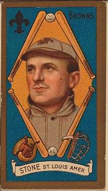
- George Stone (1876–1945), Major League Baseball left fielder who was the 1906 batting champion[12]
References
- 1 2 "US Gazetteer files 2010". United States Census Bureau. Archived from the original on 2012-06-26. Retrieved 2012-06-24.
- 1 2 "American FactFinder". United States Census Bureau. Retrieved 2012-06-24.
- ↑ "Population Estimates". United States Census Bureau. Archived from the original on 2013-06-17. Retrieved 2013-05-29.
- 1 2 "American FactFinder". United States Census Bureau. Archived from the original on 2013-09-11. Retrieved 2008-01-31.
- ↑ "US Board on Geographic Names". United States Geological Survey. 2007-10-25. Retrieved 2008-01-31.
- ↑ "Coleridge, Cedar County". Center for Advanced Land Management Information Technologies. University of Nebraska. Retrieved 1 August 2014.
- ↑ Fitzpatrick, Lillian L. (1960). Nebraska Place-Names. University of Nebraska Press. p. 33.
- ↑ Federal Writers' Project (1938). Origin of Nebraska place names. Lincoln, NE: Works Progress Administration. p. 8.
- ↑ "US Gazetteer files: 2010, 2000, and 1990". United States Census Bureau. 2011-02-12. Retrieved 2011-04-23.
- ↑ "Annual Estimates of the Resident Population for Incorporated Places: April 1, 2010 to July 1, 2015". Retrieved July 2, 2016.
- ↑ "Census of Population and Housing". Census.gov. Archived from the original on May 11, 2015. Retrieved June 4, 2015.
- ↑ "George Stone". BASEBALL-Reference. Retrieved January 23, 2011.
External links
Municipalities and communities of Cedar County, Nebraska, United States | ||
|---|---|---|
| Cities | ||
| Villages | ||
| CDPs | ||
| Unincorporated communities | ||