Cocalico Creek
| Cocalico Creek | |
|---|---|
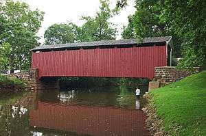 Bucher's Mill Covered Bridge spans Cocalico Creek in Lancaster County, Pennsylvania | |
| Country | Lebanon and Lancaster Counties, Pennsylvania, United States |
| Basin | |
| Main source |
Stricklerstown, Pennsylvania 1,320 feet (400 m) |
| River mouth |
Conestoga River at Talmage, Pennsylvania 278 feet (85 m) |
| Basin size | 140 square miles (360 km2) |
| Physical characteristics | |
| Length | 27.2 miles (43.8 km) |
Cocalico Creek is a 27.2-mile-long (43.8 km)[1] tributary of the Conestoga River in Lebanon and Lancaster counties in Pennsylvania in the United States. The source is at an elevation of 1,320 feet (400 m) near Stricklerstown in Millcreek Township, Lebanon County. The mouth is the confluence with the Conestoga River at an elevation of 278 feet (85 m) at Talmage in West Earl Township, Lancaster County.[2]
The name of the creek comes from the Lenape, meaning "snake dens".[3] It comes from the Lenape word Gookcalicunk (pronounced "Gook Cal-eek Unk) which means “Snake Sleep Place” in English. The Lenape considered modern East Cocalico, West Cocalico, Clay, Warwick, Elizabeth, and Penn townships, Lancaster County, Mill Creek Township, Lebanon County, and the Middle Creek Wildlife Management Area as part of Gookcalicunk.
Cocalico Creek flows south for 10 miles (16 km), then southwest 16 miles (26 km). The Cocalico Creek watershed has a total area of 140 square miles (360 km2) and is part of the larger Chesapeake Bay drainage basin via the Susquehanna River.[4]
Tributaries
- Hammer Creek
- Middle Creek
- Meadow Run
- Indian Run
- Cooper Run
- Stony Run
- Little Cocalico Creek
See also
References
- ↑ U.S. Geological Survey. National Hydrography Dataset high-resolution flowline data. The National Map Archived 2012-04-05 at WebCite, accessed August 8, 2011
- ↑ Shaw, Lewis C. (June 1984). Pennsylvania Gazetteer of Streams Part II (Water Resources Bulletin No. 16). Prepared in Cooperation with the United States Department of the Interior Geological Survey (1st ed.). Harrisburg, PA: Commonwealth of Pennsylvania, Department of Environmental Resources.
- ↑ "Indian Names Data Chart" (PDF). Susquehanna River Basin Commission. Retrieved 2006-09-04.
- ↑ "Chesapeake Bay Program: Watershed Profiles: The Cocalico Creek - At Talmage Watershed". Chesapeake Bay Program Office, 10 Severn Avenue, Suite 109, Annapolis, MD 21403. Retrieved 2006-09-03.


Coordinates: 40°12′26″N 76°08′20″W / 40.20713°N 76.13898°W