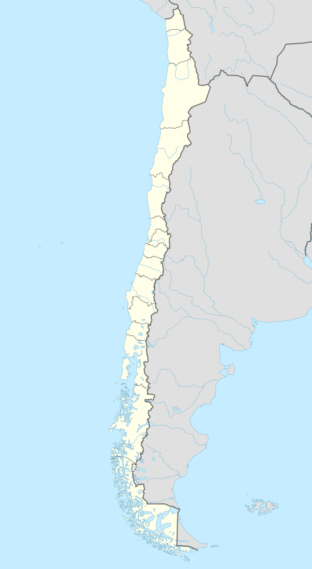
Coastal fortifications of colonial Chile
In Colonial times the Spanish Empire diverted significant resources to fortify the Chilean coast as consequence of Dutch and English raids.[1] In the 16th century the over-all Spanish strategy was to complement the fortification work in its Caribbean ports with forts in the Strait of Magellan. As attempts at settling and fortifying the Strait of Magellan were abandoned the Spanish moved to fortify the Captaincy General of Chile and other parts of the west coast of the Americas. The coastal fortifications and defense system was at its peak in the mid-18th century.[2]
History
16th century
In 1578 Francis Drake inaugurated an era of privateering and piracy in the coasts of Chile. Responding to this treat the viceroy of Peru sent in 1579 an expedition in charge of Pedro Sarmiento de Gamboa to the strait of Magellan in order to explore the feasibility of fortifying it and vitue of that controlling the entrance to the Pacific from the Atlantic. After surveying the strait Sarmiento departed to Spain and obtained there through the king ships and settlers for a definitive colonization and fortifying project.[2] Duke of Alba supported the project and suggested some modifications. The plan included the building one fort on each side of Primera Angostura, a sound within the strait. At the expedition that sat sail from Spain included about 350 settlers and 400 soldiers.[3] Back in the Strait of Magellan Sarmiento founded the cities of Nombre de Jesús and Ciudad del Rey Don Felipe in 1584.[2] Nombre de Jesús was abandoned after only five month of existence and its population sought themselves to Ciudad del Rey Don Felipe. There, realizing there were no food for all, Andrés de Biedma oredered the people to scatter along the northern coast of the strait and wait for any vessel that could provide aid.[3] Sarmiento's resupply expedition did never arrive to the straits due to a heavy storm and only a few settlers survived to be rescued by other navigators.[2][3]
17th century
In 1600 local Huilliche joined the Dutch corsair Baltazar de Cordes to attack the Spanish settlement of Castro.[4][5] While this was a sporadic attack the Spanish believed the Dutch could attempt to ally the Mapuches and establish a stronghold in southern Chile.[6] The Spanish knew of the Dutch plans to establish themselves at the ruins of Valdivia so they attempted to re-establish Spanish rule there before the Dutch arrived again.[7] The Spanish attempts were thwarted in the 1630s when Mapuches did not allow the Spanish to pass by their territory.[7] With the Spanish blocked from entering Valdivia via land the much waited Dutch invasion met no resistance when it reached the ruins of old Spanish city in August 1643. Before that the Duch did however engaged the Spanish at Carelmapu and sacked Castro. The Spanish in these two localities had been instructed use a scorched earth strategy against the incoming invaders. While the Dutch abandoned their new colony after only two months in October 1643 their invasion caused great alarm among Spanish authorities and triggered the return of the Spanish to Valdivia. The construction of the Valdivian Fort System begun in 1645.[8][9] Having been told by Manqueante that the Dutch had plans to return to the location, the Spanish viceroy in Peru sent from El Callao in Peru 1000 men in twenty ships and ordered 2000 men to march by land from Central Chile in 1644 to resettle Valdivia and fortify it. The land troops never made it to Valdivia, probably due to Mapuche resistance. The massive fleet, that was added two ships in Chile, was unprecedented in the region.[8][10] The building and maintenance of the Valdivian Fort System became a heavy burden for the Spanish colonial finances more so considering that the Dutch did never return to establish their planned colony.[10]
18th century
Ever since the Bourbon dynasty assumed power in Spain in the early 18th century the treat of a French attack dissipated, instead the British appeared as the foremost menace to Spains possessions in Chile.[2] The War of Jenkins' Ear between Britain and Spain led the British to plan an attack against the Spanish possessions in Chile. Valdivia, a heavily fortified but valuable Spanish exclave, was selected for an attack. The attack to be led by Gergo Anson's proved a complete failure even before the expedition reached Spanish ports: the ships had dispersed and Wager wrecked off the coast of Patagonia. Nevertheless, the British arrival caused great alarm among the Spanish who searched extensively the Patagonian archipelagoes to cleanse it from any possible British presence.[11][12] In the 1740s the viceroy of Peru and the governor of Chile converged in a project to advance the frontiers of the Spanish Empire in the Southeast Pacific and prevent the establishment of a British base. As result of this plan the Juan Fernández Islands were settled and the fort of Tenquehuen established in Chonos Archipelago near Taitao Peninsula.[11] This last fort was manned for one and half year before being abandoned.[12] After the Tenquehuen fort was dismantled the Marquis of the Ensenada, being briefed on local affairs, recommended the establishment of a fort in the Guaitecas Archipelago, but this never turned concrete. For Governor Antonio Narciso de Santa María Chiloé Island was the key to the Patagonian Archipelagos and his recommendations to focus on the defence of Chiloé.[11] It was the hope of the Spanish that when the supposed British return occurred they would find the Juan Fernández Islands fortified and settled.[11]
As consequence of the Seven Years' War the Valdivian Fort System was updated and reinforced from 1764 onwards. Other vulnerable localities of colonial Chile such as Chiloé Archipelago, Concepción, Juan Fernández Islands and Valparaíso were also made ready for an eventual English attack.[13][14] Inspired in the recommendations of former governor Santa María the Spanish founded the "city-fort" of Ancud in 1768 and of separated Chiloé from the Captaincy General of Chile into a direct dependency of the Viceroyalty of Peru.[11] As with other 18th century forts in Chile the establishment of Ancud led through the new Ancud-Castro road to an expansion on local trade and agriculture.[15]
Fortification engineers building 18th century forts imprinted neoclassical designs on them.[15]
19th century

During the Chilean Independence War several coastal fortification saw effective action. The First Chilean Navy Squadron led by Thomas Cochrane launched an amphibious attack on the Valdivian Fort System in 1820. The land troops led by Jorge Beauchef overran the forts on the southern side of Corral Bay. Then the remaining forts, in Niebla and Mancera Island were abandoned by the Spaniards retreated to the city of Valdivia.[16]
List of fortifications
| Picture | Locality | Coordinates | Date of building and updates | Designer(s) |
|---|---|---|---|---|
| Castillo de San Antonio | ||||
| Fuerte de Penco | 1684[upper-alpha 1] | |||
| Castillo de San Clemente | 1596 | |||
| Fuerte San Agustín | 1777 | Leandro Badarán | ||
| Fuerte Gálvez | 1780 | Leandro Badarán | ||
 |
Valdivian Fort System | 39°52′00″S 73°26′00″W / 39.866667°S 73.433333°W | 1645, 1661, 1671, 1679, 1680, 1764, 1765, 1767 | Juan de Buitrón y Mujica Constantino Vasconcelos José Antonio Birt Juan Garland |
| Carelmapu Fort System | 41°45′3.66″S 73°42′27.90″W / 41.7510167°S 73.7077500°W | 1603, 1720 | ||
 |
Lacui Fort System | 41°49′45″S 73°21′07″W / 41.829167°S 73.351944°W | 1768, 1779 | Miguel de Zorrilla Carlos de Beranger y Renaud |
 |
Ancud Fort System | 41°51′42″S 73°49′39″W / 41.861667°S 73.8275°W | 1767 or 1768, 1824 | Carlos de Beranger y Renaud |
| Chacao Fort System | 41°49′16.08″S 73°31′8.52″W / 41.8211333°S 73.5190333°W | |||
 |
Castro Fort System | 42°33′7.64″S 73°45′3.87″W / 42.5521222°S 73.7510750°W | ||
| Fuerte Tenquehuen | 45°39′S 74°48′W / 45.65°S 74.8°W | 1750 |
Notes
References
- ↑ "Ingeniería Militar durante la Colonia". Memoria chilena (in Spanish). Biblioteca Nacional de Chile. Retrieved September 30, 2014.
- 1 2 3 4 5 6 Soto Rodríguez, José Antonio (2006). "La defensa hispana del Reino de Chile" (PDF). Tiempo y Espacio (in Spanish). 16. Retrieved 30 January 2016.
- 1 2 3 Martinic, Mateo (1977). Historia del Estrecho de Magallanes (in Spanish). Santiago: Andrés Bello. pp. 110–119.
- ↑ "La encomienda", Memoria chilena (in Spanish), Biblioteca Nacional de Chile, retrieved January 30, 2014
- ↑ Urbina Burgos, Rodolfo (1990). "La rebelión indigena de 1712: Los tributarios de Chiloé contra la encomienda" (PDF). Tiempo y espacio (in Spanish). 1: 73–86. Retrieved February 22, 2014.
- ↑ Clark Berger, Eugene (2006). Permanent war on Peru's periphery: Frontier identity and the politics of conflict in 17th century Chile (PDF) (Ph.D.). Vanderbilt University. p. 13. Retrieved 13 March 2014.
- 1 2 Bengoa 2003, pp. 450–451.
- 1 2 Robbert Kock The Dutch in Chili at coloniavoyage.com
- ↑ Lane 1998, pp. 88–92
- 1 2 Lane 1998, p. 90.
- 1 2 3 4 5 Urbina Carrasco, María Ximena (2014). "El frustrado fuerte de Tenquehuen en el archipiélago de los Chonos, 1750: Dimensión chilota de un conflicto hispano-británico". Historia. 47 (I). Retrieved 28 January 2016.
- 1 2 Urbina C., M. Ximena (2013). "Expediciones a las costas de la Patagonia Occidental en el periodo colonial". Magallania (in Spanish). 41 (2). Retrieved 27 January 2016.
- ↑ "Lugares estratégicos", Memoria chilena (in Spanish), Biblioteca Nacional de Chile, retrieved 30 December 2015
- ↑ "Ingeniería Militar durante la Colonia", Memoria chilena (in Spanish), Biblioteca Nacional de Chile, retrieved 30 December 2015
- 1 2 Sahady Villanueva, Antonio; Bravo Sánchez, José; Quilodrán Rubio, Carolina (2010). "Flandes Indiano Chiloense: un patrimonio invencible en el tiempo". Revista de Urbanismo (in Spanish). 23: 1–27. Retrieved 30 January 2016.
- ↑ Guarda, Gabriel (1970). La toma de Valdivia. Santiago de Chile: Zig Zag. pp. 88–98.
Bibliography
- Bengoa, José (2003). Historia de los antiguos mapuches del sur (in Spanish). Santiago: Catalonia. ISBN 956-8303-02-2.
- Lane, Kris E. (1998). Pillageing the Empire: Piracy in the Americas 1500–1750.