Coalmont, Pennsylvania
| Coalmont, Pennsylvania | |
|---|---|
| Borough | |
|
Scene along Barnett Road | |
 Coalmont, Pennsylvania | |
| Coordinates: 40°12′38″N 78°12′03″W / 40.21056°N 78.20083°WCoordinates: 40°12′38″N 78°12′03″W / 40.21056°N 78.20083°W | |
| Country | United States |
| State | Pennsylvania |
| County | Huntingdon |
| Government | |
| • Type | Borough Council |
| • Mayor | Pamela McDonald (D) |
| Area | |
| • Total | 0.1 sq mi (0.3 km2) |
| Elevation | 1,076 ft (328 m) |
| Population (2000) | |
| • Total | 128 |
| • Density | 1,108.2/sq mi (427.9/km2) |
| Time zone | Eastern (EST) (UTC-5) |
| • Summer (DST) | EDT (UTC-4) |
| Zip code | 16678 |
| Area code(s) | 814 |
| School District: | Tussey Mountain School District |
| Local phone exchanges: 635 | |

Coalmont is a borough in Huntingdon County, Pennsylvania, United States. The population was 128 at the 2000 census.
Geography
Coalmont is located at 40°12′38″N 78°12′3″W / 40.21056°N 78.20083°W (40.210551, -78.200946).[1]
According to the United States Census Bureau, the borough has a total area of 0.1 square miles (0.26 km2), all of it land.
Demographics
| Historical population | |||
|---|---|---|---|
| Census | Pop. | %± | |
| 1870 | 189 | — | |
| 1880 | 171 | −9.5% | |
| 1890 | 219 | 28.1% | |
| 1900 | 182 | −16.9% | |
| 1910 | 228 | 25.3% | |
| 1920 | 220 | −3.5% | |
| 1930 | 159 | −27.7% | |
| 1940 | 162 | 1.9% | |
| 1950 | 207 | 27.8% | |
| 1960 | 172 | −16.9% | |
| 1970 | 129 | −25.0% | |
| 1980 | 128 | −0.8% | |
| 1990 | 109 | −14.8% | |
| 2000 | 128 | 17.4% | |
| 2010 | 106 | −17.2% | |
| Est. 2015 | 105 | [2] | −0.9% |
| Sources:[3][4][5] | |||
As of the census[4] of 2000, there were 128 people, 50 households, and 37 families residing in the borough. The population density was 1,108.2 people per square mile (411.8/km²). There were 55 housing units at an average density of 476.2 per square mile (177.0/km²). The racial makeup of the borough was 100.00% White.
There were 50 households, out of which 42.0% had children under the age of 18 living with them, 64.0% were married couples living together, 2.0% had a female householder with no husband present, and 26.0% were non-families. 26.0% of all households were made up of individuals, and 18.0% had someone living alone who was 65 years of age or older. The average household size was 2.56 and the average family size was 3.08.
In the borough the population was spread out, with 28.9% under the age of 18, 1.6% from 18 to 24, 36.7% from 25 to 44, 21.1% from 45 to 64, and 11.7% who were 65 years of age or older. The median age was 35 years. For every 100 females there were 93.9 males. For every 100 females age 18 and over, there were 106.8 males.
The median income for a household in the borough was $38,750, and the median income for a family was $52,917. Males had a median income of $30,625 versus $28,750 for females. The per capita income for the borough was $15,260. There were 5.1% of families and 7.6% of the population living below the poverty line, including 11.4% of under eighteens and none of those over 64.
References
- ↑ "US Gazetteer files: 2010, 2000, and 1990". United States Census Bureau. 2011-02-12. Retrieved 2011-04-23.
- ↑ "Annual Estimates of the Resident Population for Incorporated Places: April 1, 2010 to July 1, 2015". Retrieved July 2, 2016.
- ↑ "Census of Population and Housing". U.S. Census Bureau. Archived from the original on 11 May 2015. Retrieved 11 December 2013.
- 1 2 "American FactFinder". United States Census Bureau. Archived from the original on 2013-09-11. Retrieved 2008-01-31.
- ↑ "Incorporated Places and Minor Civil Divisions Datasets: Subcounty Resident Population Estimates: April 1, 2010 to July 1, 2012". Population Estimates. U.S. Census Bureau. Archived from the original on 17 June 2013. Retrieved 11 December 2013.
Municipalities and communities of Huntingdon County, Pennsylvania, United States | ||
|---|---|---|
| Boroughs | 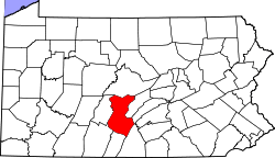 | |
| Townships | ||
| CDPs | ||
| Unincorporated communities | ||