Coal Creek, Fremont County, Colorado
| Coal Creek, Colorado | |
|---|---|
| Statutory Town | |
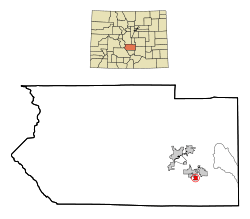 Location in Fremont County and the State of Colorado | |
| Coordinates: 38°21′43″N 105°08′30″W / 38.362038°N 105.141782°WCoordinates: 38°21′43″N 105°08′30″W / 38.362038°N 105.141782°W[1] | |
| Country |
|
| State |
|
| County | Fremont County[2] |
| Incorporated | February 11, 1882[3] |
| Government | |
| • Type | Statutory Town[2] |
| Area | |
| • Total | 1.3 sq mi (3.3 km2) |
| • Land | 1.3 sq mi (3.3 km2) |
| • Water | 0 sq mi (0 km2) |
| Elevation[4] | 5,426 ft (1,654 m) |
| Population (2010) | |
| • Total | 343 |
| • Density | 270/sq mi (104.1/km2) |
| Time zone | MST (UTC-7) |
| • Summer (DST) | MDT (UTC-6) |
| ZIP code | 81221[5] |
| INCITS place code | 0815330 |
| FIPS code | 08-15330 |
| Highways | none |
Coal Creek is a statutory town located in Fremont County, Colorado, United States. The town population was 343 at the 2010 United States Census.[6]
A post office called Coal Creek has been in operation since 1873.[7] The community was named for the local coal mining industry.[8]
Geography
Coal Creek is located in southeastern Fremont County at 38°21′38″N 105°8′47″W / 38.36056°N 105.14639°W (38.360463, -105.146512).[9] The town of Rockvale is to the west, Williamsburg is to the northwest, and the city of Florence is to the northeast.
According to the United States Census Bureau, the town has a total area of 1.3 square miles (3.3 km2), all of it land.[6]
Demographics
| Historical population | |||
|---|---|---|---|
| Census | Pop. | %± | |
| 1900 | 698 | — | |
| 1910 | 676 | −3.2% | |
| 1920 | 618 | −8.6% | |
| 1930 | 435 | −29.6% | |
| 1940 | 261 | −40.0% | |
| 1950 | 195 | −25.3% | |
| 1960 | 206 | 5.6% | |
| 1970 | 225 | 9.2% | |
| 1980 | 190 | −15.6% | |
| 1990 | 157 | −17.4% | |
| 2000 | 303 | 93.0% | |
| 2010 | 343 | 13.2% | |
| Est. 2015 | 341 | [10] | −0.6% |
As of the census[12] of 2000, there were 303 people, 114 households, and 76 families residing in the town. The population density was 307.9 people per square mile (119.4/km²). There were 125 housing units at an average density of 127.0 per square mile (49.2/km²). The racial makeup of the town was 94.72% White, 0.66% African American, 0.33% Asian, 0.99% from other races, and 3.30% from two or more races. Hispanic or Latino of any race were 1.98% of the population.
There were 114 households out of which 37.7% had children under the age of 18 living with them, 48.2% were married couples living together, 14.9% had a female householder with no husband present, and 32.5% were non-families. 27.2% of all households were made up of individuals and 14.0% had someone living alone who was 65 years of age or older. The average household size was 2.66 and the average family size was 3.25.
In the town the population was spread out with 31.4% under the age of 18, 5.0% from 18 to 24, 28.1% from 25 to 44, 24.8% from 45 to 64, and 10.9% who were 65 years of age or older. The median age was 37 years. For every 100 females there were 91.8 males. For every 100 females age 18 and over, there were 84.1 males.
The median income for a household in the town was $26,563, and the median income for a family was $29,583. Males had a median income of $17,500 versus $21,250 for females. The per capita income for the town was $12,563. About 14.3% of families and 18.6% of the population were below the poverty line, including 28.3% of those under the age of eighteen and none of those sixty five or over.
See also
References
- ↑ "2014 U.S. Gazetteer Files: Places". United States Census Bureau. July 1, 2014. Retrieved January 5, 2015.
- 1 2 "Active Colorado Municipalities". State of Colorado, Department of Local Affairs. Archived from the original on 2010-11-23. Retrieved 2007-09-01.
- ↑ "Colorado Municipal Incorporations". State of Colorado, Department of Personnel & Administration, Colorado State Archives. 2004-12-01. Retrieved 2007-09-02.
- ↑ "US Board on Geographic Names". United States Geological Survey. 2007-10-25. Retrieved 2008-01-31.
- ↑ "ZIP Code Lookup". United States Postal Service. Archived from the original (JavaScript/HTML) on September 3, 2007. Retrieved September 5, 2007.
- 1 2 "Geographic Identifiers: 2010 Census Summary File 1 (G001): Coal Creek town, Colorado". American Factfinder. U.S. Census Bureau. Retrieved April 21, 2016.
- ↑ "Post offices". Jim Forte Postal History. Archived from the original on 6 March 2016. Retrieved 24 June 2016.
- ↑ Dawson, John Frank. Place names in Colorado: why 700 communities were so named, 150 of Spanish or Indian origin. Denver, CO: The J. Frank Dawson Publishing Co. p. 14.
- ↑ "US Gazetteer files: 2010, 2000, and 1990". United States Census Bureau. 2011-02-12. Retrieved 2011-04-23.
- ↑ "Annual Estimates of the Resident Population for Incorporated Places: April 1, 2010 to July 1, 2015". Retrieved July 2, 2016.
- ↑ "Census of Population and Housing". Census.gov. Archived from the original on May 11, 2015. Retrieved June 4, 2015.
- ↑ "American FactFinder". United States Census Bureau. Archived from the original on 2013-09-11. Retrieved 2008-01-31.
External links
| Wikimedia Commons has media related to Coal Creek, Fremont County, Colorado. |
Municipalities and communities of Fremont County, Colorado, United States | ||
|---|---|---|
| Cities |  | |
| Towns | ||
| CDPs | ||
| Unincorporated communities | ||
