Cloverdale, Deschutes County, Oregon
| Cloverdale, Oregon | |
|---|---|
| Unincorporated area | |
|
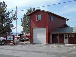
Cloverdale fire station | |
 Cloverdale  Cloverdale Location in Oregon | |
| Coordinates: 44°17′28″N 121°27′10″W / 44.29123°N 121.45282°WCoordinates: 44°17′28″N 121°27′10″W / 44.29123°N 121.45282°W | |
| Country | United States |
| State | Oregon |
| County | Deschutes |
| Elevation | 3,084 ft (940 m) |
| Time zone | Pacific (UTC-8) |
| • Summer (DST) | Pacific (UTC-7) |
Cloverdale is an unincorporated community in Deschutes County, Oregon, United States.[1] It is located about five miles east of Sisters, on Oregon Route 126.[2]
In the late 19th century, Cloverdale became important stop on the A. J. Warrin Road, an alternative route to the Santiam Wagon Road on the way to Prineville.[3][4] The community provided services for travelers and local homesteaders, with a store, blacksmith shop, and facilities for camping and boarding horses.[3] By the 1920s or 1930s, the route fell into disuse and the buildings either fell down, were torn down, or moved.[3]
Cloverdale was named by R. A. Ford, a local farmer who was also a teacher and a county school superintendent.[5] He surveyed the nearby Cloverdale Ditch, which is parallel to Whychus Creek.[5] The ditch is used for irrigation. Crops grown in the area include clover, alfalfa, potatoes, grasses and vegetables.[3]
The one-room Old Cloverdale School was built on George Cyrus' land circa 1900 on what today is known as George Cyrus Road (aka Cloverdale Market Road).[6] Also known as the Cyrus School, it is listed as a historic resource by Deschutes County.[7][8] A new school was built in 1919.[3] The 1919 school shares a site with the Cloverdale Rural Fire Protection District station and as of 2011 was in use as a preschool.[3][9][10]
References
- ↑ "Cloverdale". Geographic Names Information System. United States Geological Survey. November 28, 1980. Retrieved 2011-01-22.
- ↑ Oregon Atlas & Gazetteer (7th ed.). Yarmouth, Maine: DeLorme. 2008. p. 43. ISBN 0-89933-347-8.
- 1 2 3 4 5 6 "Cloverdale: Overview". Sisters Country Historical Society. Retrieved 2011-01-22.
- ↑ "The A J Warrin Road: Overview". Sisters Country Historical Society. Retrieved 2011-01-22.
- 1 2 McArthur, Lewis A.; McArthur, Lewis L. (2003) [1928]. Oregon Geographic Names (7th ed.). Portland, Oregon: Oregon Historical Society Press. p. 211. ISBN 978-0875952772.
- ↑ "Sisters Country Timeline". Sisters Country Historical Society. Retrieved 2011-01-22.
- ↑ "Inventory Cultural and Historic Resources" (PDF). Deschutes County Community Development Department. Retrieved 2011-01-22.
- ↑ "Cyrus School". Oregon Historic Sites Database: Oregon Department of Parks and Recreation. Retrieved 2011-01-22.
- ↑ "CRFPD History". Cloverdale Rural Fire Protection District. Retrieved 2011-01-22.
- ↑ Spry, Jeff (December 14, 2010). "Santa helps raise funds for school". The Nugget Newspaper. Retrieved 2011-01-22.
Municipalities and communities of Deschutes County, Oregon, United States | ||
|---|---|---|
| Cities | 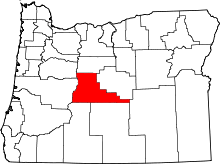 | |
| CDPs | ||
| Other unincorporated communities | ||