Clinton Township, Wayne County, Pennsylvania

Clinton Township is a second-class township in Wayne County, Pennsylvania, United States. The township's population was 2,053 at the time of the 2010 United States Census.[6]
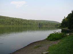
Geography
According to the United States Census Bureau, the township has a total area of 39.5 square miles (102 km2), of which, 38.4 square miles (99 km2) of it is land and 1.1 square miles (2.8 km2) of it (3.29%) is water.
Communities
The following villages are located in Clinton Township:
Demographics
As of the census of 2010, there were 2,053 people, 851 households, and 567 families residing in the township. The population density was 53.7 people per square mile (20.7/km²). There were 1,185 housing units at an average density of 30.2/sq mi (11.8/km²). The racial makeup of the township was 98.5% White, 0.2% African American, 0.05% Native American, 0.2% Asian, 0.1% from other races, and 0.8% from two or more races. Hispanic or Latino of any race were 0.9% of the population.
There were 851 households out of which 25.7% had children under the age of 18 living with them, 55% were married couples living together, 8.2% had a female householder with no husband present, and 33.4% were non-families. 28.9% of all households were made up of individuals and 12.5% had someone living alone who was 65 years of age or older. The average household size was 2.41 and the average family size was 2.97.
In the township the population was spread out with 20.8% under the age of 18, 61.6% from 18 to 64, and 17.6% who were 65 years of age or older. The median age was 44.9 years.
The median income for a household in the township was $34,811, and the median income for a family was $42,782. Males had a median income of $29,896 versus $20,341 for females. The per capita income for the township was $15,363. About 6.0% of families and 9.6% of the population were below the poverty line, including 10.0% of those under age 18 and 13.2% of those age 65 or over.
Education
Forest City Regional School District is a Preschool-12th grade public school district serving residents of Clinton Township.
Western Wayne School District a public school district serving residents of Clinton Township.
References
- 1 2 3 Goodrich, Phineas G. (1992) [1880]. History of Wayne County. Baltimore: Gateway Press, Inc. p. 324.
- ↑ "Clinton Township". Wayne County Historical Society. Wayne County Historical Society. 2014. Retrieved 15 December 2014.
- ↑ "Clinton Township Wayne County, PA". Facebook. Facebook, Inc. 3 October 2014. Retrieved 7 December 2014.
- 1 2 "Township of Clinton". Geographic Names Information System. United States Geological Survey. 1 December 1989. Retrieved 7 December 2014.
- ↑ U.S. Census Bureau. Census 2000. "Census Demographic Profiles, Clinton Township" (PDF). CenStats Databases. Retrieved 2009-01-31.
- ↑ "American FactFinder". United States Census Bureau. Archived from the original on 2013-09-11. Retrieved 2011-05-14.
- 1 2 3 "CLINTON: SECOND CLASS TOWNSHIP MAP" (PDF). Pennsylvania Department of Transportation. Commonwealth of Pennsylvania. 23 October 2013. Retrieved 13 December 2014.
- ↑ "Aldenville". Geographic Names Information System. United States Geological Survey. 2 August 1979. Retrieved 13 December 2014.
- ↑ "Forest City Station". Geographic Names Information System. United States Geological Survey. 2 August 1979. Retrieved 13 December 2014.
- ↑ "Creamton". Geographic Names Information System. United States Geological Survey. 2 August 1979. Retrieved 13 December 2014.
Municipalities and communities of Wayne County, Pennsylvania, United States | ||
|---|---|---|
| Boroughs |  | |
| Townships | ||
| CDPs | ||
| Unincorporated communities | ||