Clear Air Force Station
| Clear Air Force Station | |
|---|---|
|
Part of | |
| Denali Borough, Alaska, United States | |
|
AN/FPS-123 building (white, upper right) on Clear AFS | |
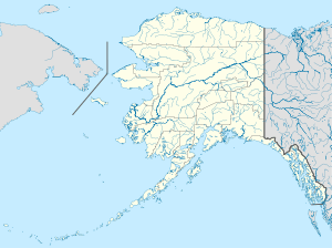 Clear Air Force Station Location in Alaska | |
| Coordinates | 64°17′26″N 149°11′13″W / 64.29056°N 149.18694°W |
| Site information | |
| Controlled by |
1983: 1st Space Wing (Space Command)
|
| Site history | |
| Built |
|
| Garrison information | |
| Past commanders | 1961: Col. Walter F. Nyblade[2] |
Clear Air Force Station ("Clear" colloq.) is an Alaska Air National Guard radar station for detecting incoming ICBMs and submarine-launched ballistic missiles[3] to NORAD's Missile Correlation Center (MCC) and to provide Space Surveillance data to Air Force Space Command's Space Control Center (SCC). Clear's AN/FPS-123 Upgraded Early Warning Radar is part of the Solid State Phased Array Radar System (SSPARS) which also includes those at Beale AFB, Cape Cod AFS, RAF Fylingdales and Thule Site J. The "historic property" was one of the Alaska World War II Army Airfields and later a Cold War BMEWS site providing NORAD data to Colorado's BMEWS Central Computer and Display Facility (CC&DF).
In addition to the "original camp area" with buildings still in use today,[4] areas of the station include the airfield (ICAO: PACL), the "SSPARS Site", the technical site (Utilador,[5] BMEWS reflectors, support buildings, power plant), and the composite site (two permanent dormitories, a mess hall, recreation area, and administrative area). In addition to the Air National Guard unit, Clear has active duty USAF, Royal Canadian Air Force, civilian, and contractor personnel.
History
The site's land with the 1918 Alaska Railroad[6] was purchased by the Department of the Interior in 1949 for Alaskan Air Command's Clear Air Force Auxiliary Field for use as a Ladd Field gunnery range.[4] Total costs for the planned Thule and Clear BMEWS stations in a May 1958 estimate were ~$800 million--an October 13, 1958, plan for both estimated completion in September 1960.[7] An additional 10-by-40-mile (16 km × 64 km) area was appropriated for BMEWS Site II (cf. BMEWS Site I at Thule).

Clear Missile Early Warning Station
Clear Missile Early Warning Station construction began in August 1958 with 700 workers[2]--e.g., a "construction" camp was being erected in September 1958 by "Patti-McDonald and Morrison-Knudsen"[8] next to the railroad (for $1.7 million, 40,000 ft of railroad were moved by 1959.)[9] Groundbreaking for radar structures was May 1959 ("Baker and Ford built a transmitter and computer building; a heat dissipation system; a radar transmitter building; wells and pumphouses; a fire station; and utilities")[9] and the AN/FPS-50 pedestals were complete by June 2, 1959.[10] In 1959[11] after the original White Alice Communications System contract, "the next segment of WACS...was series of TD-2 microwave installations to support ... two routes [that] linked the Ballistic Missile Early Warning Site (BMEWS) at Clear AFB...one going down the southeast coast (the A route) to the Ketchikan-Seattle submarine cable*, and the other, going east to the Canada–US border (B Route) through Canada, down to the lower 48" which was Clear's Rearward Communications System to Murphy Dome (A Route) and the Gold King Creek AFS (B Route) with data for the Ent AFB CC&DF.[12]
Three GE AN/FPS-50 Radar Sets were installed with antenna reflectors 165 by 400 feet (50 m × 122 m) that each weigh 1,000 short tons (910 t; 890 long tons). The "Building Two" middle transmitter building had the radar control room and room with the Sylvania AN/FSQ-28 Missile Impact Predictor Set.[13]
The "Clear Msl Early Warning Stn, Nenana, AK" was assigned to Hanscom Field, Massachusetts, on April 1, 1961,[14] and BMEWS Site II was completed July 1, 1961[2] (the date of IOC--Full operational capability was declared three months later.)
Clear transferred to Air Defense Command in November 1961. By mid-1962, BMEWS "quick fixes" for ECCM had been installed at Thule and Clear[15] and by June 30, 1962, Ent AFB integration of BMEWS and SPADATS data was completed.[16] On July 31, 1962, NORAD recommended a tracking radar at Clear to close the BMEWS gap with Thule for low-angle missiles vice those with the 15-65 degree angle for which BMEWS was designed[15] (North Dakota's Cavalier AFS radar built in 1975 currently monitors for Hudson Bay launches.)
USAF missile warning operations
Detachment 2 of the 71st Missile Warning Wing was responsible for operations by civilian contractor personnel until 1964, when Air Force personnel began permanently manning the Tactical Operations Room (TOR). (Clear was unable to perform its mission for 6 minutes due to the record 1964 earthquake.)
In 1966,[17] the last of the 5 BMEWS tracking radars was installed[18] an RCA AN/FPS-92 Radar Set with an 84-foot (26 m) diameter antenna housed in a 42.7-meter (140 ft) diameter radome.[19] The FPS-92 was an improved tbd AN/FPS-49 Radar Set variant with radome blocks having two high-density 1 millimeter thick skins that cover a 15 centimeter thick Kraft-paper core (total of 1,646 hexagonal and pentagonal blocks[20] (the hexagonal blocks were "66-inch panels".)[21] FPS-92 completion raised the "final construction price" of "the missile warning system at Clear" to $300 million ($62 million by the Alaska District of the Corps of Engineers, e.g., for excavation and poured concrete as during building of the $2.8 million construction camp.)[9]
Clear provided emergency shelter for 216 flood refugees during August 1967, the same year many "temporary" buildings were replaced. Clear subsequently provided measurements for a University of Alaska experiment which injected sulfur hexafluoride into the upper atmosphere to see if the Aurora Borealis could be affected. Clear had Bomb Alarm System equipment installed by the time the BAS was accepted on 10 February 1961[22] (deactivated in 1970.)[7] In 1975, SECDEF told Congress that Clear would be closed when the Shemya Island and Beale AFB radars became operational.[23] After a Thule radome fire, Clear's FPS-92 radome was replaced in 1981 by first disassembling the tracker, constructing the new radome, and reconstructing the FPS-92.[24] Clear's 1st all-female crew pulled its 1st shift on February 28, 1986 (the 1st female, Lt. Anderson was assigned in 1973.)
Beginning in 1987, ITT operated and maintained the Clear BMEWS under a USAF Space Command contract[20] and in the 1990s, the Southwest Research Institute upgraded Clear's pulse modulator for the transmitter final-stage power amplifier.[25]
Phased array radar
On April 16, 1998, groundbreaking for installing 1987 AN/FPS-115 PAVE PAWS components from Texas (e.g., the array elements) was held at Clear[26] for the more advanced Raytheon AN/FPS-120[26] with 2500 "solid state transmitter" modules.[27] On December 15, 2000, the FPS-50 and −92 transmissions ceased (all of the Arecibo Observatory's Litton L-5773 klystrons were obtained as surplus from Clear's decommissioned BMEWS transmitters.)[28] Clear's FPS-120 began 24-hour operations when Clear's SSPARS Site (separate from the BMEWS site) had Initial Operational Capability on January 31, 2001; the date the entire SSPARS became operational[29] (SSPARS sites were modified in the Early Warning Radar Service Life Extension Program.)[30]
On August 30, 2006, after a transition that began in 2001, the ANG's 213th Space Warning Squadron took on the early warning/space surveillance mission. BAE Systems began a 2007 contract for SSPARS maintenance,[31] and the Clear FPS-120 was subsequently upgraded to an AN/FPS-132 Upgraded Early Warning Radar (UEWR)[32] by Boeing Integrated Defense Systems[33] "featuring processor and software improvements to enhance capability."[19]
|
| |
|
| |
|
|
References
- ↑ compiled by Johnson, Mildred W (31 December 1980) [Feb 1973 original by Cornett, Lloyd H. Jr]. A Handbook of Aerospace Defense Organization 1946 - 1980 (PDF). Peterson AFB: Office of History, Aerospace Defense Center. Retrieved 2012-03-26.
- 1 2 3 "Watchful eye of BMEWS turns toward Soviets" (Google news archive). Ellensburg Daily Record. June 18, 1961. Retrieved 2014-03-09.
- ↑ "Clear AFS". GlobalSecurity.org. 2005-04-27. Retrieved 2009-11-04.
- 1 2 Cold War Historic Properties of the 21st Space Wing Air Force Space Command (PDF) (Report). OSTI.gov. Retrieved 2008-11-04.
- ↑ Clear "Utilador"
- ↑ Cultural Resources Survey and Management Plan of the Clear Air Force Station (PDF) (Report). ORNL.gov. 1991. Retrieved 2008-11-04.
- 1 2 Wainstein, L. (June 1975). The Evolution of U.S. Strategic Command and Control and Warning: Part One (1945-1953) (PDF) (Report). Study S-467. Institute for Defense Analyses. pp. 1–138. Retrieved 2014-03-09.
- ↑ page 269 "William A. Smith Contracting relocated a 40,000-foot length of the railroad."
- 1 2 3 "Rearward Communications...One route roughly paralleled the Alaska Highway; the other ran south along the Gulf of Alaska to Annette Island, and relayed data from there to Seattle by submarine cable. The Alaska District awarded 28 contracts totaling over $18 million for the 32 stations. By 1961, all site work had been completed.68"
- ↑ Rogers, Warren Jr. (June 2, 1960). "Summit Failure Speeds Up Development of BMEWS". Herald Tribune News Service. Retrieved 2014-03-09.
- ↑ Installation Restoration Program Preliminary Assessment: Gold King Creek Radio Relay Station, Alaska (PDF) (Report). Hazardous Materials Technical Center. April 1989. Retrieved 2014-04-14.
The RRS originally consisted of one radio relay building, one microwave tower enclosed by a chain link fence, and a 2,050-foot runway. These facilities total 30.32 acres. Two 14,000-gallon steel underground diesel fuel storage tanks are located west of the building. Figure 3 shows the original facilities at Gold King Creek RRS.
- ↑ http://lcweb2.loc.gov/pnp/habshaer/ak/ak0200/ak0213/data/ak0213data.pdf
- ↑ McManus, Gene (September 1996). "BMEWS - 51- Full Days". Retrieved 2014-03-19.
- ↑ Mueller, Robert (1989). Air Force Bases (PDF) (Report). Volume I: Active Air Force Bases Within the United States of America on 17 September 1982. Office of Air Force History. p. 600. ISBN 0-912799-53-6. Retrieved 2013-08-15.
Gold King Creek AFS (rdsgd Gold King Creek RR Site) (detchd instl), 45 mi NE of Fairbanks, AK, 16 Jul 1959 (dsgd) ... Wideawake Fld (rdsgd Ascension Isl Aux Fid)...Ascension Isl, South Atlantic Ocean, 25 Jun 1956 (actvd)
- 1 2 1962 NORAD/CONAD Historical Summary, July-December
- ↑ Del Papa, Dr. E. Michael; Warner, Mary P (October 1987). A Historical Chronology of the Electronic Systems Division 1947-1986 (PDF) (Report). Retrieved 2014-03-08.
7 November [1984] Installation of [SSPARS] radar hardware at Site I, Thule, Greenland, for the Ballistic Missile Early Warning System (BMEWS) was begun.
- ↑ "The Morning Record - Google News Archive Search".
- ↑ "Electronic Eye Watches For Sneak Missile Attack" (Google news archive). Herald-Journal. July 8, 1966. Retrieved 2014-03-09.
rotating 84-foot parabolic radar dish antenna…weighing 185 tons, can detect and track a 16-inch piece of wire 1-32nd of an inch in diameter, at a distance of 2,500 miles… The electronic dishes, each costing $19 million…
- 1 2 "[6.0] Miscellaneous Topics".
- 1 2 http://www.nikesitesummit.net/uploads/3/5/5/8/3558635/alaska_cold_war_legacy_-_draft.pdf
- ↑ "Reading Eagle - Google News Archive Search".
- ↑ Space and Missile Systems Organization: A Chronology, 1954-1979
- ↑ "ALERT" (PDF).
- ↑ "Clear Air Force Station, Alaska".
- ↑ Grimes, M. D.; Grothaus, M. G.; North, W. R.; Brittain, D.; Norander, R.; Kajonpong, D. (1 July 1995). "A new modulator design for the BMEWS transmitter". pp. 688–693 vol.1. doi:10.1109/PPC.1995.596791 – via IEEE Xplore.
- 1 2 Pike, John. "Clear AFS".
- ↑ Skolnik, Merrill I (1990). Radar Handbook (PDF) (2nd ed.). McGraw-Hill. ISBN 978-0-07-057913-2. Retrieved 2014-04-14.
- ↑ http://www.naic.edu/~phil/hardware/xmiter430/430tx_manual_hagen.pdf
- ↑ "Clear AFS, AK". GlobalSecurity.org. Retrieved 2014-03-05.
- ↑ Chapman, Bert. Space Warfare and Defense: A Historical Encyclopedia and Research Guide (Google books). Retrieved 2014-03-13.
BMEWS was replaced by the Solid State Phased Array Radar System (SSPARS) in 2001. ... CINCAD (Command in Chief, Aerospace Defense Command)
- ↑ "BAE Systems To Continue Maintaining SSPARS Radar Network for U.S. Air Force - SpaceNews.com". 3 March 2014.
- ↑ "U.S. to Sell Large Early Warning Radar to Qatar (August 7, 2013) (corrected February 10, 2014)". 7 August 2013.
- ↑ "Fylingdales". Raytheon.co.uk. Archived from the original on 2014-03-11. Retrieved 2014-03-08.
External ink
![]() Media related to Clear Air Force Station at Wikimedia Commons
Media related to Clear Air Force Station at Wikimedia Commons
Current military installations of Alaska | |||||||||||||||||||
|---|---|---|---|---|---|---|---|---|---|---|---|---|---|---|---|---|---|---|---|
| Army |
|  | |||||||||||||||||
| Navy |
| ||||||||||||||||||
| Air Force |
| ||||||||||||||||||
| Coast Guard |
| ||||||||||||||||||
Air Force Space Command (AFSPC) | |||||||||||||||||||||||||||||||||
|---|---|---|---|---|---|---|---|---|---|---|---|---|---|---|---|---|---|---|---|---|---|---|---|---|---|---|---|---|---|---|---|---|---|
| |||||||||||||||||||||||||||||||||
| |||||||||||||||||||||||||||||||||
| |||||||||||||||||||||||||||||||||
| |||||||||||||||||||||||||||||||||