Clayton, New York
| Clayton | |
| Town | |
| Country | United States |
|---|---|
| State | New York |
| County | Jefferson |
| Coordinates | 44°10′31″N 76°04′16″W / 44.1753°N 76.0711°WCoordinates: 44°10′31″N 76°04′16″W / 44.1753°N 76.0711°W |
| Area | 104.0 sq mi (269.4 km2) |
| Population | 5,153 (2010) |
| Density | 62/sq mi (23.9/km2) |
| Town Supervisor | David M. Storandt, Jr. (R) |
| - Town Council | |
| Timezone | EST (UTC-5) |
| - summer (DST) | EDT (UTC-4) |
| ZIP code | 13624 |
| Area code | 315 |
 Location of Clayton in New York
| |
Clayton is a town in Jefferson County, New York, USA. The population was 5,153 at the 2010 census.[1] The town is named after John M. Clayton, a federal political leader from Delaware.
The Town of Clayton contains a village named Clayton. Both town and village are northwest of Watertown.
The Village of Clayton, nearby Cape Vincent, NY, and Alexandria Bay, NY are popular tourist destinations on the New York mainland side of the Thousand Islands region.
History
The area was first settled around 1801.
The town was formed from parts of the Town of Orleans and Lyme in 1833. The town was named after statesman John M. Clayton. The Village of Clayton became the main railroad terminus for the Thousand Islands resort region, during its heyday at the turn of the twentieth century. The Town of Clayton offered several hotels to visitors, some grand, now mostly vanished.
In 1872, the community of Clayton voted to set itself apart from the town by incorporating as a village.
Fairview Manor, Swarthout Site-A04507.000038, and Grindstone Island Upper Schoolhouse are listed on the National Register of Historic Places.[2][3]
Geography
According to the United States Census Bureau, the town has a total area of 104.0 square miles (269.4 km²), of which, 82.6 square miles (213.8 km²) of it is land and 21.5 square miles (55.6 km²) of it (20.64%) is water.
The town is situated on the St. Lawrence River near Lake Ontario. Across the river lies Ontario, Canada.
The northern border of the town is the Canada–US border running through the Thousand Islands of the St. Lawrence River. The town includes one of the larger Thousand Islands, Grindstone Island, along with smaller islands, such as Bluff Island, Grenell Island, Maple Island, Picton Island, and Round Island.
A ferry once connected Clayton with Gananoque in Ontario, but was discontinued due to the construction of the Thousand Islands Bridge ten miles down-river. This bridge now carries Interstate 81 to Canada.
New York State Route 12E, which follows the south bank of the St. Lawrence River, intersects north-south New York State Route 12 at Clayton village. New York State Route 180 crosses the southeast corner of Clayton.
Demographics
| Historical population | |||
|---|---|---|---|
| Census | Pop. | %± | |
| 1840 | 3,990 | — | |
| 1850 | 4,191 | 5.0% | |
| 1860 | 4,696 | 12.0% | |
| 1870 | 4,082 | −13.1% | |
| 1880 | 4,214 | 3.2% | |
| 1890 | 4,411 | 4.7% | |
| 1900 | 4,313 | −2.2% | |
| 1910 | 4,028 | −6.6% | |
| 1920 | 3,618 | −10.2% | |
| 1930 | 3,698 | 2.2% | |
| 1940 | 3,768 | 1.9% | |
| 1950 | 3,758 | −0.3% | |
| 1960 | 3,753 | −0.1% | |
| 1970 | 4,021 | 7.1% | |
| 1980 | 4,028 | 0.2% | |
| 1990 | 4,629 | 14.9% | |
| 2000 | 4,817 | 4.1% | |
| 2010 | 5,153 | 7.0% | |
| Est. 2014 | 5,203 | [4] | 1.0% |
As of the census[6] of 2000, there were 4,817 people, 1,914 households, and 1,335 families residing in the town. The population density was 58.3 people per square mile (22.5/km²). There were 3,337 housing units at an average density of 40.4 per square mile (15.6/km²). The racial makeup of the town was 97.24% White, 0.93% Black or African American, 0.35% Native American, 0.23% Asian, 0.10% Pacific Islander, 0.48% from other races, and 0.66% from two or more races. Hispanic or Latino of any race were 1.58% of the population.
There were 1,914 households out of which 34.5% had children under the age of 18 living with them, 57.0% were married couples living together, 8.6% had a female householder with no husband present, and 30.2% were non-families. 25.1% of all households were made up of individuals and 13.0% had someone living alone who was 65 years of age or older. The average household size was 2.51 and the average family size was 3.00.
In the town the population was spread out with 26.7% under the age of 18, 6.5% from 18 to 24, 29.0% from 25 to 44, 22.6% from 45 to 64, and 15.1% who were 65 years of age or older. The median age was 38 years. For every 100 females there are 94.1 males. For every 100 females age 18 and over, there are 91.7 males.
The median income for a household in the town was $35,805, and the median income for a family was $39,727. Males had a median income of $31,402 versus $21,091 for females. The per capita income for the town was $16,947. About 4.8% of families and 8.0% of the population were below the poverty line, including 11.0% of those under age 18 and 7.0% of those age 65 or over.
Communities in the Town of Clayton
- Aunt Janes Bay – A bay on the south shore of Grindstone Island.
- Clayton – The Village of Clayton is on the shore of the St. Lawrence River in the northern part of the town.
- Bartlett's Point – A hamlet west of Clayton village, located on a geographical feature, also called Bartletts Point.
- Blind Bay – A small bay of the St. Lawrence River by the east town line.
- Chaumont River – A stream flowing through the south part of Clayton.
- Clayton Center – A hamlet located on County Road 10 in the east part of the town.
- Depauville – A hamlet on NY-12, south of Clayton village, located by the Chaumont River.
- Deferno – A former location in the town.
- Delaney Bay – A bay in the eastern part of Grindstone Island.
- Flynn Bay – A bay at the southwest part of Grindstone Island.
- French Creek – A tributary of the St. Lawerence River which empties into French Creek Bay.
- French Creek Bay – A bay on the west side of Clayton village.
- French Creek Wildlife Management Area – A conservation area in the north part of Clayton.
- Frontenac – A hamlet on northeast end of Round Island.
- Frontenac Springs – A location in the northwest corner of Clayton, known for its natural Crystal Spring Water. Frontenac Crystal Spring Water is trucked all over, can be purchased in 1 or 5 gallon jugs or filled yourself in their self-serve area.
- Grenell Island – An island in the St. Lawrence River by the east town line.
- Grenell – A hamlet in the northwest part of Grenell Island.
- Grindstone – A hamlet on north shore of Grindstone Island.
- Grindstone Island – One of the largest islands of the Thousand Islands. It lies in the St. Lawerence River opposite Clayton village.
- Gunns Corners – A hamlet in the southeast corner of the town on NY-180 at NY-12.
- Murray Isle – An island in the St. Lawrence River by the east town line.
- Reynolds Corners – A location at the south town line on County Road 125.
- Round Island – An island in the St. Lawrence River north east of Clayton with many summer homes. Little Round Island is adjacent to it.
- Schnauber Hill – An elevation by the east town line.
- Smith Corners – A location on NY-12 north of Depauville.
- South Corners – A hamlet between Clayton village and Depauville on NY-12.
- Washington Island – A small island connected to Clayton village.
Parks in the Town of Clayton
- Canoe-Picnic Point State Park – A state park on Grindstone Island accessible only by boat.
- Cedar Point State Park – A state park by the west town line.
Museums and entertainment
- Antique Boat Museum
- Clayton Opera House
Notable people
- Charles E. Bohlen - diplomat and ambassador.
- Albert Bouchard and Joe Bouchard - founding members of the band Blue Öyster Cult.
- Bill Johnston - Thousand Islands smuggler and river pirate.
- Joseph Lonsway - private in the Union Army and Congressional Medal of Honor recipient.
- Nancy Fowler McCormick - philanthropist.
References
- ↑ "American FactFinder". United States Census Bureau. Archived from the original on 2013-09-11. Retrieved 2011-05-14.
- ↑ National Park Service (2010-07-09). "National Register Information System". National Register of Historic Places. National Park Service.
- ↑ "National Register of Historic Places". Weekly List of Actions Taken on Properties: 8/13/12 through 8/17/12. National Park Service. 2012-08-24.
- ↑ "Annual Estimates of the Resident Population for Incorporated Places: April 1, 2010 to July 1, 2014". Retrieved June 4, 2015.
- ↑ "Census of Population and Housing". Census.gov. Archived from the original on May 11, 2015. Retrieved June 4, 2015.
- ↑ "American FactFinder". United States Census Bureau. Archived from the original on 2013-09-11. Retrieved 2008-01-31.
External links
- Town of Clayton, NY
- Clayton Chamber of Commerce
- Clayton historical/genealogical links
- Photo bookplate from Hawn Memorial Library of Clayton
Municipalities and communities of Jefferson County, New York, United States | ||
|---|---|---|
| City | 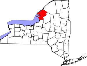 | |
| Towns | ||
| Villages | ||
| CDPs |
| |
| Hamlets | ||