Claysville, Pennsylvania
| Claysville | |
|---|---|
| Borough | |
|
The Montgomery House, a historic building on the borough's western edge | |
| Etymology: Henry Clay | |
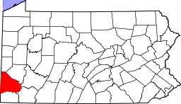
 Location of Claysville in Washington County | |
 Claysville Location of Claysville in Pennsylvania | |
| Coordinates: 40°7′8″N 80°24′45″W / 40.11889°N 80.41250°WCoordinates: 40°7′8″N 80°24′45″W / 40.11889°N 80.41250°W | |
| Country | United States |
| State | Pennsylvania |
| County | Washington |
| Established | 1812 |
| Government | |
| • Mayor | Geno Sibert |
| Area | |
| • Total | 0.3 sq mi (0.8 km2) |
| Population (2000) | |
| • Total | 724 |
| • Density | 2,400/sq mi (930/km2) |
| Time zone | EST (UTC-4) |
| • Summer (DST) | EDT (UTC-5) |
| Area code(s) | 724 |

Claysville is a borough in Washington County, Pennsylvania, United States and part of the Pittsburgh metropolitan area since 1950.[1] The population was 724 at the 2000 census. Claysville Elementary School, part of the McGuffey School District is located in Claysville. It is the birthplace of Benjamin Franklin Jones of the Jones and Laughlin Steel Company.
History
The Montgomery House was listed on the National Register of Historic Places in 2002.[2]
Geography
Claysville is located at 40°7′8″N 80°24′45″W / 40.11889°N 80.41250°W (40.118984, -80.412536).[3]
According to the United States Census Bureau, the borough has a total area of 0.3 square miles (0.78 km2), of which, 0.3 square miles (0.78 km2) of it is land and 3.12% is water.
Demographics
| Historical population | |||
|---|---|---|---|
| Census | Pop. | %± | |
| 1850 | 275 | — | |
| 1860 | 298 | 8.4% | |
| 1870 | 284 | −4.7% | |
| 1880 | 323 | 13.7% | |
| 1890 | 1,041 | 222.3% | |
| 1900 | 856 | −17.8% | |
| 1910 | 1,045 | 22.1% | |
| 1920 | 1,009 | −3.4% | |
| 1930 | 912 | −9.6% | |
| 1940 | 970 | 6.4% | |
| 1950 | 963 | −0.7% | |
| 1960 | 986 | 2.4% | |
| 1970 | 951 | −3.5% | |
| 1980 | 1,029 | 8.2% | |
| 1990 | 962 | −6.5% | |
| 2000 | 724 | −24.7% | |
| 2010 | 829 | 14.5% | |
| Est. 2015 | 810 | [4] | −2.3% |
| Sources:[5][6][7] | |||
As of the census[6] of 2000, there were 724 people, 242 households, and 189 families residing in the borough. The population density was 2,349.8 people per square mile (901.7/km²). There were 261 housing units at an average density of 847.1 per square mile (325.1/km²). The racial makeup of the borough was 99.45% White, 0.28% African American, and 0.28% from two or more races.
There were 242 households out of which 35.1% had children under the age of 18 living with them, 60.7% were married couples living together, 12.8% had a female householder with no husband present, and 21.9% were non-families. 19.4% of all households were made up of individuals and 14.0% had someone living alone who was 65 years of age or older. The average household size was 2.73 and the average family size was 3.06.
In the borough the population was spread out with 25.6% under the age of 18, 6.4% from 18 to 24, 26.2% from 25 to 44, 21.0% from 45 to 64, and 20.9% who were 65 years of age or older. The median age was 40 years. For every 100 females there were 90.0 males. For every 100 females age 18 and over, there were 87.8 males.
The median income for a household in the borough was $36,000, and the median income for a family was $40,000. Males had a median income of $28,125 versus $21,591 for females. The per capita income for the borough was $14,785. About 12.4% of families and 13.4% of the population were below the poverty line, including 16.1% of those under age 18 and 18.4% were above age 64.
References
| Wikimedia Commons has media related to Claysville, Pennsylvania. |
- ↑
- ↑ National Park Service (2010-07-09). "National Register Information System". National Register of Historic Places. National Park Service.
- ↑ "US Gazetteer files: 2010, 2000, and 1990". United States Census Bureau. 2011-02-12. Retrieved 2011-04-23.
- ↑ "Annual Estimates of the Resident Population for Incorporated Places: April 1, 2010 to July 1, 2015". Retrieved July 2, 2016.
- ↑ "Census of Population and Housing". U.S. Census Bureau. Archived from the original on 11 May 2015. Retrieved 11 December 2013.
- 1 2 "American FactFinder". United States Census Bureau. Archived from the original on 2013-09-11. Retrieved 2008-01-31.
- ↑ "Incorporated Places and Minor Civil Divisions Datasets: Subcounty Resident Population Estimates: April 1, 2010 to July 1, 2012". Population Estimates. U.S. Census Bureau. Archived from the original on 17 June 2013. Retrieved 11 December 2013.
| Counties |  Map of the Pittsburgh Tri-State with green counties in the metropolitan area and yellow counties in the combined area. | |
|---|---|---|
| Major cities | ||
| Cities and towns 15k-50k (in 2010) | ||
| Airports | ||
| Topics | ||
| ||