Clay Township, Pike County, Indiana
| Clay Township Pike County | |
|---|---|
| Township | |
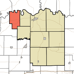 Location in Pike County | |
| Coordinates: 38°29′24″N 87°25′30″W / 38.49000°N 87.42500°WCoordinates: 38°29′24″N 87°25′30″W / 38.49000°N 87.42500°W | |
| Country |
|
| State |
|
| County | Pike |
| Government | |
| • Type | Indiana township |
| Area | |
| • Total | 23.95 sq mi (62.0 km2) |
| • Land | 23.58 sq mi (61.1 km2) |
| • Water | 0.37 sq mi (1.0 km2) 1.54% |
| Elevation | 463 ft (141 m) |
| Population (2010) | |
| • Total | 349 |
| • Density | 14.8/sq mi (5.7/km2) |
| ZIP codes | 47567, 47640 |
| GNIS feature ID | 0453217 |
Clay Township is one of nine townships in Pike County, Indiana, United States. As of the 2010 census, its population was 349 and it contained 156 housing units.[1]
As of the 2010 census, the United States Census Bureau reported that 2010 median center of population of the United States was in Clay Township, 7.1 miles (11.4 km) southwest of Petersburg.[2]
Geography
According to the 2010 census, the township has a total area of 23.95 square miles (62.0 km2), of which 23.58 square miles (61.1 km2) (or 98.46%) is land and 0.37 square miles (0.96 km2) (or 1.54%) is water.[1] The White River defines the north border of the township, as well as the north border of Pike County.
Unincorporated towns
(This list is based on USGS data and may include former settlements.)
Cemeteries
The township contains these five cemeteries: Bethlehem, Catt, Frederick, Independent Order of Odd Fellows and Odd Fellows.
School districts
- Pike County School Corporation
Political districts
- State House District 64
- State Senate District 48
References
- "Clay Township, Pike County, Indiana". Geographic Names Information System. United States Geological Survey. Retrieved 2009-11-26.
- United States Census Bureau 2009 TIGER/Line Shapefiles
- IndianaMap
- 1 2 "Population, Housing Units, Area, and Density: 2010 - County -- County Subdivision and Place -- 2010 Census Summary File 1". United States Census. Retrieved 2013-05-10.
- ↑
External links
- Indiana Township Association
- United Township Association of Indiana
- City-Data.com page for Clay Township
 |
Johnson Township, Knox County | |
Harrison Township, Knox County | |
| |
Madison Township | |||
| ||||
| | ||||
| Washington Township, Gibson County | |
Logan Township |
Municipalities and communities of Pike County, Indiana, United States | ||
|---|---|---|
| City | ||
| Towns | ||
| Townships | ||
| CDP | ||
| Other unincorporated communities |
| |
| Footnotes | ‡This populated place also has portions in an adjacent county or counties | |