Civil parishes in Berkshire

A civil parish is a country subdivision, forming the lowest unit of local government in England. There are 104 civil parishes in the ceremonial county of Berkshire, most of the county being parished; Reading is completely unparished; Bracknell Forest, West Berkshire and Wokingham are entirely parished. At the 2001 census, there were 483,882 people living in the 104 parishes, accounting for 60.5 per cent of the county's population.
History
Parishes arose from Church of England divisions, and were originally purely ecclesiastical divisions. Over time they acquired civil administration powers.[1]
The Highways Act 1555 made parishes responsible for the upkeep of roads. Every adult inhabitant of the parish was obliged to work four days a year on the roads, providing their own tools, carts and horses; the work was overseen by an unpaid local appointee, the Surveyor of Highways.[2]
The poor were looked after by the monasteries, until their dissolution. In 1572, magistrates were given power to 'survey the poor' and impose taxes for their relief. This system was made more formal by the Poor Law Act 1601, which made parishes responsible for administering the Poor Law; overseers were appointed to charge a rate to support the poor of the parish.[3] The 19th century saw an increase in the responsibility of parishes, although the Poor Law powers were transferred to Poor Law Unions.[4] The Public Health Act 1872 grouped parishes into Rural Sanitary Districts, based on the Poor Law Unions; these subsequently formed the basis for Rural Districts.[5]
Parishes were run by vestries, meeting annually to appoint officials, and were generally identical to ecclesiastical parishes,[6] although some townships in large parishes administered the Poor Law themselves; under the Divided Parishes and Poor Law Amendment Act 1882, all extra-parochial areas and townships that levied a separate rate became independent civil parishes.[7]
Civil parishes in their modern sense date from the Local Government Act 1894, which abolished vestries; established elected parish councils in all rural parishes with more than 300 electors; grouped rural parishes into Rural Districts; and aligned parish boundaries with county and borough boundaries.[7] Urban civil parishes continued to exist, and were generally coterminous with the Urban District, Municipal Borough or County Borough in which they were situated; many large towns contained a number of parishes, and these were usually merged into one. Parish councils were not formed in urban areas, and the only function of the parish was to elect guardians to Poor Law Unions; with the abolition of the Poor Law system in 1930 the parishes had only a nominal existence.[8]
The Local Government Act 1972 retained civil parishes in rural areas, and many former Urban Districts and Municipal Boroughs that were being abolished, were replaced by new successor parishes; urban areas that were considered too large to be single parishes became unparished areas.[9]
The current position
Recent governments have encouraged the formation of town and parish councils in unparished areas, and the Local Government and Rating Act 1997 gave local residents the right to demand the creation of a new civil parish.[10]
A parish council can become a town council unilaterally, simply by resolution;[9] and a civil parish can also gain city status, but only if that is granted by the Crown.[9] The chairman of a town or city council is called a mayor.[9] The Local Government and Public Involvement in Health Act 2007 introduced alternative names: a parish council can now choose to be called a community; village; or neighbourhood council.[11]

List of civil parishes and unparished areas
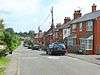


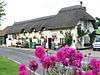


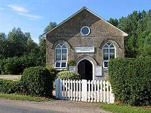


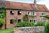
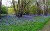
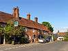
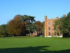
Aug2006.jpg)


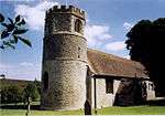

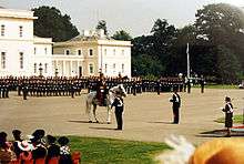
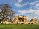
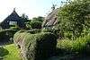
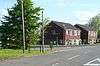
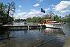
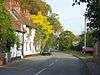
_-_geograph.org.uk_-_6233.jpg)


See also
References
- ↑ Angus Winchester, 2000, Discovering Parish Boundaries. Shire Publications. Princes Risborough, 96 pages ISBN 978-0747804703
- ↑ RAC Foundation : What Went Wrong? British Highway Development Before Motorways Retrieved 22 August 2009
- ↑ The Victorian Web : The Poor Law : Introduction Retrieved 22 August 2009
- ↑ Staffordshire University : Poor Law Unions and Registration Districts Retrieved 22 August 2009
- ↑ A Vision of Britain Through Time : Status Details for Rural Sanitary District Retrieved 22 August 2009
- ↑ Robert Tittler, The Reformation and the Towns in England, 1998, Oxford University Press, 395 pages, ISBN 9780198207184
- 1 2 Modern British Surnames : Selected Events in the History of Civil Registration and Boundary Changes 1801-1996 Archived August 1, 2010, at the Wayback Machine. Retrieved 22 August 2009
- ↑ Alex MacMorran and T R Colquhoun Dill, The Local Government Act 1894 and the Subsequent Statutes Affecting Parish Councils, 1907, Butterworth and Co, London, 626 pages
- 1 2 3 4 Office of Public Sector Information : Local Government Act 1972 Retrieved 22 August 2009
- ↑ Office of Public Sector Information : Local Government and Rating Act 1997 Retrieved 22 August 2009
- ↑ Office of Public Sector Information : Local Government and Public Involvement in Health Act 2007 Retrieved 22 August 2009
- 1 2 3 4 5 6 A Vision of Britain Through Time : Easthampstead Rural District Retrieved 3 November 2010
- 1 2 3 4 5 6 Office for National Statistics: Census 2001: Parish Headcounts: Bracknell Forest Retrieved 3 November 2010
- ↑ A Vision of Britain Through Time : Reading County Borough Retrieved 3 November 2010
- ↑ Office for National Statistics : Census 2001 : Table KS01 : Usual Resident Population Abbey; Battle; Caversham; Church; Katesgrove; Kentwood; Mapledurham; Minster; Norcot; Park; Peppard; Redlands; Southcote; Thames; Tilehurst; and Whitley wards. Retrieved 3 November 2010
- 1 2 3 4 5 6 A Vision of Britain Through Time : Eton Rural District Retrieved 3 November 2010
- 1 2 3 Office for National Statistics : Census 2001 : Parish Headcounts : Slough Retrieved 3 November 2010
- 1 2 The English Non-metropolitan Districts (Definition) Order 1972, Schedule, Part 3
- ↑ The Berkshire, Buckinghamshire and Surrey (County Boundaries) Order 1994
- ↑ A Vision of Britain Through Time : Slough Municipal Borough Retrieved 3 November 2010
- ↑ Office for National Statistics : Census 2001 : Table KS01 : Usual Resident Population Baylis and Stoke; Britwell (part); Central; Chalvey; Cippenham Green; Cippenham Meadows; Farnham; Foxborough; Haymill; Kedermister; Langley St Mary's; Upton; and Wexham Lea (part) wards. Retrieved 3 November 2010
- 1 2 3 4 5 6 7 8 9 10 11 12 13 14 15 16 17 18 19 20 21 22 23 24 25 A Vision of Britain Through Time : Bradfield Rural District Retrieved 3 November 2010
- 1 2 3 4 5 6 7 8 9 10 11 12 13 14 15 16 17 18 19 20 21 22 23 24 25 26 27 28 29 30 31 32 33 34 35 36 37 38 39 40 41 42 43 44 45 46 47 48 49 50 51 52 53 54 55 56 57 58 59 60 61 62 63 Office for National Statistics : Census 2010 : Parish Headcounts : West Berkshire Retrieved 3 November 2010
- 1 2 3 4 5 6 7 8 9 10 11 12 A Vision of Britain Through Time : Wantage Rural District Retrieved 3 November 2010
- 1 2 3 4 5 6 7 8 9 10 11 12 13 14 15 16 17 A Vision of Britain Through Time : Newbury Rural District Retrieved 3 November 2010
- 1 2 3 4 5 6 7 8 A Vision of Britain Through Time : Hungerford Rural District Retrieved 3 November 2010
- ↑ A Vision of Britain Through Time : Newbury Municipal Borough Retrieved 3 November 2010
- 1 2 3 4 5 6 7 A Vision of Britain Through Time : Cookham Rural District Retrieved 3 November 2010
- 1 2 3 4 5 6 7 8 9 10 11 12 13 14 15 Office for National Statistics : Census 2001 : Parish Headcounts : Windsor and Maidenhead" Retrieved 3 November 2010
- 1 2 A Vision of Britain Through Time : Maidenhead Municipal Borough Retrieved 3 November 2010
- ↑ A Vision of Britain Through Time : Eton Urban District Retrieved 3 November 2010
- ↑ Office for National Statistics : Census 2001 : Table KS01 : Usual Resident Population Belmont; Boyn Hill; Furze Platt; Maidenhead Riverside; Oldfield; and Pinkneys Green wards. Retrieved 3 November 2010
- ↑ A Vision of Britain Through Time : New Windsor Municipal Borough Retrieved 3 November 2010
- ↑ Office for National Statistics : Census 2001 : Table KS01 : Usual Resident Population Castle Without; Clewer East; Clewer North (part); Clewer South (part); Eton and Castle (part); and Park wards. Retrieved 3 November 2010
- 1 2 3 A Vision of Britain Through Time : Windsor Rural District Retrieved 3 November 2010
- ↑ Office of the Deputy Prime Minister: Bulletin of Changes to Local Authority Areas in England: Orders Made Between 1 April 2004 and 31 March 2005: District Council Notices of the Change of Name of a Parish Under Section 75 of the Local Government Act 1975 Archived March 14, 2012, at the Wayback Machine. Retrieved 3 November 2010
- 1 2 3 4 5 6 7 8 9 10 11 12 13 14 15 16 A Vision of Britain Through Time : Wokingham Rural District Retrieved 3 November 2010
- 1 2 3 4 5 6 7 8 9 10 11 12 13 14 15 16 17 Office for National Statistics : Census 2001 : Parish Headcounts : Wokingham" Retrieved 3 November 2010
- ↑ A Vision of Britain Through Time : Wokingham Municipal Borough Retrieved 3 November 2010
External links
- Office for National Statistics: Geographical Area Listings
- Bracknell Forest Council: Parish Councils
- Slough Borough Council: Parish Councils
- West Berkshire Council: Parish Council Contact Details
- The Royal Borough of Windsor and Maidenhead: Parish and Town Councils in the Royal Borough
- Wokingham Borough Council: Town and Parish Council Contacts