Norton, Virginia
| Norton, Virginia | ||
|---|---|---|
| Independent city | ||
|
A view overlooking Norton, Virginia | ||
| ||
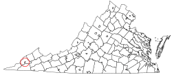 Location in the Commonwealth of Virginia | ||
| Coordinates: 36°56′12″N 82°37′30″W / 36.93667°N 82.62500°WCoordinates: 36°56′12″N 82°37′30″W / 36.93667°N 82.62500°W | ||
| Country | United States | |
| State | Virginia | |
| County | None (Independent city) | |
| Founded | 1894 | |
| Named for | Eckstein Norton | |
| Government | ||
| • Mayor | William Mays | |
| Area | ||
| • Total | 7.5 sq mi (19 km2) | |
| • Land | 7.5 sq mi (19 km2) | |
| • Water | 0.0 sq mi (0 km2) | |
| Elevation | 2,684 ft (818 m) | |
| Population (2010) | ||
| • Total | 3,958 | |
| • Density | 529/sq mi (204/km2) | |
| Time zone | EST (UTC-5) | |
| • Summer (DST) | EDT (UTC-4) | |
| ZIP code | 24273 | |
| Area code(s) | 276 | |
| FIPS code | 51-57688[1] | |
| GNIS feature ID | 1485924[2] | |
| Website | http://www.nortonva.org/ | |


Norton is an independent city in the Commonwealth of Virginia. As of the 2010 census, the population was 3,958,[3] making it the least populous city in Virginia, along with the westernmost. The Bureau of Economic Analysis combines the city of Norton with surrounding Wise County for statistical purposes.
History
Norton was named for Eckstein Norton, a railroad official.[4]
The Hotel Norton is listed on the National Register of Historic Places.[5]
Education
- John I. Burton High School
- Norton Elementary and Middle School
Geography
Norton is located at 36°56′12″N 82°37′31″W / 36.936805°N 82.625146°W, along the Powell and Guest Rivers.
According to the United States Census Bureau, the city has a total area of 7.5 square miles (19 km2), virtually all of which is land.
Major highways
Demographic
| Historical population | |||
|---|---|---|---|
| Census | Pop. | %± | |
| 1900 | 654 | — | |
| 1910 | 1,866 | 185.3% | |
| 1920 | 3,068 | 64.4% | |
| 1930 | 3,077 | 0.3% | |
| 1940 | 4,006 | 30.2% | |
| 1950 | 4,315 | 7.7% | |
| 1960 | 4,996 | 15.8% | |
| 1970 | 4,001 | −19.9% | |
| 1980 | 4,757 | 18.9% | |
| 1990 | 4,247 | −10.7% | |
| 2000 | 3,904 | −8.1% | |
| 2010 | 3,958 | 1.4% | |
| Est. 2015 | 3,939 | [6] | −0.5% |
| U.S. Decennial Census[7] 1790–1960[8] 1900–1990[9] 1990–2000[10] 2010–2012[3] | |||
As of the census[11] of 2000, there were 3,904 people, 1,730 households, and 1,067 families residing in the city. The population density was 518.5 people per square mile (200.2/km²). There were 1,946 housing units at an average density of 258.4 per square mile (99.8/km²). The racial makeup of the city was 91.57% White, 6.15% Black, 0.08% Native American, 1.00% Asian, 0.13% Pacific Islander, 0.18% from other races, and 0.90% from two or more races. Hispanic or Latino of any race were 0.87% of the population.
There were 1,730 households out of which 26.1% had children under the age of 18 living with them, 43.0% were married couples living together, 15.7% had a female householder with no husband present, and 38.3% were non-families. 34.9% of all households were made up of individuals and 14.3% had someone living alone who was 65 years of age or older. The average household size was 2.23 and the average family size was 2.88.
In the city the population was spread out with 21.8% under the age of 18, 10.2% from 18 to 24, 27.3% from 25 to 44, 25.4% from 45 to 64, and 15.3% who were 65 years of age or older. The median age was 39 years. For every 100 females there were 81.8 males. For every 100 females age 18 and over, there were 78.5 males.
The median income for a household in the city was $22,788, and the median income for a family was $30,889. Males had a median income of $30,000 versus $23,229 for females. The per capita income for the city was $16,024. About 19.1% of families and 22.8% of the population were below the poverty line, including 35.7% of those under age 18 and 12.1% of those age 65 or over.
Notable residents
- Dock Boggs – musician and songwriter
- Vernon Crawford "Jack" Cooke – bluegrass musician
References
- ↑ "American FactFinder". United States Census Bureau. Retrieved 2008-01-31.
- ↑ "US Board on Geographic Names". United States Geological Survey. 2007-10-25. Retrieved 2008-01-31.
- 1 2 "State & County QuickFacts". United States Census Bureau. Retrieved January 6, 2014.
- ↑ Tennis, Joe (2004). Southwest Virginia Crossroads: An Almanac of Place Names and Places to See. The Overmountain Press. p. 19. ISBN 978-1-57072-256-1.
- ↑ National Park Service (2010-07-09). "National Register Information System". National Register of Historic Places. National Park Service.
- ↑ "Annual Estimates of the Resident Population for Incorporated Places: April 1, 2010 to July 1, 2015". Retrieved July 2, 2016.
- ↑ "U.S. Decennial Census". United States Census Bureau. Retrieved January 6, 2014.
- ↑ "Historical Census Browser". University of Virginia Library. Retrieved January 6, 2014.
- ↑ "Population of Counties by Decennial Census: 1900 to 1990". United States Census Bureau. Retrieved January 6, 2014.
- ↑ "Census 2000 PHC-T-4. Ranking Tables for Counties: 1990 and 2000" (PDF). United States Census Bureau. Retrieved January 6, 2014.
- ↑ "American FactFinder". United States Census Bureau. Retrieved 2011-05-14.