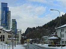
Churwalden
| Churwalden | ||
|---|---|---|
|
Church of Churwalden | ||
| ||
 Churwalden | ||
|
Location of Churwalden  | ||
| Coordinates: 46°47′N 9°33′E / 46.783°N 9.550°ECoordinates: 46°47′N 9°33′E / 46.783°N 9.550°E | ||
| Country | Switzerland | |
| Canton | Graubünden | |
| District | Plessur | |
| Government | ||
| • Mayor | Alex Gubelmann | |
| Area[1] | ||
| • Total | 48.54 km2 (18.74 sq mi) | |
| Elevation | 1,230 m (4,040 ft) | |
| Population (Dec 2015[2]) | ||
| • Total | 2,030 | |
| • Density | 42/km2 (110/sq mi) | |
| Postal code | 7075 | |
| SFOS number | 3911 | |
| Localities | Passugg, Sagens | |
| Surrounded by | Almens, Chur, Maladers, Malix, Parpan, Praden, Scheid, Trans, Tschiertschen, Vaz/Obervaz | |
| Website |
www SFSO statistics | |


Churwalden is a municipality in the district of Plessur in the canton of Graubünden in Switzerland. On 1 January 2010 the municipalities of Malix and Parpan merged into Churwalden.[3]
History
Churwalden is first mentioned in 1149 as silva Augeria. In 1191 it was mentioned as de Curwalde.[4]
Geography
Churwalden has an area, as of 2006, of 26.7 km2 (10.3 sq mi). Of this area, 40.6% is used for agricultural purposes, while 40.1% is forested. Of the rest of the land, 3.1% is settled (buildings or roads) and the remainder (16.1%) is non-productive (rivers, glaciers or mountains).[5]
The municipality is located in Churwalden sub-district of the Plessur district on the Rabiusa river and near the Lenzerheide Pass. The village lies in the valley between the cantonal capital Chur and the resort Lenzerheide. The Lenzerheide Bergbahnen AG offers access to the skiing area of Lenzerheide as well as Stätzerhorn, Danis, Scalottas, and Rothorn. The longest toboggan run (Rodelbahn) is in Churwalden. The run at Pradaschier is 3.5 kilometers (2.2 mi) long.
At the end of 2013 the ski resort was linked with Arosa by cable-car, creating the new ski resort of Arosa Lenzerheide. Since then transport passes work in both resorts.
The municipality consists of the linear village of Churwalden and the hamlets of Passugg, Araschgen and scattered farm houses. The municipalities of Churwalden, Malix, and Parpan sought approval from the Canton to merge on 1 January 2010 into a new municipality to be known as Churwalden.[6]
Demographics
Churwalden has a population (as of 31 December 2015) of 2,030.[2] As of 2008, 31.4% of the population was made up of foreign nationals.[7] Over the last 10 years the population has decreased at a rate of -9.5%. Most of the population (as of 2000) speaks German (79.7%), with Turkish being second most common (3.9%) and Romansh being third (2.3%).[5]
As of 2000, the gender distribution of the population was 50.4% male and 49.6% female.[8] The age distribution, as of 2000, in Churwalden was as follows: 127 children or 10.3% of the population are between 0 and 9 years old. 75 teenagers or 6.1% are 10 to 14, and 92 teenagers or 7.4% are 15 to 19. Of the adult population, 206 people or 16.7% of the population are between 20 and 29 years old. 201 people or 16.3% are 30 to 39, 174 people or 14.1% are 40 to 49, and 127 people or 10.3% are 50 to 59. The senior population distribution is 101 people or 8.2% of the population are between 60 and 69 years old, 88 people or 7.1% are 70 to 79, there are 39 people or 3.2% who are 80 to 89, and there are 6 people or 0.5% who are 90 to 99.[7]
In the 2007 federal election the most popular party was the SVP which received 43.5% of the vote. The next three most popular parties were the SP (20.1%), the FDP (18%) and the CVP (17.6%).[5]
The Swiss population as a whole is generally well educated. In Churwalden about 64% of the population (between age 25-64) have completed either non-mandatory upper secondary education or additional higher education (either University or a Fachhochschule).[5]
Churwalden has an unemployment rate of 1.37%. As of 2005, there were 76 people employed in the primary economic sector and about 25 businesses involved in this sector. 145 people are employed in the secondary sector and there are 18 businesses in this sector. 259 people are employed in the tertiary sector, with 43 businesses in this sector.[5]
From the 2000 census, 483 or 39.1% were Roman Catholic, while 476 or 38.5% belonged to the Swiss Reformed Church. Of the rest of the population, there were 20 individuals (or about 1.62% of the population) who belonged to the Orthodox Church. There were 116 (or about 9.39% of the population) who are Muslim. There were 17 individuals (or about 1.38% of the population) who belonged to another church (not listed on the census), 89 (or about 7.20% of the population) belonged to no church and/or were agnostic or atheist, and 35 individuals (or about 2.83% of the population) did not answer the question.[7]
The historical population is given in the following table:[4]
| year | population |
|---|---|
| 1623 | c. 575 |
| 1850 | 695 |
| 1900 | 620 |
| 1950 | 815 |
| 1990 | 1,247 |
| 2000 | 1,236 |
Heritage sites of national significance
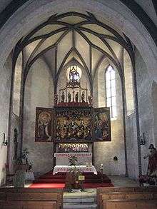
The Catholic Church of St. Maria and Michael and the Wohnturm (a tower house) are listed as Swiss heritage sites of national significance.[9]
Business
The Grischuna Bündnerfleisch is produced in Churwalden.
References
- ↑ Arealstatistik Standard - Gemeindedaten nach 4 Hauptbereichen
- 1 2 Swiss Federal Statistical Office - STAT-TAB, online database – Ständige und nichtständige Wohnbevölkerung nach institutionellen Gliederungen, Geburtsort und Staatsangehörigkeit (German) accessed 30 August 2016
- ↑ Amtliches Gemeindeverzeichnis der Schweiz, Mutationsmeldungen 2009 / Répertoire officiel des communes de Suisse, Mutations 2009 / Elenco ufficiale dei Comuni della Svizzera, Mutazione 2009 (PDF) (Report). Federal Statistical Office. 2009. nden. Archived from the original (PDF) on 18 November 2010. Retrieved 6 March 2010.
- 1 2 Churwalden in German, French and Italian in the online Historical Dictionary of Switzerland.
- 1 2 3 4 5 Swiss Federal Statistical Office Archived January 5, 2016, at the Wayback Machine. accessed 27-Oct-2009
- ↑ Amtliches Gemeindeverzeichnis der Schweiz published by the Swiss Federal Statistical Office (German) accessed 23 September 2009
- 1 2 3 Graubunden Population Statistics Archived August 27, 2009, at the Wayback Machine. (German) accessed 21 September 2009
- ↑ Graubunden in Numbers Archived September 24, 2009, at the Wayback Machine. (German) accessed 21 September 2009
- ↑ Swiss inventory of cultural property of national and regional significance Archived May 1, 2009, at the Wayback Machine. 21.11.2008 version, (German) accessed 27-Oct-2009
| Wikimedia Commons has media related to Churwalden. |