Churu district
| churu district चूरु जिला | |
|---|---|
| District of Rajasthan | |
 Location of churu district in Rajasthan | |
| Country | India |
| State | Rajasthan |
| Administrative division | Bikaner Division |
| Headquarters | Churu |
| Tehsils | Churu, Ratangarh, Taranagar, Rajgarh, Sardarshahar, Sujangarh, Bidasar |
| Government | |
| • Lok Sabha constituencies | Churu[1] |
| Area | |
| • Total | 13,858 km2 (5,351 sq mi) |
| Population (2011) | |
| • Total | 2,041,171[2] |
| • Urban | 576,480 |
| Demographics | |
| • Literacy | 67.46% |
| Major highways | NH-52 |
| Average annual precipitation | 43cm mm |
| Website | Official website |

Churu district (Hindi: चुरू जिला) is a district of the Indian state of Rajasthan in western India. The town of Churu is the administrative headquarters of the district.
Churu lies in the Jangladesh region of northern Rajasthan and shares boundaries with the Hanumangarh District to the north, the Haryana state to the east, the Jhunjhunun and Sikar districts to the southeast, the Nagaur District to the south, and the Bikaner District to the west.
The district has an area of approximately 16,830 km², with a road length of 1901 km. The 2011 population was approximately 2,041,171. The gender ratio is 938 females per 1,000 males; literacy among residents is 67.46%. There are 6 tehsils in the district: Churu, Ratangarh, Taranagar, Rajgarh, Sardarshahar, and Sujangarh.
The major crops include bajra and gram. The major minerals found in the district are copper and gypsum.


Attractions
Sujangarh, Ratangarh, Sardarshahar, Tarangar, Rajgarh, Ratannagar, Chapper, Bidasar and Rajaldesar are the other major towns in the district. The Tal Chhapar Sanctuary, a blackbuck sanctuary, has more than 1,680 black bucks and migratory birds. It is a major attraction for wildlife enthusiasts. Other attractions include the grand palatial Havelies in the towns of Ratannagar, Ratangarh and Sardarshahar, the Hanuman temple at Salasar and the Venkateshwar temple at Sujangarh, the birthplace of local deity, Goga Pir, in Dadrewa. The Bhadrakali Temple at Rajaldesar is popular among Shakta Tantra followers from all over India, which was established by Anant Shri Vibhushit Dandi Swami Jogendrashram ji Maharaj. Baba Phool Nath Temple at Nawa, Rajgarh is popular and related to NATH Community.
Demographics
According to the 2011 census, Churu district has a population of approximately 2,041,172,[3] roughly equal to the nation of Botswana[4] or the US state of New Mexico.[5] This gives it a ranking of 224th in India (out of a total of 640 districts).[3] The district has a population density of 148 inhabitants per square kilometre (380/sq mi).[3] Its population growth rate over the decade 2001-11 was approximately 6.1%.[3] Churu has a sex ratio of 938 females for every 1000 males,[3] and a literacy rate of about 67.46%.[3]
Percentage distribution of local work force
- Cultivators: 73.17%
- Agricultural laborers: 3.16%
Local industries
- Processing, servicing, and repairs: 2.26%
- Other workers: 21.41%
Major crop production
- Wheat: 60,654 tonnes
- Rapeseed and Mustard: 24,705 tonnes
- Pulses: 9,594 tonnes
- Gram: 316 tonnes
- Bajra: 2545467 tonnes
Communication facilities
- Public call offices: 682
- Post offices: 392
- Telegraph offices: 89
- Telephone exchanges: 83
Educational facilities and institutions
- Primary and middle schools: 1,472
- Secondary and higher secondary schools: 207
- Private BED Colleges: 14
- Post graduate and under graduate: 11
- ITIs: 5
- Government BED Colleges: 1
Industrial scenario
- Large and Medium Scale Units: 2
- Small Scale Units: 3,963
- Industrial Areas: 6
Infrastructure
A majority of the district's power supply is provided by the Bhakra Hydel Complex through 132 kV lines coming via Hissar in Haryana. 902 of the district's 926 villages have access to electricity. Water is available at the depth of 30 to 48 metres, with the exception of places such as Sujangarh and Taranagar Tehsils.
The district has good connections within and outside the state. National Highway Nos. 11 (Agra-Bikaner), 65 (Ambala-Pali), and 709 Ext. (Rohtak-Rajgarh) pass through the district. The total length of roads in the district is 3,010 km and is 240 km from Delhi via Hisar and 210 km. via Behal. The Churu district is served by broad gauge lines of the Northern-Western Railway. The total length of rail line is 363 km. The broad gauge is developing in some areas of the district. The nearest airport is at Jaipur (approximately 245 km outside the district).
Churu was ranked as 423rd in a ranking of 423 districts for the National Urban Sanitation Policy in 2009-2010. In the absence of citizen awareness, it continues to hold that rank, making it officially India's dirtiest district.(Report)
Primary industries
- Aluminium utensils
- Blanket weaving
- Cement production
- Churan
- Chatni
- Guargum
- Hand loomed cloth
- Iron and steel fabrication
- Oil production
- Salt production
- Sewing macine (DABLA)
Notable people
- Swami Gopal das-famous freedom fighter of churu district.
- Nand Kishore Chaudhary - chairman and managing director of Jaipur Rugs and social entrepreneur
- chandra singh birkali- famous poet of rajasthani, writer of Badli,Loo.
- Lakshmi Mittal - the "Steel King", born at Sadulpur in Churu District.
- Bimal Jalan - former RBI governor
- Bharat Vyas - Writer of the prayer song, ‘Ae Malik Tere Bande Hum’ and 'Ye Kaun Chitrakar Hai'. He directed a Bollywood film Rangeela Rajasthani.
- Col. Thakur Kishan Singh Rathore - one of the first recipients of the Maha Vir Chakra (MVC) (second highest military decoration in India)
- Devendra Jhajharia - India's first Paralympic gold medalist.
- Kanhaiyalal Sethia- prominent Rajasthani writer.
- Rai Bahadur Bhagwandas Bagla- the first Marwari Shekhawati millionaire
See also
- Churu (Lok Sabha constituency)
- Churu
- Ratangarh
- Ratannagar
- Sadulpur
- Sardarshahar
- Bidasar
- List of villages in Churu district
- Sujangarh
- Sandwa
- Tal Chhapar Sanctuary
- Rajaldesar
- Taranagar
- Baba Phoolnath Teample
- Nawa, Rajgarh, Churu
- Rajpura, Churu
References
- ↑ "Parliamentary Constituencies of Rajasthan" (PDF). http://164.100.9.199/home.html. 2012. Retrieved 2012-02-23. External link in
|publisher=(help) - ↑ "Name Census 2011, Rajasthan data" (PDF). censusindia.gov.in. 2012. Retrieved 28 Feb 2012.
- 1 2 3 4 5 6 "District Census 2011". Census2011.co.in. 2011. Retrieved 2011-09-30.
- ↑ US Directorate of Intelligence. "Country Comparison:Population". Retrieved 2011-10-01.
Botswana 2,065,398
- ↑ "2010 Resident Population Data". U. S. Census Bureau. Archived from the original on 2013-10-19. Retrieved 2011-09-30.
New Mexico - 2,059,179
External links
 |
Hanumangarh district | | ||
| Bikaner district | |
Bhiwani district, Haryana | ||
| ||||
| | ||||
| Nagaur district | Sikar district | Jhunjhunun district |
| Outline | 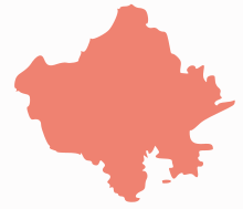 | ||||||||||||||||||||||||||
|---|---|---|---|---|---|---|---|---|---|---|---|---|---|---|---|---|---|---|---|---|---|---|---|---|---|---|---|
| Governance | |||||||||||||||||||||||||||
| Divisions and Districts |
| ||||||||||||||||||||||||||
| Major cities | |||||||||||||||||||||||||||
| Related templates |
| ||||||||||||||||||||||||||
Coordinates: 28°17′24″N 74°57′36″E / 28.29000°N 74.96000°E