Church Street (Manhattan)
Coordinates: 40°42′57″N 74°00′26″W / 40.7157°N 74.0073°W

Church Street is a short, but heavily travelled, north-south street in Lower Manhattan in New York City. Its southern end is at Trinity Place, of which it is a continuation, and its northern end is at Canal Street.
Trinity Place begins at Battery Place and runs uptown, passing west of Trinity Church, the Trinity and United States Realty Buildings and Zuccotti Park. It then forms the southern part of the eastern boundary of the World Trade Center site before becoming Church Street, which continues as the eastern boundary. A few blocks before Canal Street, Church Street connects to the southern end of Avenue of the Americas, with a roadway branching off Church Street. When not obstructed by construction on the World Trade Center site, Trinity Place, Church Street, and Avenue of the Americas form a continuous northbound four-lane through-route from Lower Manhattan to Central Park.
Church Street is named after Trinity Church, an historic Gothic-style parish church on Broadway at Wall Street, Extended in 1784, Church Street was in existence as early as 1761. Part of the street was owned by the church, but was given to the city in 1804.[1] Trinity Place is also a namesake of the church, being named so in 1834, prior to which it was known at various times as "Lumber Street" and "Lombard Street".[2] Prior to 1869, the south end of the street was at Fulton Street, three blocks north of Trinity Place;[3] then, over several years, a connection was cut through those blocks, both streets were widened, and Trinity Place was extended south to Morris Street. The work, plagued by delays and, allegedly, corruption, was completed by the end of 1872.[4]
Places
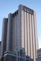
The Church Street Station post office at 90 Church Street serves the 10048 ZIP code as well as the surrounding area, and is listed on the National Register of Historic Places, as is the Canal Street Station post office at the north end of Church Street. Other notable buildings include the rear of the 1765 St. Paul's Chapel, the residential tower under construction at 99 Church Street, and St. Peter's Church.
Near Rector Street, Trinity Place passes under the Trinity Place bridge. Completed in 1989, the bridge is a private elevated walkway connecting the rear side of Trinity Church to its parish house across Trinity Place.
The IND Eighth Avenue Line (A C E trains) in the New York City Subway runs below Church Street from Liberty Street to Sixth Avenue. A portion of the BMT Broadway Line (N R W trains) runs under Church Street south of Vesey Street. The Cortlandt Street station, damaged in the September 11 attacks, is adjacent to the former site of the Twin Towers.
Gallery
-

Canal Street Station post office at north end of Church Street
-

The Cary Building is a New York City Landmark and listed on the National Register of Historic Places
-

The rear of St. Paul's Chapel in 1937
-

St. Peter's Roman Catholic Church on the corner of Barclay Street, also a NYC landmark and on the NRHP
References
Notes
- ↑ Moscow, Henry (1978), The Street Book: An Encyclopedia of Manhattan's Street Names and Their Origins, New York: Hagstrom, ISBN 0823212750, p.39
- ↑ Moscow, Henry (1978), The Street Book: An Encyclopedia of Manhattan's Street Names and Their Origins, New York: Hagstrom, ISBN 0823212750, p. 101
- ↑ 1865 map
- ↑ 1873 map; "The Church Street Extension", The New York Times (May 6, 1869); "Church Street Extension", The New York Times (August 13, 1870); "Cholera Seeds", The New York Times (August 19, 1871); "New York and Suburban News. New York", The New York Times (December 15, 1872), paragraph 5