Chunkarani
| Chunkarani | |
|---|---|
 Chunkarani Location in Bolivia | |
| Highest point | |
| Elevation | 5,076 m (16,654 ft) [1] |
| Coordinates | 18°08′15″S 68°28′15″W / 18.13750°S 68.47083°WCoordinates: 18°08′15″S 68°28′15″W / 18.13750°S 68.47083°W |
| Geography | |
| Location | Bolivia, Oruro Department, Sajama Province |
| Parent range | Andes |
Chunkarani (Aymara chunkara pointed mountain,[2] -ni a suffix to indicate ownership, "the one with a pointed mountain", Hispanicized spelling Chungarani) is a 5,076-metre-high (16,654 ft) mountain in the Andes of Bolivia. It lies in the Oruro Department, Sajama Province, on the border of the Curahuara de Carangas Municipality and the Turco Municipality.[3] Chunkarani is situated north-east of the volcanic complex of Asu Asuni.
References
- ↑ BIGM map 1:50,000 Estancia Marcarani Hoja 5939-IV (Chungarani)
- ↑ "Diccionario Bilingüe Castellano-Aymara 2002". Félix Laime Pairumani. Retrieved September 13, 2014.
- ↑ "Turco". Archived from the original on March 3, 2016. Retrieved September 13, 2014. (Chingurani)
Capital: Oruro | ||
| Provinces | 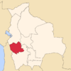 | |
| Municipalities (and seats) |
| |
This article is issued from Wikipedia - version of the 11/24/2016. The text is available under the Creative Commons Attribution/Share Alike but additional terms may apply for the media files.