Chugwater, Wyoming
| Chugwater, Wyoming | |
|---|---|
| Town | |
|
The Chugwater Soda Fountain | |
 Location in Platte County and the state of Wyoming. | |
 Chugwater, Wyoming Location in the United States | |
| Coordinates: 41°45′21″N 104°49′32″W / 41.75583°N 104.82556°WCoordinates: 41°45′21″N 104°49′32″W / 41.75583°N 104.82556°W | |
| Country | United States |
| State | Wyoming |
| County | Platte |
| Area[1] | |
| • Total | 3.06 sq mi (7.93 km2) |
| • Land | 3.06 sq mi (7.93 km2) |
| • Water | 0 sq mi (0 km2) |
| Elevation | 5,295 ft (1,614 m) |
| Population (2010)[2] | |
| • Total | 212 |
| • Estimate (2012[3]) | 216 |
| • Density | 69.3/sq mi (26.8/km2) |
| Time zone | Mountain (MST) (UTC-7) |
| • Summer (DST) | MDT (UTC-6) |
| ZIP code | 82210 |
| Area code(s) | 307 |
| FIPS code | 56-14165[4] |
| GNIS feature ID | 1609180[5] |

Chugwater is a town in Platte County, Wyoming, in the United States. As of the 2010 census, the town population was 212.
History
The Chugwater area, with its proximity to Fort Laramie, was visited by some of the earliest Western expeditions, including that of Stephen Watts Kearny in 1845, and cattle were first wintered in the valley as early as 1859.[6]
Early expeditions to the Valley
In 1870, the Hayden Expedition passed through what they referred to as "the valley of the Chug". Along on the expedition was famed Hudson River School painter, Sanford Robinson Gifford (1823-1880), who sketched Chugwater Bluff, and later completed a large painting of it entitled "Valley of the Chugwater". Hayden's photographer, William Henry Jackson, noted in his journal that the Chugwater area was a wintering area for cattle: "A very conspicuous feature which we notice in descending the valley of the Chug is the high bluff of Lower Cretacious sandstone, which stretches away toward the northeast like a hugh wall. the jointage is so regular that it presents the appearance of massive mason-work gradually falling to decay. The sides of these sandstone walls are from 40 to 60 feet perpendicular, sometimes overhanging, large masses of which have broken off and fallen to the base. Their most striking feature, however is to weather into most picturesque castlllated forms. The valley of the Chug is 100 miles long, and is a favorite place to winter stock."[6]
First settlers & the coming of the railroad
The first settler in the valley is reported to have been James Bordeaux (1814-1878), who opened a general store in 1868, located at the crossroads where the road from Cheyenne forks into the roads leading to Fort Fetterman and to Fort Laramie. In 1884, the Swan Land and Cattle Co. was established, and in 1886, the Cheyenne and Northern Railway was chartered to serve points north of Cheyenne in Wyoming. It was as a result primarily of the Swan Land and Cattle Co., and the railroad, that the town of Chugwater grew up.[6]
Establishment of the town
The town of Chugwater was surveyed and laid out by engineers for the Swan Land and Cattle Co. in 1886. The town grew slowly, but in 1904 a Masonic Hall was constructed, and the Grant Hotel opened in 1912. After the drought in the early 20th Century, many of the early settlers left the area, but a number stayed, and by 1919 the town was incorporated.[6]
As late as the 1940s, Chugwater was still a railroad stop where cattle were loaded for shipment east to the Union Stockyards in Omaha, Nebraska.
Clayton Danks, the model for the rider on the Wyoming Bucking Horse and Rider state symbol, worked on the 2-Bar Ranch near Chugwater early in the 20th century. The bucking horse on the logo, that he rode at the Cheyenne Frontier Days rodeo in 1909, was Steamboat, who was foaled at Chugwater in 1896.[7]
State Representative Robert Mills Grant was among those who have drove cattle into Chugwater.[8]
The former Speaker of the Wyoming House of Representatives, Harold Hellbaum, farmed and ranched in Chugwater. He served in the state legislature from 1963–1977, with his last term as Speaker.
Etymology of the town's name
Some historians hold that the name "Chugwater" is derived from a Mandan account of a bison hunt. According to this narrative, a chief was disabled during the hunt and his son took charge of the hunt or "buffalo jump". Under his direction, hunters drove the bison over nearby cliffs; when the animals reached the ground below, a sound of "chugging" was heard by the hunters. The story concludes with an etymology: since a stream was near the base of the cliffs, the site of the stampede has been called "the place" or "water at the place where the buffalo chug.".[9]
The Chugwater horse called "Steamboat"
The iconic black horse named "Steamboat", who was the model for the bucking horse and rider motif on Wyoming license plates, came from the Tyrrell ranch located near Chugwater, and was given to the Cheyenne Frontier Days organization by the ranch's general chairman, Ace V. Tyrrell. As a young horse, Steamboat sustained a nose injury, requiring removal of a bone fragment from a nostril, and as a result, developed a sound resembling the whistling of a steamboat whenever he bucked.[10][11]

Steamboat was first ridden at a Frontier Days rodeo in 1909, by Clayton Danks (1879 – 1970) who was then working as a ranch hand in the Chugwater area, and was stabled for many years south of Chugwater near Cheyenne, in an historic barn owned and maintained by Mike and Linda Holst.[7] The Wyoming license plate logo, showing Steamboat being ridden by Danks, is the longest-running license plate motif in the world.[12]
The famous horse died in 1914, and is buried in Frontier Park in Cheyenne near bucking chute number 9, the only horse to be so honored with interment on park grounds. In 1975, Steamboat was inducted into the National Cowboy Hall of Fame in Oklahoma City, and in 1979, into the Pro Rodeo Hall of Fame in Colorado Springs.[10] Steamboat and Danks are also on the logo for the University of Wyoming, and on the Wyoming state quarter.[11][12]
Geography and climate
Chugwater is located at 41°45′21″N 104°49′32″W / 41.75583°N 104.82556°W (41.755797, -104.825482).[13]
According to the United States Census Bureau, the town has a total area of 3.06 square miles (7.93 km2), all of it land.[1]
Chugwater is located in a valley with steep claystone bluffs to the north and west. Chugwater Creek, which runs through the middle of the valley and cuts through the southern edge of town, is the town's namesake.
| Climate data for Chugwater, Wyoming (1981–2010) | |||||||||||||
|---|---|---|---|---|---|---|---|---|---|---|---|---|---|
| Month | Jan | Feb | Mar | Apr | May | Jun | Jul | Aug | Sep | Oct | Nov | Dec | Year |
| Average high °F (°C) | 40.6 (4.8) |
41.9 (5.5) |
49.5 (9.7) |
58.0 (14.4) |
67.5 (19.7) |
78.0 (25.6) |
86.4 (30.2) |
84.5 (29.2) |
75.1 (23.9) |
62.0 (16.7) |
48.4 (9.1) |
39.5 (4.2) |
60.9 (16.1) |
| Average low °F (°C) | 17.6 (−8) |
17.8 (−7.9) |
23.4 (−4.8) |
29.6 (−1.3) |
38.8 (3.8) |
47.1 (8.4) |
53.3 (11.8) |
51.9 (11.1) |
41.8 (5.4) |
31.0 (−0.6) |
23.5 (−4.7) |
16.3 (−8.7) |
32.7 (0.4) |
| Average precipitation inches (mm) | 0.41 (10.4) |
0.57 (14.5) |
1.09 (27.7) |
1.84 (46.7) |
2.91 (73.9) |
2.32 (58.9) |
1.82 (46.2) |
1.62 (41.1) |
1.32 (33.5) |
1.17 (29.7) |
0.67 (17) |
0.66 (16.8) |
16.40 (416.6) |
| Average snowfall inches (cm) | 8.2 (20.8) |
9.6 (24.4) |
11.9 (30.2) |
9.3 (23.6) |
2.4 (6.1) |
0.0 (0) |
0.0 (0) |
0.0 (0) |
1.2 (3) |
4.8 (12.2) |
9.9 (25.1) |
11.5 (29.2) |
68.9 (175) |
| Source: NOAA[14] | |||||||||||||
Demographics
| Historical population | |||
|---|---|---|---|
| Census | Pop. | %± | |
| 1930 | 286 | — | |
| 1940 | 245 | −14.3% | |
| 1950 | 283 | 15.5% | |
| 1960 | 207 | −26.9% | |
| 1970 | 187 | −9.7% | |
| 1980 | 282 | 50.8% | |
| 1990 | 192 | −31.9% | |
| 2000 | 244 | 27.1% | |
| 2010 | 212 | −13.1% | |
| Est. 2015 | 216 | [15] | 1.9% |

2010 census
As of the census[2] of 2010, there were 212 people, 93 households, and 60 families residing in the town. The population density was 69.3 inhabitants per square mile (26.8/km2). There were 106 housing units at an average density of 34.6 per square mile (13.4/km2). The racial makeup of the town was 97.2% White, 0.5% African American, 0.9% Native American, 0.5% from other races, and 0.9% from two or more races. Hispanic or Latino of any race were 5.7% of the population.
There were 93 households of which 25.8% had children under the age of 18 living with them, 48.4% were married couples living together, 10.8% had a female householder with no husband present, 5.4% had a male householder with no wife present, and 35.5% were non-families. 34.4% of all households were made up of individuals and 12.9% had someone living alone who was 65 years of age or older. The average household size was 2.28 and the average family size was 2.90.
The median age in the town was 48.3 years. 25% of residents were under the age of 18; 3.8% were between the ages of 18 and 24; 17% were from 25 to 44; 34% were from 45 to 64; and 20.3% were 65 years of age or older. The gender makeup of the town was 51.9% male and 48.1% female.
2000 census
As of the census[4] of 2000, there were 244 people, 94 households, and 64 families residing in the town. The population density was 80.0 people per square mile (30.9/km²). There were 120 housing units at an average density of 39.3 per square mile (15.2/km²). The racial makeup of the town was 95.90% White, 0.41% Native American, 0.82% from other races, and 2.87% from two or more races. Hispanic or Latino of any race were 4.92% of the population and not a single African American in the town.
There were 94 households out of which 33.0% had children under the age of 18 living with them, 55.3% were married couples living together, 8.5% had a female householder with no husband present, and 30.9% were non-families. 26.6% of all households were made up of individuals and 16.0% had someone living alone who was 65 years of age or older. The average household size was 2.60 and the average family size was 3.18.
In the town the population was spread out with 29.9% under the age of 18, 10.2% from 18 to 24, 21.7% from 25 to 44, 20.9% from 45 to 64, and 17.2% who were 65 years of age or older. The median age was 34 years. For every 100 females there were 110.3 males. For every 100 females age 18 and over, there were 111.1 males.
The median income for a household in the town was $23,750, and the median income for a family was $26,250. Males had a median income of $24,688 versus $17,917 for females. The per capita income for the town was $10,609. About 27.9% of families and 30.3% of the population were below the poverty line, including 38.5% of those under the age of eighteen and 28.6% of those sixty five or over.
Education
Public education in the town of Chugwater is provided by Platte County School District #1. Chugwater School, a K-12 campus, serves the town.
Economy
In 2005, a promotion to attract new residents to the town offered building lots for $100, provided the new owner built a house within a year, and lived on the property for at least two years.[17] Four lots were sold.[18]
Chugwater lost its only grocery and gas station when an SUV crashed into Horton's Corner on December 30, 2012, resulting in a fire that burned the convenience store.[18] The loss of the convenience store has forced residents to drive to Wheatland, or to Cheyenne, to buy gas. The town also has erected electronic highway signs on Interstate 25 to inform motorists that gas can not be purchased in Chugwater, yet drivers still stop in the town to fill up based on inaccurate GPS information.[18]
Chugwater Chili, which employs 15 people, lost a major seller of its packets of chili mix with the closure of Horton's Corner.[18]
Highways
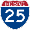 I-25 - north-south Interstate from New Mexico to Wyoming; runs north-south through Chugwater, concurrent with US 87.
 I-25 Bus. - Alternate Interstate Business Route through Chugwater.
 US 87 - north-south route through Chugwater, concurrent with I-25.
 WYO 211 (Iron Mountain Rd)
 WYO 313 (Lone Tree Rd)
Area attractions
The Diamond Ranch, established near Chugwater in 1878 by George Rainsford, was placed on the National Register of Historic Places on September 28, 1984.[19] It continues to function as a guest ranch.
Notable people
- Clayton Danks (1879 – 1970) - famous Cheyenne Frontier Days rodeo rider, cowboy & ranch hand.
- Robert Mills Grant - Wyoming State Representative.
- Harold Hellbaum - former Speaker of the Wyoming House of Representatives.
See also
References
- 1 2 "US Gazetteer files 2010". United States Census Bureau. Archived from the original on 2012-01-24. Retrieved 2012-12-14.
- 1 2 "American FactFinder". United States Census Bureau. Retrieved 2012-12-14.
- ↑ "Population Estimates". United States Census Bureau. Archived from the original on 2013-06-17. Retrieved 2013-06-01.
- 1 2 "American FactFinder". United States Census Bureau. Archived from the original on 2013-09-11. Retrieved 2008-01-31.
- ↑ "US Board on Geographic Names". United States Geological Survey. 2007-10-25. Retrieved 2008-01-31.
- 1 2 3 4 Wyoming Tales and Trails - "Chugwater"."Archived copy". Archived from the original on 2015-07-22. Retrieved 2015-07-31. Retrieved 2015-07-31
- 1 2 "Frontier Days: Clayton Danks". wyomingtalesandtrails.com. Retrieved September 23, 2013.
- ↑ "For the Record: Robert Mills Grant, May 2, 2012". Platte County Record Times. Retrieved August 10, 2013.
- ↑ The history of Chugwater - How the town got its name wheatlandwy.com. Retrieved 2010-02-21.
- 1 2 "Questions & Answers". lemen.com. Retrieved September 23, 2013.
- 1 2 "Kelsey Bray, Blazin' saddle". Wyoming Tribune-Eagle. Retrieved September 23, 2013.
- 1 2 "Historical Information Wyoming Secretary of State".
- ↑ "US Gazetteer files: 2010, 2000, and 1990". United States Census Bureau. 2011-02-12. Retrieved 2011-04-23.
- ↑ "NOWData - NOAA Online Weather Data". National Oceanic and Atmospheric Administration. Retrieved May 5, 2013.
- ↑ "Annual Estimates of the Resident Population for Incorporated Places: April 1, 2010 to July 1, 2015". Retrieved July 2, 2016.
- ↑ "Census of Population and Housing". Census.gov. Archived from the original on May 11, 2015. Retrieved June 4, 2015.
- ↑ Wyoming Town Offers Cheap Land for New Blood NPR, 2005-02-14
- 1 2 3 4 Gruver, Mead. Ripple effect after fire takes out Wyoming town store. Associated Press. Retrieved May 9, 2013.
- ↑ National Park Service (2010-07-09). "National Register Information System". National Register of Historic Places. National Park Service.
Municipalities and communities of Platte County, Wyoming, United States | ||
|---|---|---|
| Towns | 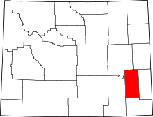 | |
| CDPs | ||
| Unincorporated communities | ||
| Ghost town | ||