Platanos, Aetolia-Acarnania
| Platanos Πλάτανος | |
|---|---|
 Platanos | |
|
Location within the regional unit 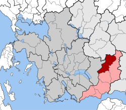 | |
| Coordinates: 38°36′N 21°47′E / 38.600°N 21.783°ECoordinates: 38°36′N 21°47′E / 38.600°N 21.783°E | |
| Country | Greece |
| Administrative region | West Greece |
| Regional unit | Aetolia-Acarnania |
| Municipality | Nafpaktia |
| • Municipal unit | 169.7 km2 (65.5 sq mi) |
| Elevation | 832 m (2,730 ft) |
| Population (2011)[1] | |
| • Municipal unit | 1,611 |
| • Municipal unit density | 9.5/km2 (25/sq mi) |
| Time zone | EET (UTC+2) |
| • Summer (DST) | EEST (UTC+3) |
| Postal code | 300 22 |
| Area code(s) | 26340 |
| Vehicle registration | ME |
Platanos (Greek: Πλάτανος meaning plane tree) is a village and a former municipality in Aetolia-Acarnania, West Greece, Greece. Since the 2011 local government reform it is part of the municipality Nafpaktia, of which it is a municipal unit.[2] The municipal unit has an area of 169.678 km2.[3] Population 1,611 (2011). The population of the village was 207 in 2011 and the population of the municipal district, which includes the village Kato Platanos, was 253. The river Evinos is situated east of the town.
Geography
The municipal unit Platanos is subdivided into the following communities (constituent villages in brackets):
- Platanos (Platanos, Kato Platanos)
- Agios Dimitrios
- Arachova (Arachova, Kranes)
- Achladokastro
- Dendrochori (uninhabited)
- Kastanea
- Klepa
- Livadaki
- Neochori Nafpaktias (Neochori, Petroto)
- Perdikovrysi
- Perista
- Chomori (Chomori, Agia Triada)
Historical population
| Year | Village | Municipal district | Municipality |
|---|---|---|---|
| 1981 | - | 358 | |
| 1991 | 227 | - | 1,694 |
| 2001 | 324 | 404 | 1,775 |
| 2011 | 207 | 253 | 1,611 |
References
- ↑ "Απογραφή Πληθυσμού - Κατοικιών 2011. ΜΟΝΙΜΟΣ Πληθυσμός" (in Greek). Hellenic Statistical Authority.
- ↑ Kallikratis law Greece Ministry of Interior (Greek)
- ↑ "Population & housing census 2001 (incl. area and average elevation)" (PDF) (in Greek). National Statistical Service of Greece.
External links
- Municipality of Platanos (Greek)
- Platanos (municipality) on GTP Travel Pages (in English and Greek)
- Platanos (village) on GTP Travel Pages (in English and Greek)
- Oiniades on culture.gr
- Chomori Village (municipality of Platanos) (in English and Greek)
This article is issued from Wikipedia - version of the 12/2/2016. The text is available under the Creative Commons Attribution/Share Alike but additional terms may apply for the media files.