Cholapuram
| Cholapuram | |
|---|---|
| city | |
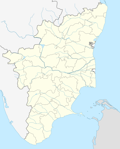 Cholapuram Location in Tamil Nadu, India | |
| Coordinates: 11°3′5″N 79°24′55″E / 11.05139°N 79.41528°ECoordinates: 11°3′5″N 79°24′55″E / 11.05139°N 79.41528°E | |
| Country |
|
| State | Tamil Nadu |
| District | Thanjavur |
| Elevation | 123 m (404 ft) |
| Population (2001) | |
| • Total | 6,364 |
| Languages | |
| • Official | Tamil |
| Time zone | IST (UTC+5:30) |
| Telephone code | 0435 |
| Vehicle registration | TN 68 |
Cholapuram (Tamil: சோழபுரம்) is a panchayat town in the Thanjavur district of the state of Tamil Nadu, India.In ancient time, it's called as Pairavapuram.
Population
According to the 2001 Indian population census, the population of Cholapuram was 6,364,[1] of which women constituted 52%. Cholapuram's literacy rate stood at 79%, which is higher than the national average of 59.9%. The male literacy rate was 79%, compared to the female literacy rate of 66%. Cholapuram also has a substantially large number of people under the age of six: according to the census that year this number stood at 12% of the population.
People from this panchayat town studied well and doing professional job in abroad, chennai, bangalore, hydrabad and other major cities in India in IT, Medical, and Engineering, etc...
Agriculture
The income of Cholapuran's residents is heavily dependent upon agriculture and the welding works. The major crops cultivated in are paddy, pulses, gingelly, groundnut and sugarcane. Minor crops like maize, soybeans, and red gram vegetables, cotton, casuarina trees (savukku), fruits, chili, banana trees, ginger, groundnut, and pulses are also grown.
Education
Schools and colleges in Cholapuram include:
- Cholapuram Government High School
- Jayam Middle School
- Cholapuram Government School (From 1st - 5th Standard)
- Sri Venkateshwara Matriculation School
- Morning Star Mat-Cholapuram Kumbakonam
- Annai College Of Arts & Science, Kallapuliyur Village Kumbakonam Thanjavur
- Skis Arts College, Thirupanandal Kumbakonam Thanjavur
- Mass College Of Arts & Science, Kallapuliyur Village Kumbakonam Thanjavur
- Arasu Engineering College, Kallapuliyur Village Kumbakonam Thanjavur.
Business
Major business in Cholapuram include the Indian Bank and the Indian Overseas Bank. The Cholapuram area is popular for welding works. There are number of general merchant stores, medicals, fertilizer shops, fancy stores, super market, Restaurants, Hotels and Sweet Stalls are doing business.
Temples
- Kailasanathar Temple
- Sarabheswarar Temple
- Vinayagar Temple
- Amman Temple
Transportation
The Kumbakonam railway station is the nearest to Cholapuram, however, the Thanjavar railway station, 50 km away, is the only major railway station in the area. The main bus terminal in Kumbakonam, provides inner and outer area transportation. There are airports located in Thanjavur and Trichy.
References
Notes
- ↑ "Census of India 2001: Data from the 2001 Census, including cities, villages and towns (Provisional)". Census Commission of India. Archived from the original on 2004-06-16. Retrieved 2008-11-01.
For Additional InfoAthiyur
| District headquarters | 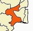 | |
|---|---|---|
| Country | ||
| State | ||
| Region | ||
| Divisions | ||
| Taluks | ||
| Revenue blocks | ||
| Municipal Corporations | ||
| Municipalities | ||
| Rivers | ||
| History | ||
| Places of interest |
| |
| Religious and monastic institutions | ||
| Universities | ||
| ||