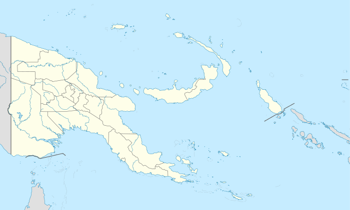
Choiseul Island
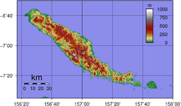 Topographic map of Choiseul | |
 Choiseul Choiseul Island (off the coast of Bougainville Island, Papua New Guinea) | |
| Geography | |
|---|---|
| Location | Solomon Islands |
| Coordinates | 7°05′S 157°00′E / 7.08°S 157.0°ECoordinates: 7°05′S 157°00′E / 7.08°S 157.0°E |
| Area | 2,971 km2 (1,147 sq mi) |
| Administration | |
|
Solomon Islands | |
| Province | Choiseul Province |
Choiseul Island, native name Lauru,[1] is the largest island (2,971 km2 (1,147 sq mi)) of the Choiseul Province, Solomon Islands, at 7°05′S 157°00′E / 7.08°S 157°E.
Description
This island is named after Étienne François, duc de Choiseul.
The first recorded sighting by Europeans was by the Spanish expedition of Álvaro de Mendaña in April 1568. More precisely the sighting was due to a local voyage done by a small boat, in the accounts the brigantine Santiago, commanded by Maestre de Campo Pedro Ortega Valencia and having Hernán Gallego as pilot. They charted it as San Marcos, and also who named the narrow channel separating San Jorge from Santa Isabel Island as the Ortega channel after the commander of the expedition.[2][3]
Choiseul islanders suffered attacks from blackbirding in the nineteenth century (the often brutal recruitment or kidnapping of labourers for the sugar plantations in Queensland and Fiji).
In April 1885 a German Protectorate was declared over the North Solomon Islands, including Choiseul. In 1900, under the terms of Treaty of Berlin (14 November 1899), Germany transferred the North Solomon Islands (except for Bougainville and its surrounding islands) to the British Solomon Islands Protectorate in exchange for the British giving up all claims to Samoa. Missionaries settled on Choiseul under both protectorates, converting most of the population to Christianity. In the early 20th century several British and Australian firms began large-scale coconut planting.
Choiseul was visited by Austrian anthropologist and photographer Hugo Bernatzik in 1932. Bernatzik documented some of the few remaining ancestral customs of the island people which are included in an ethnography that he published a few years later. He also took some photographs of the islanders and brought back a stone urn with carvings, reflecting a culture that he deemed was dying in contact with the modern world.[4]
During World War II, the Choiseul was occupied by Japanese forces in 1942.
With the independence of the Solomon Islands in July 1978, Choiseul has been administered as part of Choiseul Province.
The administrative headquarters of Choiseul Province is situated in the town of Taro.
See also
References
- ↑ Hugo Bernatzik, Südsee; ein Reisebuch, first edition Leipzig 1934
- ↑ Sharp, Andrew The discovery of the Pacific Islands Oxford, 1960, p.45.
- ↑ Brand, Donald D. The Pacific Basin: A History of its Geographical Explorations The American Geographical Society, New York, 1967, p.133.
- ↑ Hugo Bernatzik, Owa Raha. Büchergilde Gutenberg, Vienna / Zürich / Prague, 1936
External links
 Media related to Choiseul, Solomon Islands at Wikimedia Commons