Chengalpattu
| Chengalpattu செங்கல்பட்டு செங்கை | |
|---|---|
| Town | |
|
Kolavai Lake on the outskirts of Chengalpattu | |
| Nickname(s): Chengai | |
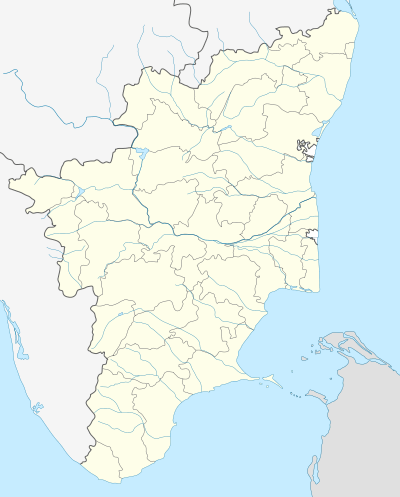 Chengalpattu Location in Tamil Nadu, India | |
| Coordinates: 12°41′N 79°59′E / 12.683°N 79.983°ECoordinates: 12°41′N 79°59′E / 12.683°N 79.983°E | |
| Country |
|
| State | Tamil Nadu |
| District | Kanchipuram |
| Elevation | 36 m (118 ft) |
| Population (2011) | |
| • Total | 62,579 |
| Languages | |
| • Official | Tamil |
| Time zone | IST (UTC+5:30) |
| PIN | Chengalpattu-603001, 603002 |
| Telephone code | +91-44 |
| Vehicle registration | TN-19 |

Chengalpattu, formerly known as Chingleput,[1] is located on the GST Road and southwest of Kanchipuram in Kanchipuram district, Tamil Nadu, India. The British Government called this whole district Chingleput; now it is named Kanchipuram District. Chengalpattu is the 2nd largest town in the district, after Kanchipuram.
Chengalpattu Railway Station, generally known as CGL, is one of the major railway junctions of the Southern Railway and is a nationally important halt. It is the headquarters of the Chengalpattu Taluk of the district and is 55 kilometres (34 mi) southwest of the state capital, Chennai and 22km Away from Chennai City Entrance Gateway Vandalur on the National Highway 45.
Chengalpattu Government Hospital is a landmark and the largest government hospital in this district. The Hospital has a medical college. The town has the principal court of the district, and Dr. Ambedhkar Law College.
The city is believed to have been named after a lily called 'chenkazhuneer poo' which is found aplenty in the region. It is on the Palar River about 56 km southwest of Chennai city (Madras). Chengalpattu is an important commercial center. It has a medical college and other colleges affiliated with the University of Madras. As of 2011, the town had a population of 62,579.
History
Chengalpattu was formerly a capital of the kings of Vijayanagara, after their defeat by the Deccan sultanates at Battle of Talikota in 1565.[1] In 1639 a local governor or nayak, subject to these kings, granted a piece of coastal land to the British East India Company where Fort St George now stands,[1] which became the nucleus of the city of Madras. The fortress at Chengalpattu, built by the Vijayanagara kings in the 16th century, was of strategic importance, owing to its swampy surroundings and the lake that flanked its side.[1]
Chengalpattu was taken by the French in 1751 and was retaken in 1752 by Robert Clive, after which it proved of great strategic advantage to the British, especially when Lally failed to capture the fortress in his advance on Madras.[1]
During the wars of the British with Hyder Ali of Mysore, it withstood his assault and afforded a refuge to the nearby residents. In 1780, after the defeat of Colonel W Baillie, the army of Sir Hector Munro took refuge there.[1] By 1900 the town was noted for its manufacture of pottery and was a local market center, especially of the rice trade.[1] The surrounding district was home to cotton and silk weaving, indigo dyeing, tanneries, and a cigar factory, and extensive salt manufacturing took place along the coast.
Geography
Chengalpattu is located at 12°42′N 79°59′E / 12.7°N 79.98°E.[2] It has an average elevation of 36 metres (118 ft). Lake Kolavai is the largest located in Chengalpattu.
Demographics
According to 2011 census, Chengalpattu had a population of 62,579 with a sex-ratio of 1,020 females for every 1,000 males, much above the national average of 929.[3] A total of 5,884 were under the age of six, constituting 3,045 males and 2,839 females. Scheduled Castes and Scheduled Tribes accounted for 15.55% and 1.44% of the population respectively. The average literacy of the town was 83.25%, compared to the national average of 72.99%.[3] The town had a total of 15675 households. There were a total of 23,937 workers, comprising 264 cultivators, 215 main agricultural labourers, 475 in house hold industries, 19,376 other workers, 3,607 marginal workers, 127 marginal cultivators, 66 marginal agricultural labourers, 175 marginal workers in household industries and 3,239 other marginal workers.[4] As per the religious census of 2011, Chengalpattu had 85.33% Hindus, 6.09% Muslims, 6.48% Christians, 0.02% Sikhs, 0.13% Buddhists, 0.13% Jains, 1.79% following other religions and 0.02% following no religion or did not indicate any religious preference.[5]
Education
There are number of educational institutes in Chengalpattu.
Colleges
- Chengalpet Government Medical College
- Government Law College, Chengalpattu.
- Rajeswari Vedachalam Govt Arts College
- Karpaga Vinayaga College of Engineering and Technology
- Karpaga Vinayaga Institute of Medical Science
- Karpaga Vinayaga Institute of Dental Science
- Karpaga Vinayaga Institute of Nursing
- Asan Memorial College of Engineering and Technology
- Indra Gandhi Women's College of Engineering
- Vidyasagar Women's College
- Shri Andal Alagar College of Engineering
Schools
- St.Paul's Academy(CBSE).
- St.Paul's Matriculation School.
- St.Hilda'&St.Hugh's.Matric.Hr.Sec.School.
- St.Joseph's Hr.Sec. School.
- St.Joseph's Matric. Hr. Sec. School.
- St.Mary's Girls Hr. Sec. School.
- St.Mary's Primary School.
- St.Columba's Hr. Sec. School.
- Shri Ramakrishna Mission Boys Hr. Sec. School.
- Shri Ramakrishna Mission Girls Hr. Sec. School.
- Little Jacky Matric. Hr. Sec. School.
- Brindhavan Public School.
- Vidhya Sagar Global School.
- Maharishi Vidhya Mandir School.
- Seventh Day Adventist Matric. Hr. Sec.School.
- Mahindra World School.
- SCAD World School.
- Government Girls Hr. Sec. School.
- St.Ann's Matric Hr. Sec.School.
- CSI Alison Cassie Girls Higher Secondary School.
- Prasan Vidhya Mandir School.
- Blessings Matric Hr. Sec. School.
- Guardian International Nursery School.
Music School
- Oviya School of Music
Hospitals
- Chengalpattu Government Medical College Hospital
- JSP Hospital.
- Sree Renga Nursing Home.
- Venkat Ramana Hospital.
- Beent Hospital.
- JJ Hospital.
- Government Leprosy Hospital.
Transport

Chenglapattu is well connected by road and rail. The Chennai Airport lies just 38 km north of the town and can be reached in about 1 hour by road. Melmaruvathur is about 35 km from Chengalpattu. To reach Tindivanam, which is 69 km away,it takes about 1.3 hours through GST Road or NH 45.
Chengalpattu is a railway junction and it lies in the Main Broad Gauge line and most of the south bound trains stop here. There is a railway connection to Arakkonam via Kanchipuram. There are many trains running from Kanchipuram via Chengalpattu to Beach Station stopping at all stations up to Chennai city Tambaram. Superfast trains are available, running from Chengalpattu to Chennai city area's Tambaram, Guindy, Mambalam, Egmore, Park and finally Beach Station.
There are many buses connecting Chengalpattu with other parts of the state and beyond. Some of them are
| Route Number | Start | End | Via | ||||||||||||||||||||||||||||||||||||||||||||||||||||||||||
|---|---|---|---|---|---|---|---|---|---|---|---|---|---|---|---|---|---|---|---|---|---|---|---|---|---|---|---|---|---|---|---|---|---|---|---|---|---|---|---|---|---|---|---|---|---|---|---|---|---|---|---|---|---|---|---|---|---|---|---|---|---|
| 82C | Chengalpattu | Tiruvallur | Sriperrumbudur | ||||||||||||||||||||||||||||||||||||||||||||||||||||||||||
| 108 B | Chengalpattu | Mamallapuram | Tirukalukundram | ||||||||||||||||||||||||||||||||||||||||||||||||||||||||||
| 108 | Kalpakkam | Chennai | Chengalpattu, Tambaram | ||||||||||||||||||||||||||||||||||||||||||||||||||||||||||
| 157 Cut | Kalpakkam | Kanchipuram | Chengalpattu | ||||||||||||||||||||||||||||||||||||||||||||||||||||||||||
| 157 | Kalpakkam | Vellore | Kanchipuram, Chengalpattu | ||||||||||||||||||||||||||||||||||||||||||||||||||||||||||
| 157 M | Mamallapuram | Cheyyar | Kanchipuram, Chengalpattu | ||||||||||||||||||||||||||||||||||||||||||||||||||||||||||
| 164 C | Kalpakkam | Chittoor | Chengalpattu, Kanchipuram, Arakonam | ||||||||||||||||||||||||||||||||||||||||||||||||||||||||||
| 144 C | Chengalpattu | Chittoor | Kanchipuram, Ranipet, Ponnai | ||||||||||||||||||||||||||||||||||||||||||||||||||||||||||
| 197 UD | Kalpakkam | Nagercoil | Chengalpattu, Trichi | ||||||||||||||||||||||||||||||||||||||||||||||||||||||||||
| 831 UD | Tambaram | Bengaluru | Chengalpattu, Vellore | ||||||||||||||||||||||||||||||||||||||||||||||||||||||||||
| 212 H | Kalpakkam | Tirupathi | Chengalpattu, Arakonam, Thiruthani | ||||||||||||||||||||||||||||||||||||||||||||||||||||||||||
| EXP | Kalpakkam | Trichy | Chengalpattu, Tindivanam, Villupuram | ||||||||||||||||||||||||||||||||||||||||||||||||||||||||||
| 471 UD | Kalpakkam | Coimbatore | Chengalpattu, Tindivanam, Salem | ||||||||||||||||||||||||||||||||||||||||||||||||||||||||||
| 834 UD / 444K EXP | Kalpakkam | Bangalore | Chengalpattu, Kanchipuram, Vellore, Krishnagiri, Hosur | ||||||||||||||||||||||||||||||||||||||||||||||||||||||||||
|
Few MTC Buses Towards Chengalpattu
TourismToday Chengalpattu has developed as a touristic spot for many foreign travellers on their way to Mamallapuram, Thirukazhukundram, Vedanthangal Bird Sanctuary and Kanchipuram, [Kraikali Bird Sanctuary]. The boat house established by Tamil Nadu Tourism Development Corporation (TTDC) in the Kolavai lake which is alongside the NH 45 highway has turned into a place where people can relax with their families on weekends. The monsoon rains flooded the gates of the lake in December 2005 due to which the TTDC boat club operation has been stopped. It also serves as a bridge connecting all nearby districts with the renowned tourist places like Mahabalipuram, Muttukadu, theme parks on East Coast Road (ECR), Thirukazhukundram, town. Kolavai LakeKolavai Lake is the second largest lake in the Kanchipuram District after Madhuranthagam Lake. Kolavai Lake is well known for its perennial nature: There are no records of going dry in summers. It even supplies water to industries in Chennai when the lakes in Chennai go dry. The lake is now being polluted due to the rapid urbanisation of Chengalpattu. The early morning sunrise and the moon hovering above the lake over its waters in the night are scenic to the eyes. The lake's beauty can be experienced by taking a train from the Chengalpattu station to Paranur. IndustryThere are several modern industries around Chengalpattu, due to the town's proximity to Chennai and its frequent connectivity to other places through rail and road. Several companies in and around the town like Tech Mahindra, Wipro, BMW, Ford, Flextronics, Foxconn, Dell, Samsung, Infosys, Pepsi, TVS, Siemens, Nissan Renault, Apollo Tyres, Mahindra R & D, Bay forge have production plants near Chengalpattu. Madurantakam Co operative Sugar Mill. PoliticsChengalpattu assembly constituency is part of Kancheepuram (Lok Sabha constituency).[6] References
External links
|
|||||||||||||||||||||||||||||||||||||||||||||||||||||||||||||
