Chilly, Haute-Savoie
| Chilly | |
|---|---|
|
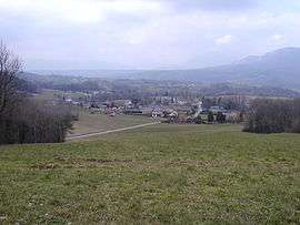
A general view of Chilly | |
 Chilly | |
|
Location within Auvergne-Rhône-Alpes region  Chilly | |
| Coordinates: 45°59′33″N 5°57′13″E / 45.9925°N 5.9536°ECoordinates: 45°59′33″N 5°57′13″E / 45.9925°N 5.9536°E | |
| Country | France |
| Region | Auvergne-Rhône-Alpes |
| Department | Haute-Savoie |
| Arrondissement | arrondissement de Saint-Julien-en-Genevois |
| Canton | Canton of Frangy |
| Intercommunality | Communauté de communes du Val des Usses |
| Government | |
| • Mayor (2008–2014) | Georges Bouverot |
| Area1 | 18.58 km2 (7.17 sq mi) |
| Population (1999)2 | 939 |
| • Density | 51/km2 (130/sq mi) |
| Time zone | CET (UTC+1) |
| • Summer (DST) | CEST (UTC+2) |
| INSEE/Postal code | 74075 / 74270 |
| Elevation | 327–730 m (1,073–2,395 ft) |
|
1 French Land Register data, which excludes lakes, ponds, glaciers > 1 km² (0.386 sq mi or 247 acres) and river estuaries. 2 Population without double counting: residents of multiple communes (e.g., students and military personnel) only counted once. | |
Chilly is a commune in the Haute-Savoie department in the Auvergne-Rhône-Alpes region in south-eastern France.
The commune includes the hamlets of Botilly, Coucy, Curnillex, Darogne, Ferraz, Grange bouillet, Lacry, Les vernays, Mannecy, Mougny, Novéry, planaise, Quincy et Vers grange.
See also
References
| Wikimedia Commons has media related to Chilly (Haute-Savoie). |
This article is issued from Wikipedia - version of the 10/28/2016. The text is available under the Creative Commons Attribution/Share Alike but additional terms may apply for the media files.