Chicago Lakefront Trail

The Chicago Lakefront Trail (abbreviated as LFT) is a foreshoreway for walking and cycling, running 18 miles (29 km) along the coast of Lake Michigan in Chicago, Illinois . The path connects various beaches and recreational amenities located along the lakefront and also serves as a route for bicycle commuters.
The trail is located wholly within the Chicago city limits and spans from 7100 South/2560 East to 5800 North/1000 West. It is a dedicated-use path, although frequent intersections do pose a threat to path users. These intersections are clearly signed both to path users and motorists. From north to south, it runs through Lincoln Park, Grant Park, Burnham Park, and Jackson Park.
Attractions
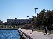
Some attractions along the path (listed from south to north) are the South Shore Cultural Center, the Museum of Science and Industry, McCormick Place, Soldier Field, Chicago's Museum Campus, Monroe Harbor, Navy Pier, Belmont Harbor, and the Waveland Clock Tower. The Lakefront Trail connects most of the Chicago beaches and three skate parks (31st Street, Grant Park, Wilson Avenue).
Maintenance
Path maintenance is solely provided by the Chicago Park District. The Lakefront Trail is open 24 hours a day, but the parks and beaches along the path close at 11 PM. During winter the path is often closed or difficult to traverse at the "Oak Street Curve" because of the revetment shape and waves crashing onto the path and freezing before the water recedes. The Active Transportation Alliance promotes using the #chiLFT hashtag on Twitter so users, especially bicycle commuters, can quickly disseminate reports to others.
Navy Pier Flyover
From Wacker Drive to Illinois Street the Lakefront Trail shares the pedestrian sidewalk on lower-level Lake Shore Drive, which is very heavily congested during the warm-weather months. In order to reduce the conflicts between pedestrian and bicyclists, and avoid the very busy intersections at Illinois Street and Grand Avenue, the Chicago Department of Transportation has been designing the Navy Pier Flyover since 2000. This bridge will run alongside the upper level of Lake Shore Drive from north of the Ohio Street Beach to Illinois Street, and then alongside the lower level of Lake Shore Drive as it crosses the Chicago River, with an exit in the middle serving Navy Pier and DuSable Park.[1] Construction began in spring 2014 and will continue until 2018.[2]
|


References
External links
Coordinates: 41°52′58″N 87°36′52″W / 41.88275°N 87.61433°W