Chhijmuri
| Chhijmuri | |
|---|---|
 Chhijmuri Location within Bolivia | |
| Highest point | |
| Elevation | 2,830 m (9,280 ft) [1] |
| Coordinates | 17°58′45″S 65°15′28″W / 17.97917°S 65.25778°WCoordinates: 17°58′45″S 65°15′28″W / 17.97917°S 65.25778°W |
| Geography | |
| Location |
Bolivia, Cochabamba Department |
| Parent range | Andes |
Chhijmuni (Aymara chhijmu edible part of the clover plant,[2] -ri a suffix, also spelled Chijmuri) is a 2,830-metre-high (9,280 ft) mountain in the Bolivian Andes. It is located in the Cochabamba Department, on the border of the Campero Province, Aiquile Municipality, and the Mizque Province, Mizque Municipality, southeast of Mizque. It lies south of the peak of Juch'uy Chhijmuri (Quechua juch'uy small, "small Chhijmuri"). The Chhijmuri Mayu originates east of the peak. It flows to the east.[1][3]
References
- 1 2 Bolivia 1:100,000 Mizque 3835
- ↑ Radio San Gabriel, "Instituto Radiofonico de Promoción Aymara" (IRPA) 1993, Republicado por Instituto de las Lenguas y Literaturas Andinas-Amazónicas (ILLLA-A) 2011, Transcripción del Vocabulario de la Lengua Aymara, P. Ludovico Bertonio 1612 (Spanish-Aymara-Aymara-Spanish dictionary)
- ↑ "Mizque". INE, Bolivia. Retrieved April 9, 2016.
Capital: Cochabamba | ||
| Provinces | 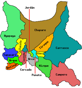 | |
| Municipalities (and seats) |
| |
This article is issued from Wikipedia - version of the 5/5/2016. The text is available under the Creative Commons Attribution/Share Alike but additional terms may apply for the media files.