Chevington, Suffolk

| Chevington | |
 All Saints Church Chevington |
|
 Chevington |
|
| Population | 630 (2001)[1] 602 (2011)[2] |
|---|---|
| District | St Edmundsbury |
| Shire county | Suffolk |
| Region | East |
| Country | England |
| Sovereign state | United Kingdom |
| Post town | Bury St. Edmunds |
| Postcode district | IP29 |
| Police | Suffolk |
| Fire | Suffolk |
| Ambulance | East of England |
| EU Parliament | East of England |
Coordinates: 52°12′22″N 0°36′50″E / 52.206°N 0.614°E
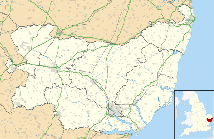
Chevington is a village and civil parish in the St Edmundsbury district of Suffolk in East Anglia, England. Located around 10 km south-west of Bury St Edmunds, in 2005 its population was 630,[1] reducing to 602 at the 2011 Census. The parish also contains the hamlets of Broad Green and Tan Office Green.
Name of the Village
Chevington was probably from 'Ceofan', a leader of a clan of the Angles called 'Cifongas' with the 'ing' meaning a place, farm or clearing belonging to him. It appeared in the 'Little Domesday' Book as 'Ceuentuna', 200 years later it was either 'Chevintun' or 'Cheveton' and from the 14th century as 'Chevington'.
History
Chevington, was a part of the Saxon estate of Britulf, but was given over to the Abbey of St Edmund after the Norman Conquest. The Abbey in Bury had been founded by the Benedictines in 1020 to shelter the remains of St Edmund and became one of the largest in England.
1086, 'Little Doomsday' Book The Abbot held Ceuentuna, a manor of 6 caracutes* There were 13 villeins**, 6 slaves, 140 sheep, 40 goats & 3 hives of bees. There was also one 'soakman' *** who probably farmed 30 acres.
[* or hides abt 800 acres, ** tied tenants, *** free tenant].
Besides generating income for the Abbey, some of the woods were used as a retreat for hunting deer & fishing for the Abbot & guests.
1268, The Abbot, John de Norwold, owned 460 acres of arable land in Chevington, 8 acres of meadow, 4 acres of wood & a windmill. His villeins held 322 acres of arable land, 2 acres of wood & 3 acres of pasture. The Cottars held 18 acres of arable land. Adam & Robert de Seburgh were free tenants, with the Pamans owning land with virtual right of occupation.
Chevington was a 'close' parish, with movement into the village restricted until the early 19th century, and as a high proportion of the parish was owned by a single family, there were relatively few freeholders.
Leading People in the village in 1844
ALLEN – Holly Bush Green, gent,
BRIDGE – carpenter,
EDWARD – wheelwright,
FENTON – bricklayer & builder,
MAYHEW – shopkeeper,
PARKER – shoe-maker & schoolmaster,
ROLFE – gentleman,
SIMKIN James – beer-house keeper,
SIMKIN John – thatcher,
WHITE rev John – rectory,
WHITE Misses Elis & Frances,
WITHAM J – shopkeeper,
WRIGHT Christopher – butcher,
Farmers in the village in 1844,
ADAMS – Hill House,
ARGENT R,
BREWSTER Sam – Coolege Farm,
FINCH J – Holly Bush Green,
GOSSICK J – Horse Pool,
JENNISON W – Chevington Lodge,
KEMP J – Chevington Hall,
KEMP J – malster,
ROLFE W – corn miller,
SIMKIN Robert J – Garrod's Farm & vet,
SIMKIN Robert – Hole,
TRUGGITT – Broad Green,
WEBB John – Moat Farm,
Sites of Interest
Church of All Saints
A church was recorded in the Domesday survey, but was replaced by a Norman church in stone in about the 12th century, with parts still existing. Since then. it has been extensively added or removed. In the 16th century, the bell tower was added, which is said to have and extended in height in the early 19th century, said to be so it could be seen from the newly constructed hall at Ickworth. In about 1700, the roof was lowered & shortened in length.
Chevington Park Cottages
there was a hunting lodge, part of which was converted into cottages.
Former Rectory
College Farmhouse,
is thought to have been the site of a college of secular priests, with some of the original timbers still embedded behind the 18th-century façade.
Moat Farmhouse at Brooks's Corner,
is the only grade II* domestic building in the village. It is from the early 15th century with later alterations & extensions. It is an example of a three-cell open hall house with a late 16th-century first floor and attics. It is likely that the rear wing of the house, formerly moated, was added at the same time as the first floor of the hall.
Ruffin's Farmhouse,
15th century. The name has lingered since Henry Ruffyn helped to survey Chevington Manor for Abbot Cratfield in the early 15th century. It is an open-hall timber-framed house of the Wealden type with later extensions as late as the 17th century on the east.
The Lodge
David Clarkson's
Broad Green House,
although altered in the 19th century.
Batleys House in Depden Lane, later called Hole Farm
with a 17th-century axial red brick chimney, it was one owned by Dr John Battely, Archdeacon of Canterbury, occupied by the Simkens in the 19th century.
Horsepool Farmhouse
Tan Office Farmhouse,
with a cross-passage entry & jettied upper floor, it was rebuilt in the 16th century with two bays.
The Old Rectory,
originally moated, it was built in the 16th century, but reconstructed in the 18th. The rear is the oldest section.
Chevington Hall
It is on the site of an ancient camp, of which little is known. The earthworks and a fosse surrounding the hall are thought to have been constructed for defence and appear to predate the Romans. It was used as the retreat house of the Abbots of St. Edmunds Abbey from the 13th century. After the Dissolution, it became a manor house for Thomas Kytson of Hengrave and then later the Gages, who became the largest land-owners in the district. It's been suggested that the widow of Thomas Kytson modified the Abbot's Hall, but retained its general plan, steep roof and mullioned windows and incorporating some framing members from the Hall. The current farmhouse, is mid 16th century with alterations. Timber-framed, encased in painted brick at front and sides. Two storeys, hipped plain-tiled roof with axial chimneys of red brick, 18th-century mullioned and transomed windows of 4 & 6 lights. Late 18th-century 6-panelled entrance door with architrave and flat canopy.
Stonehouse Farmhouse,
formerly the Old Factory Farmhouse, is situated near the original Clothing Factory of 1852. It is timber framed & previously thatched. It is mainly 17th century.
Grazier's House of Weather Cock Hill,
with its attics & axial chimney of red brick, possibly where Robert Somerton had his house in the 14th century. Hollybush Stud, site of Seburgh's where a Robert Gooday once lived in the early 17th century.
Mill House,
about 1680. Thatched, with a 3 cell lobby entrance & an interesting red brick chimney. It was where William Rolfe, the miller lived in 1850.
Chevington Grove later Tallyho Stud,
was owned by the Whites for close on a century. The rear is a Queen Anne fragment of about 1710, but the front appears to be later. This very beautiful house has a 19th-century service wing running at right angles on the back.
Thatched Cottage on Church Rd,
probably from the 18th century, was inhabited for a lengthy period by the Arbon family. The steep roof does not possess dormers and there is a single prominent central chimney. The lean-to building on the west side was once used as a shop.
Shoemeadow Cottage,
timber-framed from the 18th century. It hides in the valley near Chevington Way between Ickworth & Chedburgh.
Raie Wilman's house on Weathercock Hill,
is Grade II from the 18th century although there is parts from the 17th century and perhaps earlier. At one time the house was divided into four or five cottages. Still thatched, the main timber-framed building has two stories with a distinguished newel staircase leading from the ground floor.
Demography
In the 2001 census, Chevington had a population of 603 with 248 households.[3]
Population change
| Population growth in Chevington from 1801 to 1891 | ||||||||||
|---|---|---|---|---|---|---|---|---|---|---|
| Year | 1801 | 1811 | 1821 | 1831 | 1841 | 1851 | 1881 | 1891 | ||
| Population | 445 | 490 | 590 | 573 | 624 | 600 | 556 | 545 | ||
| Source: A Vision of Britain Through Time[4] | ||||||||||
| Population growth in Chevington from 1901 to 2001 | ||||||||||
|---|---|---|---|---|---|---|---|---|---|---|
| Year | 1901 | 1911 | 1921 | 1931 | 1951 | 1961 | 2001 | |||
| Population | 457 | 471 | 466 | 417 | 358 | 373 | 603 | |||
| Source: A Vision of Britain Through Time[4] | ||||||||||
Location grid
 |
Barrow | Great Saxham | Horringer | |
| Hargrave | |
Whepstead | ||
| ||||
| | ||||
| Depden | Chedburgh | Rede |
References
- 1 2 Estimates of Total Population of Areas in Suffolk Archived 19 December 2008 at the Wayback Machine. Suffolk County Council
- ↑ "Civil Parish population 2011". Neighbourhood Statistics. Office for National Statistics. Retrieved 18 August 2016.
- ↑ "Suffolk County Council – 2001 Census Profiles" (PDF). Archived from the original (PDF) on 28 September 2011. Retrieved 22 February 2011.
- 1 2 "A Vision of Britain Through Time". University of Portsmouth & others. Retrieved 22 February 2011.
Further reading
- Cooper, Frank (1984). Chevington: A Social Chronicle of a Suffolk Village. Chichester: Phillimore & Co. ISBN 978-0-850-33558-3.
- Dyer, Christopher (2007). "A suffolk farmer in the fifteenth century". Agricultural History Review. 55 (1): 1–22. JSTOR 40276126. Traces the life of Chevington farmer Robert Parman (c.1405 – 1475), and so contains historical details of Chevington and its people during his lifetime.
- 'WHITE'S 1844 SUFFOLK History, Gazetteer, & Directory of Suffolk' by William White
External links
![]() Media related to Chevington, Suffolk at Wikimedia Commons
Media related to Chevington, Suffolk at Wikimedia Commons
| Boroughs or districts | |
|---|---|
| Major settlements | |
| Topics | |