Cherryvale, Kansas
| Cherryvale, Kansas | |
|---|---|
| City | |
 Location within Montgomery County and Kansas | |
 KDOT map of Montgomery County (legend) | |
| Coordinates: 37°16′5″N 95°33′3″W / 37.26806°N 95.55083°WCoordinates: 37°16′5″N 95°33′3″W / 37.26806°N 95.55083°W | |
| Country | United States |
| State | Kansas |
| County | Montgomery |
| Platted | 1871 |
| Incorporated | 1880 |
| Area[1] | |
| • Total | 1.92 sq mi (4.97 km2) |
| • Land | 1.90 sq mi (4.92 km2) |
| • Water | 0.02 sq mi (0.05 km2) |
| Elevation | 837 ft (255 m) |
| Population (2010)[2] | |
| • Total | 2,367 |
| • Estimate (2012[3]) | 2,293 |
| • Density | 1,200/sq mi (480/km2) |
| Time zone | Central (CST) (UTC-6) |
| • Summer (DST) | CDT (UTC-5) |
| ZIP code | 67335 |
| Area code | 620 |
| FIPS code | 20-12925 [4] |
| GNIS feature ID | 0469813 [5] |
| Website | CherryvaleUSA.com |
Cherryvale is a city in Montgomery County, Kansas, United States.[6] As of the 2010 census, the city population was 2,367.[7]
History
Cherryvale was founded on the land of the Osage Indians who were pushed out by veterans of the American Civil War looking for land. The first white man to purchase property and settle here was Mr. Abe Eaton, who later sold it to the Kansas City, Lawrence & Southern Kansas Railroad which then became the Leavenworth, Lawrence & Galveston Railway. The town site was platted by the railroad in 1871.[8] It was named Cherryvale from its position in the valley of Cherry Creek.[9]
Between 1871 and 1873, at least eleven people vanished in the vicinity of an inn and general store operated by the Bender family about eight miles (13 km) northeast of Cherryvale. Following the disappareance of the Benders in 1873, it was discovered that they had apparently murdered a number of travellers. Between eight and eleven bodies were discovered buried on the premises. Governor Thomas A. Osborn offered a reward of $2,000 for the apprehension of the Benders, but they were never found.[10][11]
The main part of the town was destroyed by fire in 1873, but was soon rebuilt, and in 1880 Cherryvale became a city of the third and afterwards of the second class. Natural gas, which is used as a factory fuel and for street and domestic lighting, was found here in 1889, and oil several years later.[6]
The city is currently the headquarters for the South Kansas and Oklahoma Railroad, a shortline that runs 511 miles of track in Kansas and Oklahoma.The railroad, owned by WATCO, painted SD-40-2 4158, in the High School's colors of Blue & White in 2011, and the unit is stationed at the New yard, completed 2013, north of Cherryvale.
Geography
Cherryvale is located at 37°16′5″N 95°33′3″W / 37.26806°N 95.55083°W (37.268010, -95.550778).[12] According to the United States Census Bureau, the city has a total area of 1.92 square miles (4.97 km2), of which, 1.90 square miles (4.92 km2) is land and 0.02 square miles (0.05 km2) is water.[1] Is self-described as the "Gateway to Big Hill Lake."
Climate
The climate in this area is characterized by hot, humid summers and generally mild to cool winters. According to the Köppen Climate Classification system, Cherryvale has a humid subtropical climate, abbreviated "Cfa" on climate maps.[13]
Demographics
| Historical population | |||
|---|---|---|---|
| Census | Pop. | %± | |
| 1880 | 690 | — | |
| 1890 | 2,104 | 204.9% | |
| 1900 | 3,472 | 65.0% | |
| 1910 | 4,304 | 24.0% | |
| 1920 | 4,698 | 9.2% | |
| 1930 | 4,251 | −9.5% | |
| 1940 | 3,185 | −25.1% | |
| 1950 | 2,952 | −7.3% | |
| 1960 | 2,783 | −5.7% | |
| 1970 | 2,609 | −6.3% | |
| 1980 | 2,769 | 6.1% | |
| 1990 | 2,464 | −11.0% | |
| 2000 | 2,386 | −3.2% | |
| 2010 | 2,367 | −0.8% | |
| Est. 2015 | 2,230 | [14] | −5.8% |
| U.S. Decennial Census | |||
2010 census
As of the census[2] of 2010, there were 2,367 people, 930 households, and 615 families residing in the city. The population density was 1,245.8 inhabitants per square mile (481.0/km2). There were 1,087 housing units at an average density of 572.1 per square mile (220.9/km2). The racial makeup of the city was 94.3% White, 1.0% African American, 1.3% Native American, 0.3% Asian, 0.2% Pacific Islander, 0.8% from other races, and 2.1% from two or more races. Hispanic or Latino of any race were 4.0% of the population.
There were 930 households of which 34.0% had children under the age of 18 living with them, 46.1% were married couples living together, 12.6% had a female householder with no husband present, 7.4% had a male householder with no wife present, and 33.9% were non-families. 29.7% of all households were made up of individuals and 14.1% had someone living alone who was 65 years of age or older. The average household size was 2.50 and the average family size was 3.05.
The median age in the city was 36.9 years. 27.1% of residents were under the age of 18; 8.6% were between the ages of 18 and 24; 23.8% were from 25 to 44; 24.6% were from 45 to 64; and 16% were 65 years of age or older. The gender makeup of the city was 49.6% male and 50.4% female.
2000 census
As of the census[4] of 2000, there were 2,386 people, 982 households, and 639 families residing in the city. The population density was 1,537.2 people per square mile (594.3/km²). There were 1,142 housing units at an average density of 735.7 per square mile (284.5/km²). The racial makeup of the city was 94.09% White, 0.08% African American, 1.97% Native American, 0.13% Asian, 1.30% from other races, and 2.43% from two or more races. Hispanic or Latino of any race were 2.77% of the population.
There were 982 households out of which 31.3% had children under the age of 18 living with them, 49.7% were married couples living together, 11.1% had a female householder with no husband present, and 34.9% were non-families. 31.2% of all households were made up of individuals and 15.8% had someone living alone who was 65 years of age or older. The average household size was 2.39 and the average family size was 2.98.
In the city the population was spread out with 26.8% under the age of 18, 8.2% from 18 to 24, 26.9% from 25 to 44, 21.2% from 45 to 64, and 16.9% who were 65 years of age or older. The median age was 37 years. For every 100 females there were 91.2 males. For every 100 females age 18 and over, there were 87.2 males.
The median income for a household in the city was $27,917, and the median income for a family was $33,599. Males had a median income of $25,964 versus $19,356 for females. The per capita income for the city was $13,655. About 13.0% of families and 18.9% of the population were below the poverty line, including 26.4% of those under age 18 and 15.7% of those age 65 or over.
Education
USD 447 is home to Lincoln Central Elementary School (Cherryvale) (K-6), Thayer Elementary (K-8) and Cherryvale Middle/High School (7-12). They compete in the Tri-Valley League and the mascot is the Charger, represented by a knight. It was previously the Fighting Cherries. The mascot was changed in 1969 by the high school student council after an overwhelming vote of the student body.
Notable people
- Sam Avey, wrestling promoter
- Frank Bellamy (1876–1915),[15] contested author of the Pledge of Allegiance[16][17][18][19]
- Louise Brooks, dancer, silent film star, and author
- Claude Wendell Horton, Sr., geophysicist, acoustic researcher
- Billy Sandow, manager for World Champion Ed "Strangler" Lewis
- Vivian Vance, actress who played Ethel Mertz on I Love Lucy
See also
- National Register of Historic Places listings in Montgomery County, Kansas
- Big Hill Lake
- Bloody Benders
References
- 1 2 "US Gazetteer files 2010". United States Census Bureau. Archived from the original on 2012-01-24. Retrieved 2012-07-06.
- 1 2 "American FactFinder". United States Census Bureau. Retrieved 2012-07-06.
- ↑ "Population Estimates". United States Census Bureau. Archived from the original on 2013-06-17. Retrieved 2013-05-29.
- 1 2 "American FactFinder". United States Census Bureau. Archived from the original on 2013-09-11. Retrieved 2008-01-31.
- ↑ "US Board on Geographic Names". United States Geological Survey. 2007-10-25. Retrieved 2008-01-31.
- 1 2
 Chisholm, Hugh, ed. (1911). "Cherryvale". Encyclopædia Britannica. 6 (11th ed.). Cambridge University Press. p. 85.
 - ↑ "2010 City Population and Housing Occupancy Status". U.S. Census Bureau. Archived from the original on July 21, 2011. Retrieved January 8, 2012.
- ↑ Blackmar, Frank Wilson (1912). Kansas: A Cyclopedia of State History, Embracing Events, Institutions, Industries, Counties, Cities, Towns, Prominent Persons, Etc. Standard Publishing Company. p. 323.
- ↑ Kansas State Historical Society (1916). Biennial Report of the Board of Directors of the Kansas State Historical Society. Kansas State Printing Plant. p. 243.
- ↑ "Bender Knife". Kansas Historical Society. Retrieved May 6, 2016.
- ↑ Potter, Tim. "The Bloody Benders: 140-year-old crime scene still fascinates today". Wichita Eagle. August 24, 2013. Retrieved May 6, 2016.
- ↑ "US Gazetteer files: 2010, 2000, and 1990". United States Census Bureau. 2011-02-12. Retrieved 2011-04-23.
- ↑ Climate Summary for Cherryvale, Kansas
- ↑ "Annual Estimates of the Resident Population for Incorporated Places: April 1, 2010 to July 1, 2015". Retrieved July 2, 2016.
- ↑ Frank Elmer Bellamy at Find a Grave
- ↑ Frank E. Bellamy 1876-1915
- ↑ Case for the Pledge of Allegiance; Kansas Historical Society
- ↑ "Joyce Long is debating history"; The Morning Sun; July 8, 2012.
- ↑ "A Kansas Schoolboy Wrote Our Pledge of Loyalty to the Flag"; Kansas City Star; April 1917.
External links
| Wikimedia Commons has media related to Cherryvale, Kansas. |
- City
- Schools
- USD 447, local school district
- Historical
- Cherryvale Museum
- Cherryvale History
- Historic Images of Cherryvale, Special Photo Collections at Wichita State University Library
- Maps
- Cherryvale City Map, KDOT
Municipalities and communities of Montgomery County, Kansas, United States | ||
|---|---|---|
| Cities | 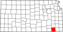 | |
| Unincorporated communities | ||