Cheraw Historic District
|
Cheraw Historic District | |
|
Cheraw Town Hall, Cheraw Historic District, September 2006 | |
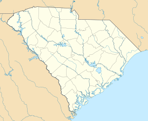  | |
| Location | Bounded by Front, Kershaw, 3rd, McIver, Cedar, Greene, Christian, and Church Sts., Cheraw, South Carolina |
|---|---|
| Coordinates | 34°41′50″N 79°53′15″W / 34.69722°N 79.88750°WCoordinates: 34°41′50″N 79°53′15″W / 34.69722°N 79.88750°W |
| Area | 600 acres (240 ha) |
| Built | 1865 |
| Architectural style | Mixed (more Than 2 Styles From Different Periods) |
| NRHP Reference # | 74001844[1] |
| Added to NRHP | November 20, 1974 |

Cheraw Historic District is a national historic district located at Cheraw, Chesterfield County, South Carolina. The district encompasses 39 contributing buildings and 1 contributing object in Cheraw. Located within the district are a variety of architectural styles that include the early frame homes of the 1800s (often called upcountry farmhouses, or essentially I-House in type), antebellum structures with Classical Revival details and Greek Revival porticos, and Victorian houses from the turn of the 20th century. The district also includes several churches, a cemetery, and the towns’ original boundary markers dating from 1766. Notable buildings include Town Hall, First Presbyterian Church, St. Peter's Catholic Church, Chicola Club / Brady's Restaurant, First Federal Savings and Loan, B.C. Moore and Sons, Coulter Memorial Academy Building, and Godfrey House. Located in the district is the separately listed St. David's Episcopal Church and Cemetery.[2][3]
It was listed on the National Register of Historic Places in 1974.[1]
References
- 1 2 National Park Service (2010-07-09). "National Register Information System". National Register of Historic Places. National Park Service.
- ↑ Mary Ann Eaddy; Vicki Funderburk; Sarah Spruill (August 1974). "Cheraw Historic District" (pdf). National Register of Historic Places - Nomination and Inventory. Retrieved 17 March 2014.
- ↑ "Cheraw Historic District, Chesterfield County (Cheraw)". National Register Properties in South Carolina. South Carolina Department of Archives and History. Retrieved 17 March 2014. and Accompanying map
| Topics |   | |
|---|---|---|
| Lists by county |
| |
| Lists by city | ||
| Other lists | ||